Natural Vegetation :
Plants that grow naturally in nature, without any human interference are called ‘Natural Vegetation7. In other words, “Naturally growing trees, plants and grasses are together called ‘Natural Vegetation’.
“WBBSE class 6 physical geography chapter 10 notes”
Natural vegetation is a combined result of climate, soil, topography and biotic factors. Of course, the most important is the climatic factors, which comprised temperature, humidity, rainfall etc.
Natural vegetation are considered to be one of the country’s valuable resources. In India, about 20-55% of the land is under natural vegetation. This natural vegetation can form forests or jungles.
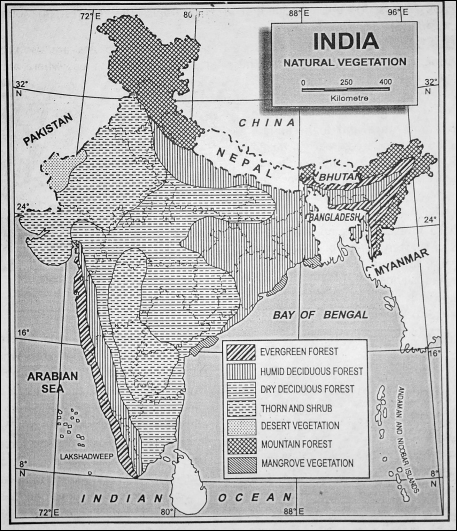
Types of Natural Vegetation in India :
India has a varied relief of landforms, terrain, soil and climatic conditions (temperature, rainfall etc.). The result is that a great variety of vegetation is found in India. India possesses about 45000 different species of plants. Nearly 5000 of the species are found exclusively in India.

The natural vegetation of India may be classified broadly into the following types :
- Tropical Evergreen Forests
- Tropical Deciduous Forests
- Tropical Desert Forest
- Mountain Forests and
- Mangrove Forests.
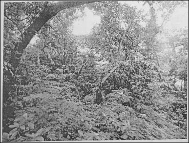
1. Tropical Evergreen Forests :
‘The Tropical Evergreen Forests’ are also known as ‘Tropical Evergreen Rain Forests’. These forests are found in areas where annual rainfall is more than 200 cm. and the mean temperature is more than 24°C.
Then forests grow rapidly due to high temperatures and high rainfall. Sometimes these trees reach a height of 60 metres. These are hardwood trees like equatorial forests. These are evergreen trees because these do not shed their leaves.
“natural vegetation of India WBBSE class 6 geography notes”
These forests are found in western parts of Western ghats, plains of West Bengal, Odisha, Eastern Himalayas and the Andaman Islands. Important varieties of trees are Mehagony, Rosewood, Ironwood, Sishu, Chaplash, Garjan, Sandlewood and Bamboo.

2. Tropical Deciduous Forests :
These forests are found in areas where rainfall is between 75 and 200 cm. These trees shed their leaves in the dry winter and summer seasons. So, these are called ‘deciduous’ forests. These forests are the true monsoon forests.
| Class 6 History | Class 6 Social Science |
| Class 6 Geography | Class 6 Science |
| Class 6 Maths | Class 6 Science MCQs |
| Class 6 General Science | Class 6 Maths Solutions |
| Class 6 Geography | Class 6 Hindi |
These are of two types—
- Moist and
- Dry. ‘Teak’ is the important species of moist deciduous and ‘Sal’ is the dry deciduous. These are not dense forests.
These forests are found in Terai, Chhotanagpur plateau, the Eastern slopes of Western Ghats and the eastern part of peninsular India. The main trees are Sal, Teak, Palash, Khair and Bamboo.
3. Deserts and Semi-deserts Thorny Vegetation :
These types of vegetation grow in areas where rainfall is less than 50 cm and the summer temperature is between S5°C – 40°C. These trees have long roots and thick bark. These trees are scattered.
These gradually merge into scrubs and thorny bushes. These form the typical desert vegetation. To avoid loss of water due to transpiration, the leaves of the trees turn into thorns.
“summary of class 6 physical geography chapter 10 WBBSE”
These vegetations are found in Rajasthan, Haryana, parts of Gujarat, Maharashtra, Punjab and Karnataka. Mostly thorny bushes, acacia, babul and sand-binding grasses are found in this vegetation zone.
4. Coastal or Tidal Mangrove Forests :
These forests are found in deltas of rivers in coastal areas. These are called ‘Tidal forests’ or ‘Deltaic forests’. They grow in the coastal regions where the water is saline. Oxygen in soil is very limited or nil due to the salinity of the water.
This necessitates the mangrove root system to take up oxygen from the atmosphere. For this purpose, mangrove trees have special roots that can be seen above ground called ‘pneumatophores’ or ‘breathing roots’.
Besides they have ‘stilt’ (supporting) roots above the ground for safety. Annual average rainfall of more than 50 cm and annual average temperature between 25°C and 35°C are required for its growth. These forests supply timber and firewood.
“important questions from natural vegetation of India class 6”
These forests are found in the Ganges-Brahmaputra Delta, Deltas of Mahanadi, Godavari, Krishna and Kaveri. In West Bengal and Bangladesh, these forests are known as the ‘Sundarbans’ because the ‘Sundari’ tree is the most significant tree in these forests. The other important trees are Garan, Geona, Gilepata, Golpata, Hogla, Pasur, Hental etc.

5. Mountainous Temperate Forests :
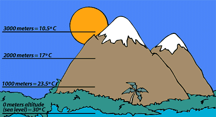
These forests are found on the southern slopes of the Himalayas from Kashmir to Assam. Mixed deciduous and coniferous forests are found. A gradual change in vegetation occurs according to altitude and climate.
In Western Himalayas, coniferous forests are found due to low rainfall and low temperature. But in Eastern Himalayas, evergreen forests are found as there is heavy rainfall and high temperature.
- Tropical moist deciduous forests of ‘Sal’ are found up to a height of 1200 metres in foothills.
- Temperate forests of ‘oak’, ‘chestnut’ and ‘pine’ trees are found up to a height of 2000 metres.
- Coniferous trees are found up to a height of 3300 metres. These include ‘Spruce’, ‘Deodar’, ‘Pine’, ‘Birch’, ‘Silver fir’ etc.
- Alpine pastures are found beyond 3600 metres where pastoral tribes like Gujjars graze their sheep on short grasses.
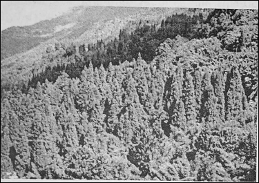
Mountain forests are found in the states of Jammu and Kashmir, Himachal Pradesh, Uttarakhand, Sikkim, West Bengal (Darjeeling), Arunachal Pradesh and Tamil Nadu (Nilgiri Hills) etc.
Forests-Our Friends :
Importance of Forests :
Forests are a valuable resource; like a river system, it is multiple resources. Forests provide mankind with some products. Forests have greatly influenced human activities and act as our friends.
Modern civilization depends more and more on forests. The direct and indirect advantages of forests are as follows :
Forests help in occurring rainfall by capturing moisture in the air. These affect the climate of an area.
- It absorbs carbon dioxide and releases oxygen in the air.
- Forests help to balance the ecological system.
- Forests prevent soil erosion, floods and droughts.
- Forests increase the fertility of the soil and help agriculture.
- They check the advance of deserts.
- Forests provide shelter to wild animals and help to the recreation of wildlife.
- Soft woods supply raw materials for wood pulp, paper, and rayon industries.
- Forests provide plywood and fibrewood for packing purposes.
- Many products like rubber, pitch, gum, honey, wax, tanning materials, cork, camphor, fir, herbs etc. are . gathered from forests.
- Forests are a source of timber for house building, furniture making, shipbuilding etc.
- Forests also help to develop lumbering.
- Forests supply about 40% of the fuel of the world. Wood has been the major source of fuel in houses, smelting industries and running locomotives.
- Forests provide many things to meet our food requirements like wild fruits, nuts, berries etc. Many tribes are dependent on gathering of these products in forests.
Forest Resources of India :
The forests are a gift of nature. The forest resources play a dominant role in solving the economic problems of India both directly and indirectly. These forests supply a wide variety of resources.
These provide structural timber and wood for making pulp and furniture, match wood, wood for charcoal, fibres, cones, resins, gums etc. Besides these, there are many other forest products such as leaves, fruits, lac, bee-wax, honey, turpentine oil, tan dyes and medicinal herbs.
Problems of Forestry :
Indian forestry faces many problems. Forests have been depleted in India due to the following reasons :
- The clearing of extensive forest areas for agriculture.
- Heavy soil erosion.
- Overgrazing of pastures.
- Reckless cutting of trees for timber and fuel.
- The practice of shifting (Jhum) cultivation destroys forests and invites soil erosion.
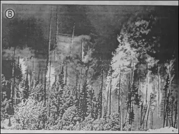
- Forest fire often destroys forests; and
- Human occupancy of forest land.
Forest Conservation :
Forest conservation refers to the proper and need-based utilisation of forests without hampering the environment and residing animals ‘on causing much destruction of the tree species.
The several needs for forest conservation are-
- To reduce soil erosion,
- To control droughts and floods,
- To control desertification,
- To control global warming,
- To maintain ecological balance and conserve numerous plants and animal species etc.
Measures of Forest Conservation :
The following measures should be adopted for the conservation of forests :
- Deforestation or the felling of trees should be checked.
- Felling of immature or pre-mature trees should be controlled by law.
- Cheap and alternate methods or sources of fuel should be used to control the loss of forest wood as well as to prevent the environment.
- Forests should be protected from natural hazards like a forest fire.
- Grazing of cattle should be controlled.
- Afforestation and reforestation is needed to check deforestation.
- Jhum cultivation should be banned by law.
- Poaching and stealing of valuable timber should be controlled and stopped by law.
- Forest management programmes should be undertaken.
- Active involvement of man is indispensable for the conservation of forests.
To preserve the forest, the Government of India has taken up a series of programmes in support of the states :
- The forests are declared as “Protected Forests”, “Reserve Forests” etc.
- The “Forest Research Institute” has been set up at Dehra Dun for the promotion and preservation of the forests properly.
- 21st of March is observed as “World Forest Day” every year.
- A good programme of “Van Mahotsav’ has been chalked out by the government, thousands of trees are planted every year in the months of July and August to promote new forestation.
- “Social forestry” and “Agro¬forestry” conservation processes taken up by the Government of India.
Social Forestry :
“Social forestry” is afforestation outside the forest area in barren and fallow land for the benefit to the economically weaker section of our society.
This is a project started by the ‘National Commission on Agriculture in 19761 The aim of this project was to plant trees in the fallow and wastelands in order to remove pressure from the traditional forests.
In this programme, trees are planted beside the canals and rivers, in open spaces,of schools, offices and religious places; along the road and railways and around the agricultural fields.
“WBBSE class 6 geography chapter 10 key points”
As a result, the production of wood, fruits, fodder crops and forest products increases as well as unused barren and fallow lands are used for economically profitable purposes leading to the development of the environment as well as the socio-economic field. It is actually the forestry is ‘of the people, by the people and for the people.’
Some Essential Medicinal Herbs :
Since ancient times herbal plants are used in Indian medicine. The medicinal method that has developed from it is known as! ‘Ayurveda’.
A list of some important and useful herbs is given below :
Forests And Wildlife
Definition of Wildlife :
India is rich in forests and wildlife. Wildlife is a gift of nature and a thing of beauty. All the lives other than cultivated or domesticated ones, which live freely and adapt in natural habitats are called ‘wildlife’.
There is a great biological diversity in India and India’s forests are habitat to a large variety of wildlife.
There are about 75000 known species of animals. It has 2500 species of fish and 2000 species of birds. In addition, there are amphibians, reptiles, mammals and small insects and worms. Our rich wildlife has a rich heritage formed through centuries.
Several well-known varieties of Wildlife in India :
India is home to several well-known varieties of wildlife.
These are as follows :
- The tiger is one of the most powerful species in our jungles. The famous ‘Royal Bengal Tiger’ is found in the Sundarbans, the tidal forests of India.
- The Giant Crocodiles are also found in the Sundarban areas in West Bengal.
- Elephant is a typical animals of hot and humid equatorial forests. It is found in the jungles of Assam, Kerala and Karnataka.
- Indian lion is found in the ‘Gir’ forests in Saurashtra (Gujarat). Lion is the most majestic of all the animals.
- Indian one-horned rhinoceros are found in swampy and marshy lands of Assam and North Bengal.
- Camels and wild asses are found in extremely hot and arid deserts. While the camels are common to the ‘Thar Desert’, the wild asses are confined to the arid areas of the Rann of Kachchh.
- Black Panther is found in Anshi National Park in Karnataka.
- Highest tiger population in India including white tigers are found at ‘Bandhavgarh National Park, M.P.
- Red Panda, Bear, Cheetah, Wild Cat and monkeys are found at the Himalayan mountainous region.
- Sambar, Gaur, Barking deer, Jungle cat, Wild Bear etc. are found at Simlipal National Park in Odisha.
- Different types of reptiles like snakes are found in the wetlands of India.
- Birdlife in India is both rich and colourful. Many beautiful species of birds are found throughout India.

Conservation of wildlife in India :
India is rich in forests and wildlife, but many of this wildlife have been destroyed by man. Many rare species have become extinct in India. It must be preserved because the existence of these different species of animals is in grave danger.
So, it is necessary to conserve these forests and wildlife. Wildlife can be conserved by the following ways :
- Wildlife Act should be activated properly, for the protection and conservation of different species of wildlife.
- By establishing Zoos, national parks, bio-reserves, tiger reserves, sanctuaries etc. wildlife can be conserved.
- Endangered, vulnerable and rare species of wildlife should be conserved.
- ‘Reserved Forests’ and ‘Protected Forests’ should be made to conserve the animals.
- Efforts should be taken to stop the hunting of endangered and rare species. Killing of wild animals without any cause should be strictly prohibited by law.
- Much social awareness should be improved regarding the conservation of forests and wildlife.
Reserve Forest (R.F.) :
When the number of wildlife of a forest decreases remarkably, the Forest department of the State Government declares the forest as a reserve forest until the forest’s wildlife is restored again.
“types of forests in India class 6 geography”
In this, the public are strictly prohibited from entering that forest. In reserved forests hunting, grazing and other activities are prohibited, e.g. Chapramari and Gorumara of West Bengal, Kodarma Reserve Forest of Jharkhand etc.
Protected Forest (P.F.) :
A protected forest is one where human intervention is not prohibited, but hunting and poaching of animals are not permitted. In protected forests rights to activities like hunting and grazing are sometimes given to communities living on the fringes of the forest, who sustain their livelihood partially or wholly from forest produce or resources.
Sanctuary :
The forest area in which wild animals can live freely and reproduce safely is known as a ‘sanctuary’. In sanctuaries, the protection and proliferation of endangered species are in focus.
In this area trapping and killing of animals are prohibited. Here trespassers are prosecuted under the law. In sanctuaries, collection of minor forest products, harvesting of timber, and private ownership rights are permitted so long as they do not interfere the cause of animals.
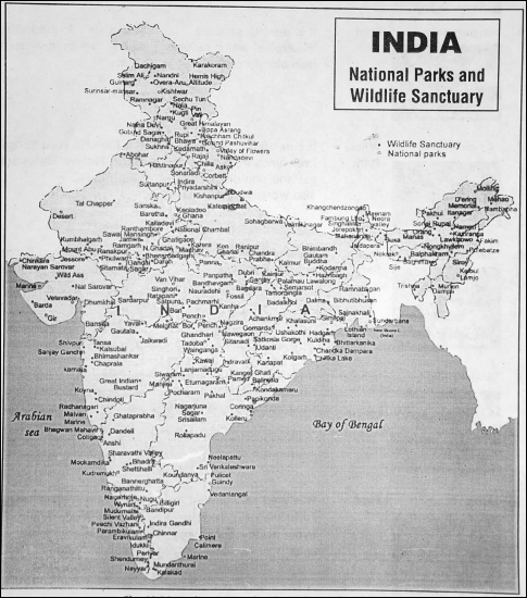
There are 490 sanctuaries in India, e.g. Jaldapara Sanctuary and the Sundarbans of West Bengal, Kaziranga of Assam etc.
National Park :
A national park is a reserved area for preserving its natural vegetation, natural beauty and wildlife. The protected forest is larger than the sanctuary controlled by the Central government is called a ‘National Park’.
These parks are reserved for the betterment of wildlife. The public are considered to enter these parks only with special permission from the Govt, authority.
There are about 88 national parks in India, e.g. Kaziranga national park is located in Assam, and Corbett national park lies in terrai area of Uttarakhand. Kaziranga is famous for the Rhinoceros project.
Birdlife in India :
Bird life in India is both rich and colourful. The peacock is our national bird. Pheasants, geese, ducks, mynahs, parakeets, pigeons, cranes, hornbills and sunbirds belong to the forests and wetlands.
Sometimes birds in groups migrate from one area to another where foods are available with breeding facilities. Birds in the winter season fly away from the Siberian cold areas to tropical countries like India.
“tropical rainforests in India and their characteristics”
The birds travel hundreds or thousands of kilometres during migration, depending upon their preference for habitation. They return to their homeland after breeding in summer. These birds are called ‘Migratory birds’.

Measures were taken by the Government for Wildlife Conservation in India :
The government of India planned the wildlife conservation and ‘The Wildlife Protection Act’ was constituted in 1972. It was declared that 41 varieties of large animals, 18 types of birds and 2 types of amphibians and reptiles are protected by law from 9th September 1972.
Besides these, Forest Conservation Act’ came up in 1980 ‘And the National Wild Life Action Plan’ was taken up in 1983-1984. ‘The Wildlife Conservation Act’ was finally amended in 1991.
The organization and institutions involved in the protection of wildlife in India are the Indian Board for Wildlife (IBWL) Botanical Survey of India (BSI), the Zoological Survey of India (ZSI) etc. It should be mentioned that every year the first week of October is celebrated as ‘Wildlife Week’
WBBSE Notes for Class 6 Junior School Geography
- Chapter 1 The Universe and Solar System
- Chapter 2 Shape of The Earth: Is The Earth Around?
- Chapter 3 Location of a Place on The Earth’ Surface: Where You Are
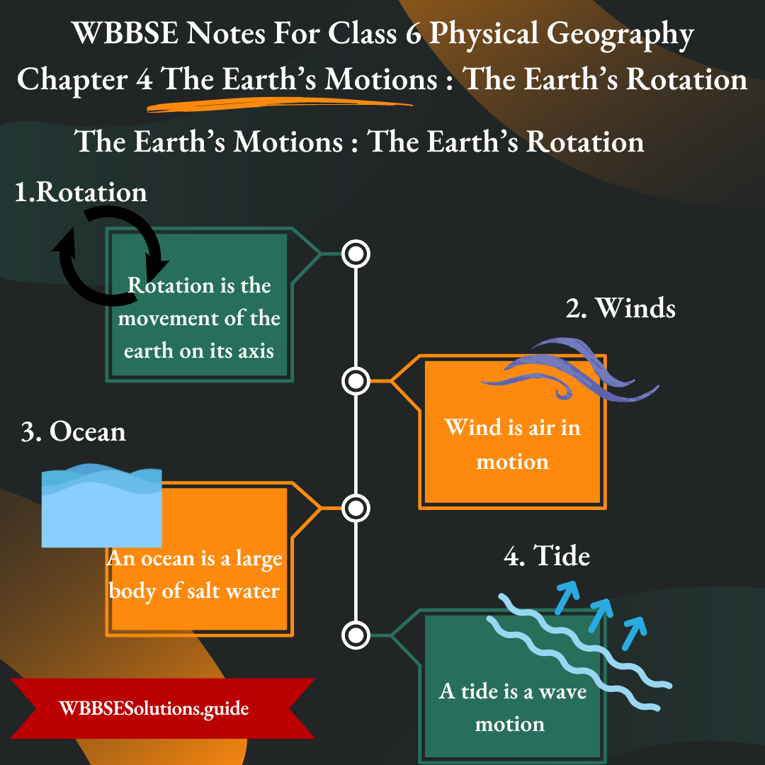
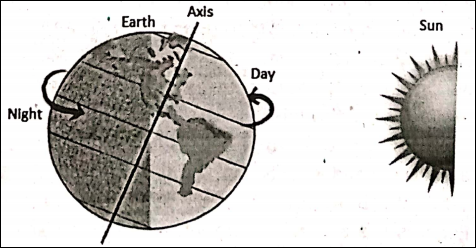
- Chapter 4 The Earth’s Motion: The Earth Rotation
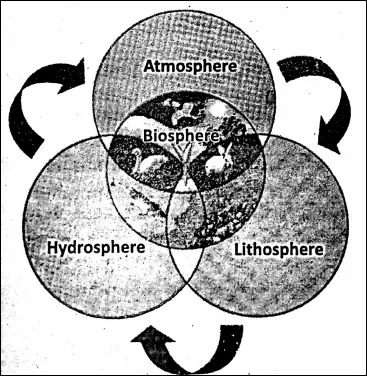
- Chapter 5 Water – Land – Air
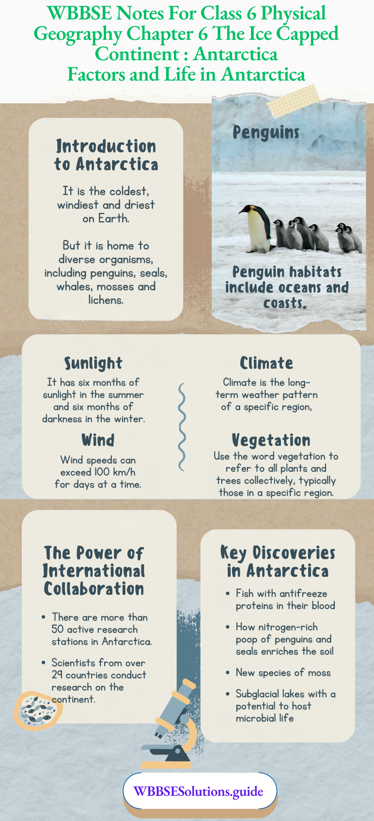
- Chapter 6 The Ice Capped Continent: Antartica
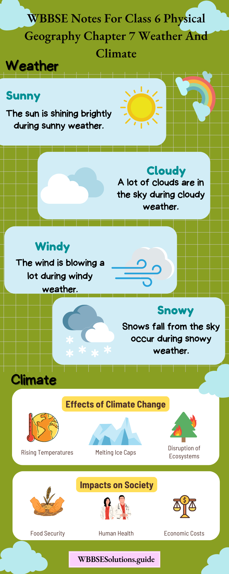
- Chapter 7 Weather And Climate
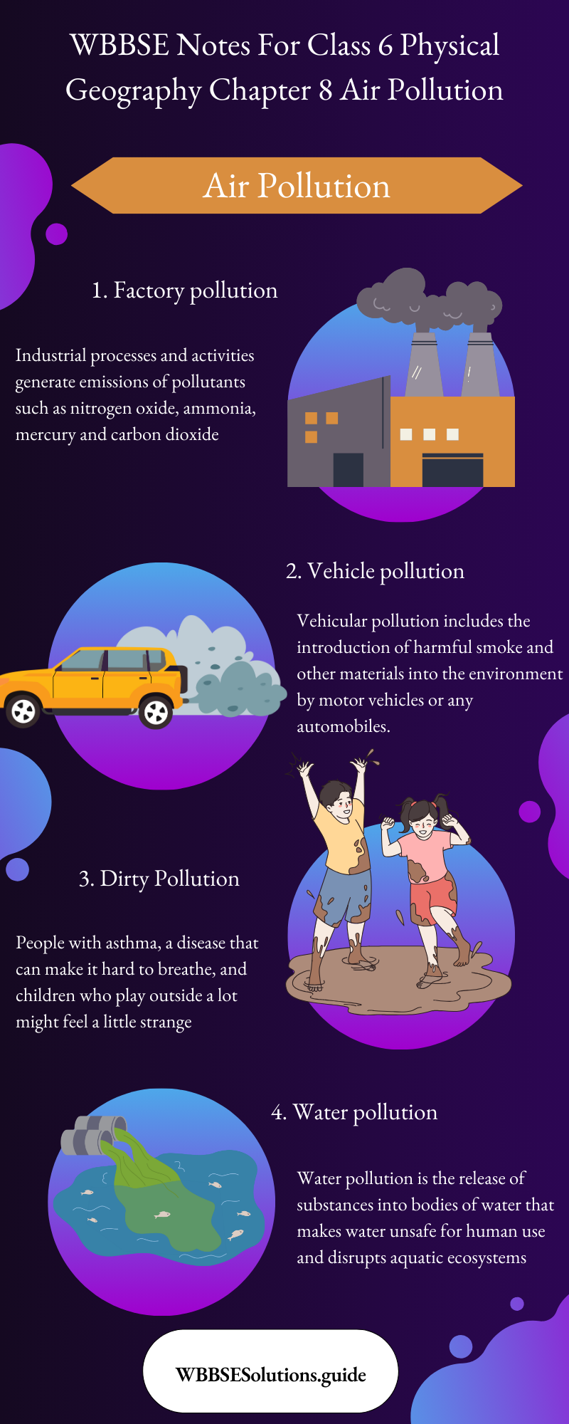
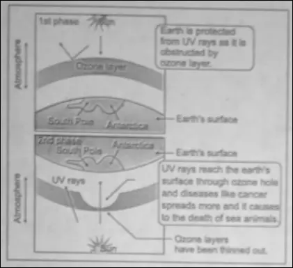
- Chapter 8 Air Pollution
- Chapter 9 Noise Pollution
- Chapter 10 India