Chapter 11 Oceania
Oceania:
The smallest continent of the world Oceania is a continent of oceanic islands. It consists of ten thousand islands floating in the Pacific Ocean. The word ‘Oceania’ is derived from the word ‘ocean’. It is a collective name for the islands scattered mainly in the Pacific Ocean.
“WBBSE Class 8 Geography Chapter 11 notes, Oceania”
Of the numerous islands, Australia is the largest (7-68 million sq km) as it accounts for 87% of the landmass of Oceania, it was considered as a continent. Though a part of Oceania, Australia is the sixth largest country in the world, is itself regarded as an Island Continent.
Read and Learn all WBBSE Notes For 8 Class Middle School Geography
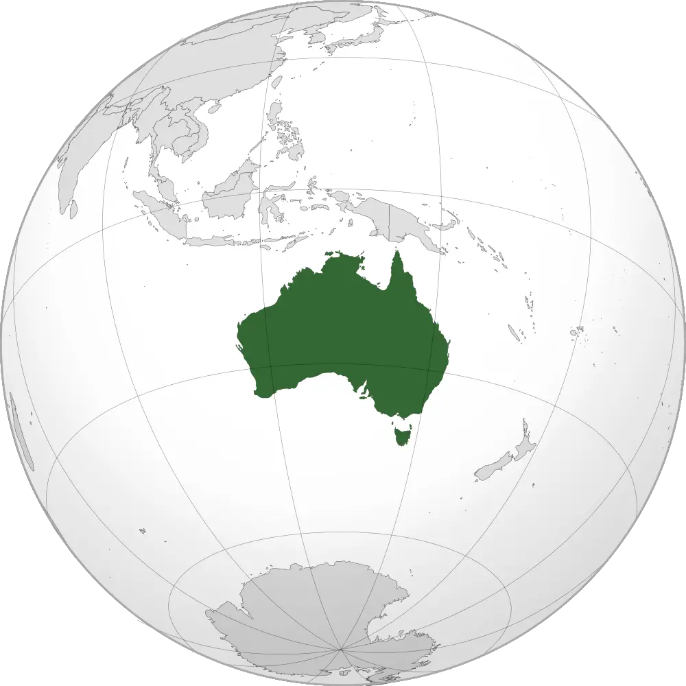
Location of Oceania: The continent of Oceania is located to southeast Asia. It extends from 114° east longitude in the west to 135° west longitude in the east and from 28° north latitude in the north to 47° south latitude in the south.
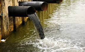
“Class 8 WBBSE Geography Chapter 11 notes, Oceania study material”
Boundaries Of Oceania:
Oceania is bounded on the north by the Pacific Ocean (The northern boundary of Hawaiian Island) and on the south 47°S (Stewart Island) by the Antarctic Ocean. On the east by (135° W) the Pacific Ocean and on the west by (114° E) the Indian Ocean.
Area: Oceania comprises about 8-8 million square kilometers area. It is the smallest continent of the world.
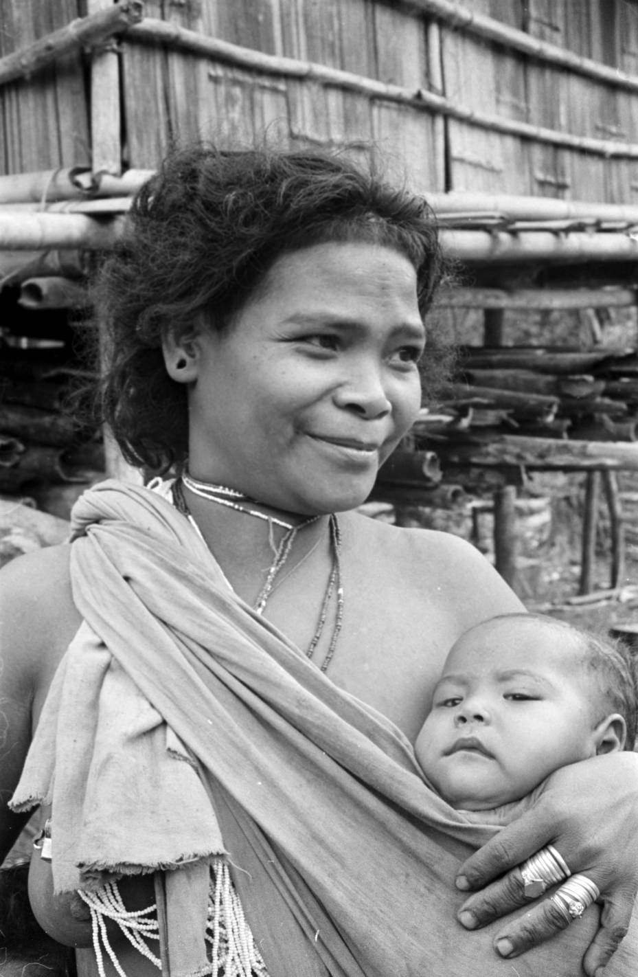
Population: The total population of Oceania is about 3,5162670 (2011).
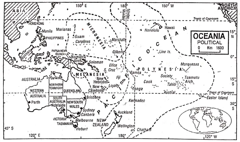
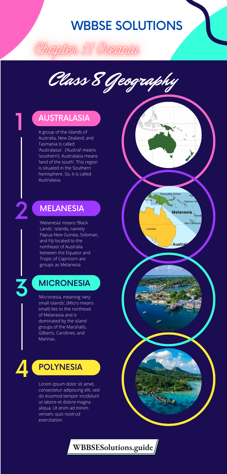
Regional Divisions: Oceania is the continent of a group of islands. The Islands of Oceania can be grouped into four major divisions-
- Australasia,
- Melanesia,
- Micronesia and
- Polynesia.
| Class 8 General Science | Class 8 Maths |
| Class 8 History | Class 8 Science LAQs |
| Class 8 Geography | Class 8 Science SAQs |
| Class 8 Maths | Class 8 Geography |
| Class 8 History MCQs | Class 8 History |
“WBBSE Class 8 Geography Chapter 11, Oceania study guide”
Australasia: A group of the islands of Australia, New Zealand, and Tasmania is called ‘Australasia’. (‘Austral’ means ‘southern’). Australasia means ‘land of the south’. This region is situated in the Southern hemisphere. So, it is called Australasia.
Melanesia: ‘Melanesia’ means ‘Black Lands’. Islands, namely Papua-New Guinea, Soloman, and Fiji located to the northeast of Australia between the Equator and Tropic of Capricorn are groups as Melanesia. Due to the black skin colour of the inhabitants of that region, the name of that region is Melanesia.
“WBBSE Class 8 Oceania notes, Geography Chapter 11”
Micronesia: Micronesia, meaning ‘very small islands’, (Micro means small) lies to the northeast of Melanesia and is dominated by the island groups of the Marshalls, Gilberts, Carolines, and Marinas. These islands are located between the Equator and the Tropic of Cancer.
Polynesia: The meaning of Polynesia is ‘many islands’ (‘Poly’ means ‘many’). These islands located to the east of the International Date Line are grouped as Polynesia. It includes Hawai, Samon, Tonga etc.
Geographical Importance of Oceania: In spite of many obstacles to development like vast desert tracts and barren uplands, absence of natural harbors, and difficulties in constructing roads and railways. Oceania developed mainly due to its geographical importance.
- The location of Oceania is of international importance as Asia is located to the east and America to the west of it.
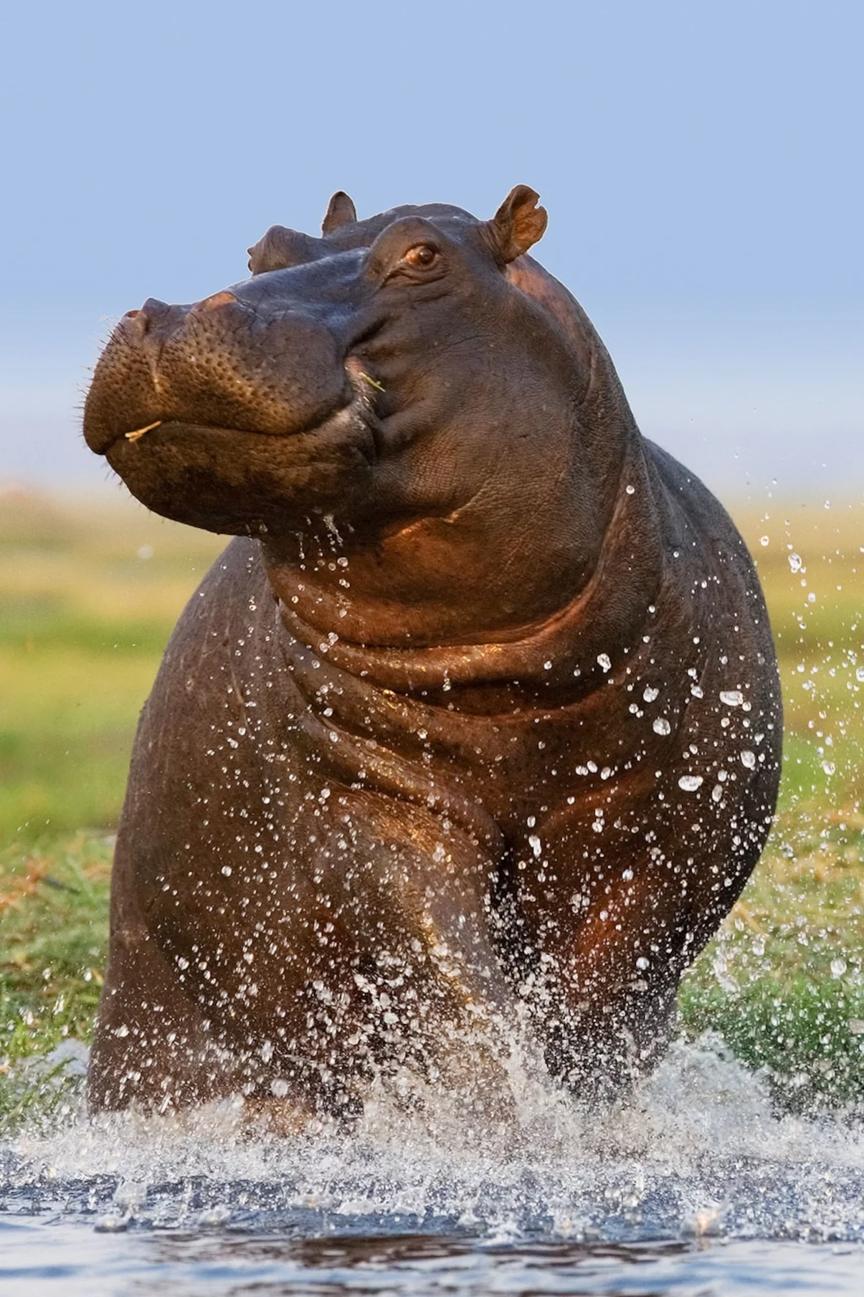
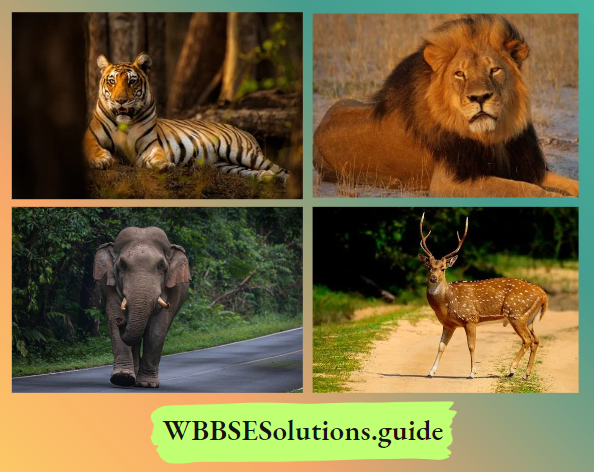
- The uniqueness of the continent lies in its geographical isolation from the rest of the world. The natural isolation of Australia has resulted in the evolution of peculiar flora and fauna that are not found anywhere else in the world. Eucalyptus, Emu, Kiwi, Kangaroo, Koala bear, Platypus etc. belong to this continent only.
- Seaports and airports help as halting centres for long-distance journeys.
- The military base of many countries is also located here.
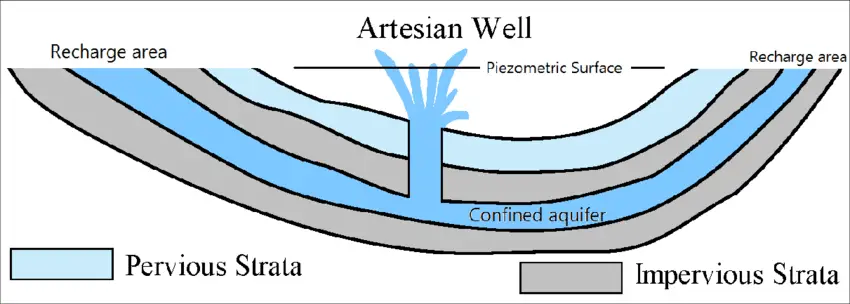
- Australia, though many dry and locking in river water, has vast reserves of underground water in the form of Artesian basins. This has made farming possible even in areas of scanty rainfall.
- Australia is the chief sheep-producing country in the world and also has large cattle farms. Good quality sheep like Merino and cattle like Jersy built up a prosperous economy. It is now the world’s leading exporter of wool, frozen mutton, and beef.
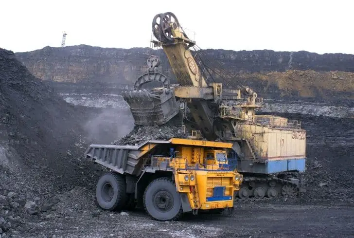
- The continent is well endowed with minerals like gold, silver, iron ore, bauxite, lead, zinc, petroleum, and coal.
- All the developed countries have to depend on the dairy and animal products of this continent.
- The development of railways, Commonwealth roads, and domestic aviation (air transport) have had a great effect on the high development of this continent.
- Islands of the Pacific Ocean attract many tourists from other continents.
- Oceania is a sparsely populated continent. Due to less population pressure farmlands are now plenty and vast resources of minerals are yet to be tapped. So, rich in natural wealth, certainly, this continent will become the focus of international importance.
- Due to prosperity and uniqueness the future of this continent, especially Australasia, looks bright.
Chapter 11 Oceania: Physical Features of Oceania
There are innumerable islands in Oceania, as such, the physiography of different island groups is discussed below.
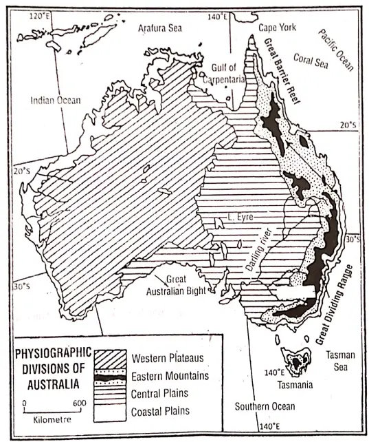
Physiography of Australasia: Physiography of Australia: Physiographically Australia can be divided into four divisions:
- Eastern Mountains,
- Western Plateaus,
- Central Plains and
- Coastal Plains.
- The Eastern Mountains: The Eastern Mountains/Highlands or the Great Dividing Range, forming the highest part of Australia and occupying the eastern part of Australia. It is 3250 km long with a height varying between 1000-1500 m.It extends from Cape York Peninsula in the north to Tasmania across the Bass Strait. It has different names, such as Darling Range in Queensland, New England Range, Liverpool Range, Blue Range in New South Wales, and Australian Alps in Victoria.Mt. Kosciusko (2231 m), the peak of the Great Dividing Range is the highest peak of Australia. Townsend, the second highest peak (2211 m) in the country is located at Victoria.
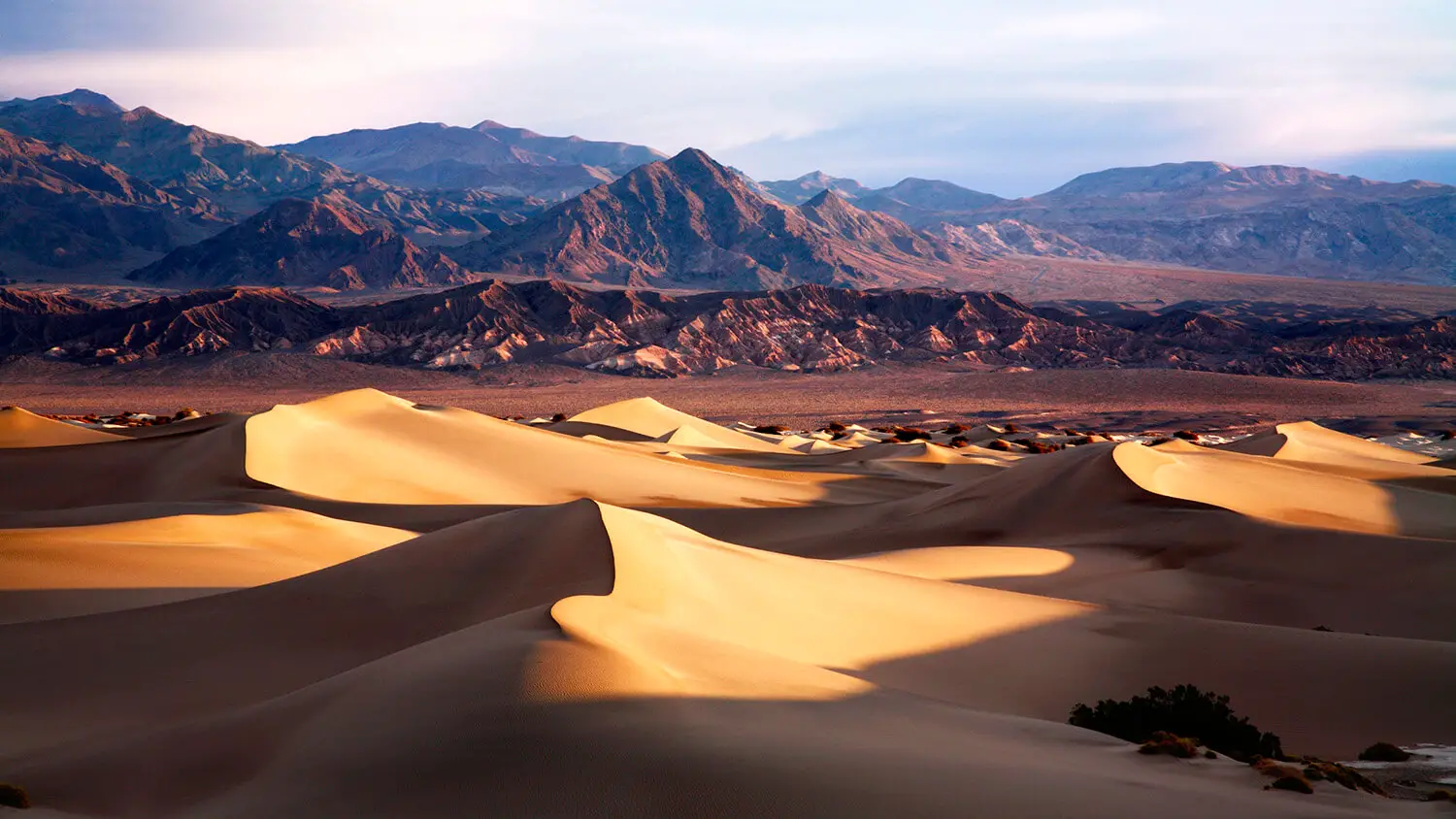
- The Western Plateau: An extensive undulating plateau occupies the western part of Australia. This is the oldest part of Australia. It is made up of old crystalline rocks known as the ‘Australian Shield’.The ancient land has been eroded to form a vast low plateau between 450 and 500 meters in height. Only the most resistant rocks still rise above the flat surface as low residual ranges (900 to 1500 m) such as Hamersley Range, and Albert Edwin Range in the West.The eastern section of this plateau is called ‘Barkley Table land’. There are a few hills, such as Macdonell Range, Musgrave Range, etc. There are a few deserts in this plateau region, such as the Great Sandy Desert, Gibson Desert, and Victoria Desert.
- The Central Plains/Lowlands: There is a lowland between the Great Dividing Range in the east and the plateau in the west. In the southern part of this plan, there are Flinders Range, and Grey Range mountain. The southern part of this plain is called
- Murray-Darling River Basin, the Central part of this plain is called
- Lake Eyre Basin and the northern part is called
- Carpentaria plain.
- The Coastal Plains: Coastal Plains of Australia are usually narrow except in the north, the Carpentaria coastal plain, and in the South, the Great Australian Bight coastal plain is wide.
The Great Barrier Reef: The Great Barrier Reef (2000 km long), the world’s biggest and longest coral reef is located to the northeast of Australia. It stretches along the eastern coast from Cape York to Rockhampton. It is formed of dead coral polyps and other lime-secreting organisms.
Physiography of New Zealand: New Zealand comprises
- North Island,
- South Island,
- Stewart,
- Chatham and many other small islands and is located to the southeast of Australia.
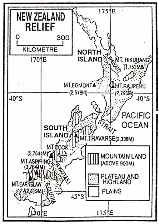
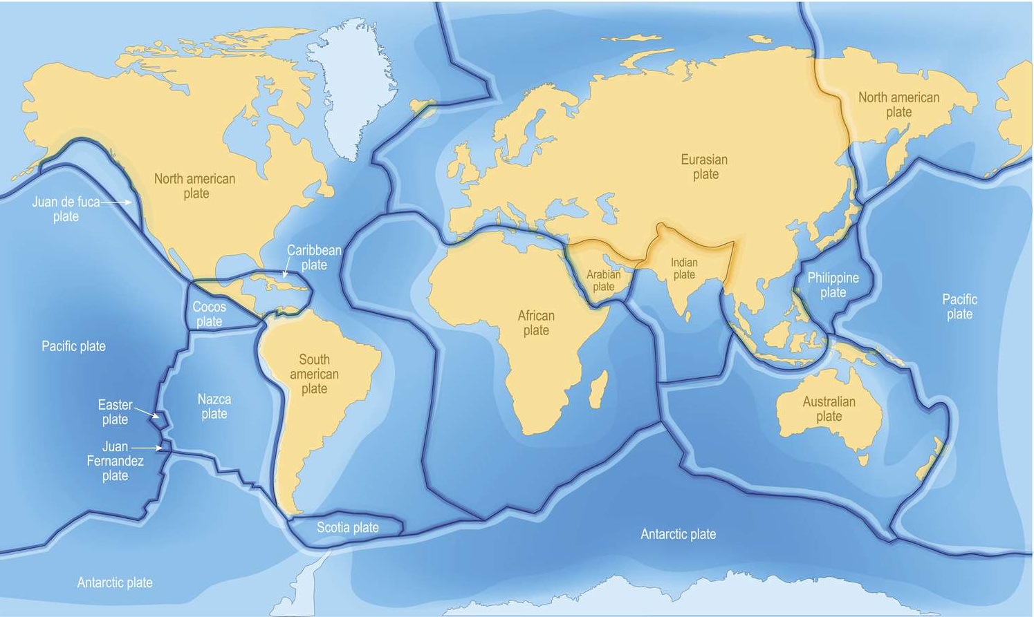
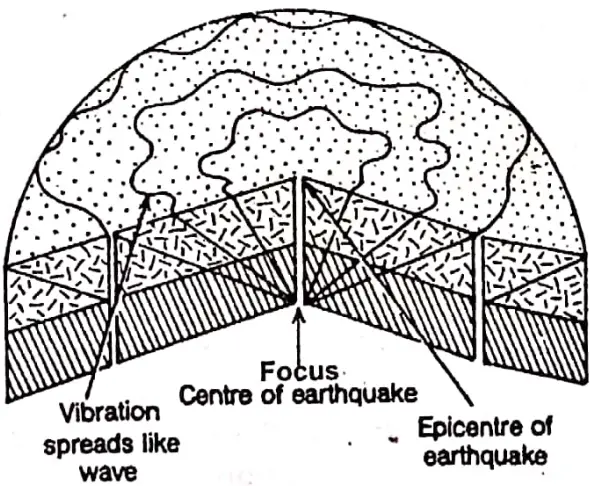
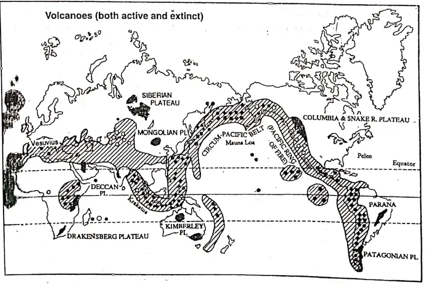
A series of fold mountains form the backbone of New Zealand. It is a part of the ‘Pacific Ring of Fire’ where earthquakes and volcanic activities are common.
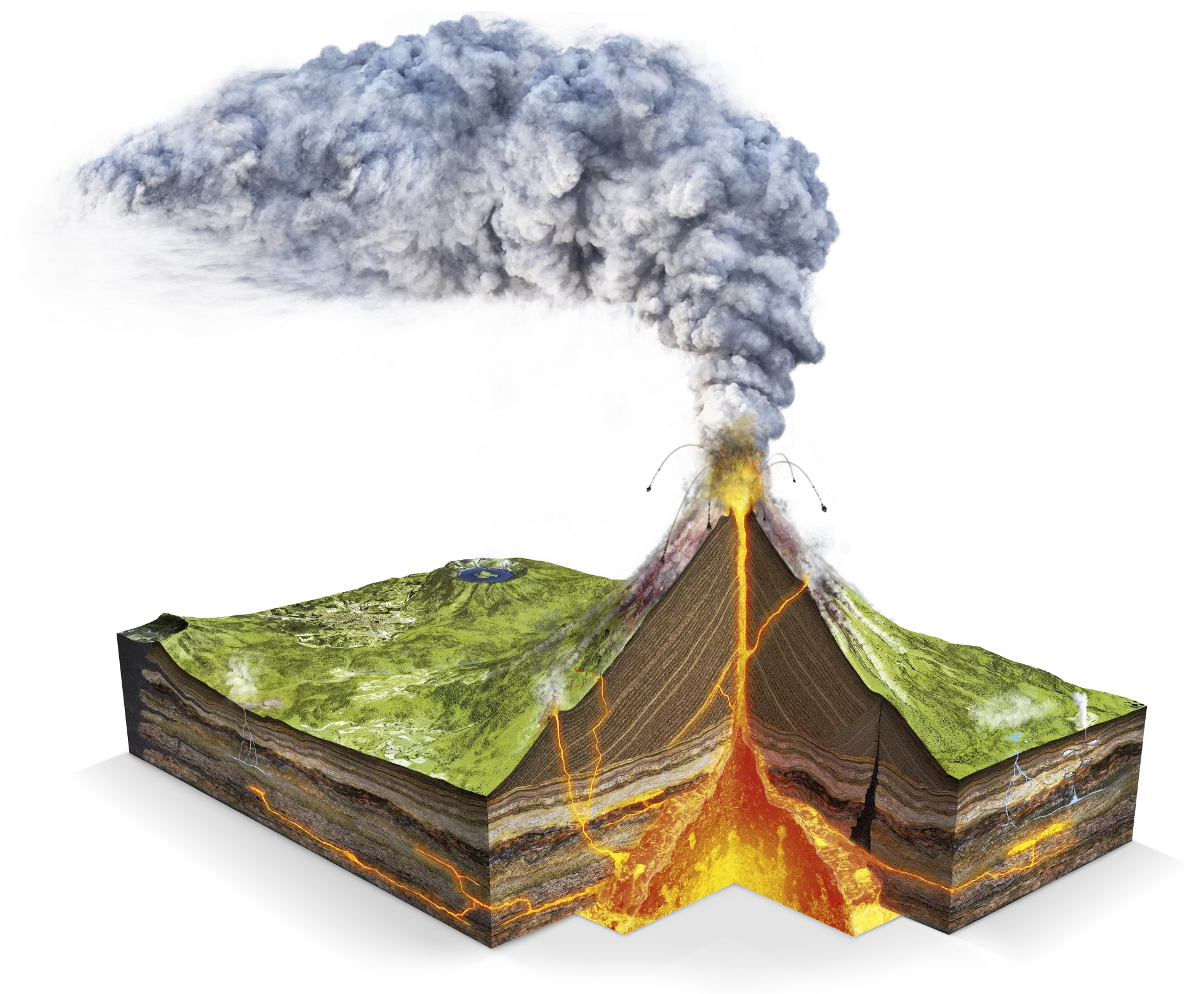
In the central part of North Island, there are small active volcanoes like Ruapehu and Tongariro. Hot springs and geysers are also common in parts of the island. Mt. Egmont (2400 m), an extinct volcano is the highest peak of North Island. Ruahine Range and Kuimanawa Range is also important.
“Class 8 WBBSE Geography Chapter 11, Oceania easy explanation”
The principal range of the South Island is called the Southern Alps. They contain glaciers and twenty peaks above 3000 metres. The highest peak of this range is Mt. Cook (3764 m). This is the highest peak of New Zealand also. To the east of this island is Canterbury plain.
Physiography of Papua-New Guinea: The Melanesian islands like New Guinea which was once joined to Australia and is called a continental island. New Guinea is mountainous in nature and folds mountain ranges called the Central Cordillera to extend across the island from west to east.
Between the parallel mountain ranges lie broad upland valleys. The average height of the mountain chain is 3000 metres. The highest peak of Oceania is Mt. Wilhelm (4509 m/4700 m) of Papua New Guinea.
Physiography of Micronesia and Polynesia: The island groups of Micronesia and Polynesia are oceanic islands and consist of low coral islands and high volcanic islands. Some volcanic islands still have active volcanoes.
Mouna Kea (4205 m) and Mouna Loa (4169 m) are two active volcanoes of Hawaii, Kilauea is also an important volcano Coral islands are Gilbert, Marshall etc.
Chapter 11 Oceania: Rivers of Oceania
Oceania, the ‘continent of islands’ consists of about ten thousand islands. Of the numerous islands, Australia is the largest followed by Papua New Guinea and New Zealand. So, the major rivers of Oceania are mainly found there.
Characteristics of the rivers of Oceania are as follows:
- Though Australia is the largest landmass of Oceania, but there is a vast arid desert tract. Due to high temperatures, uncertain and less rainfall only a few number of rivers are found there.
- Great Dividing Range is the principal watershed of Australia.
- Most of the rivers of Australia as well as Oceania are short in length.
- These rivers do not contain much water during the dry season. They exist only during the rainy season.
- There are a few inland rivers.
- The rivers partially dry up in summer and their courses are marked by pools of water in places.
- The rivers of New Zealand are good for the generation of hydel power.
- In the small islands of Oceania, rivers are short and not mentionable.
Major Rivers of Oceania:
| Region/Country | Name of the Rivers | Source of the Rivers | The mouth of the Rivers | Specific Characteristic |
| Australia | Murray (2589 Km) | Australian Alps. | Encounter Bay | Murray-Darling is the Longest river (3718 km) in Oceania |
| Darling (2739 km) | New England Range | |||
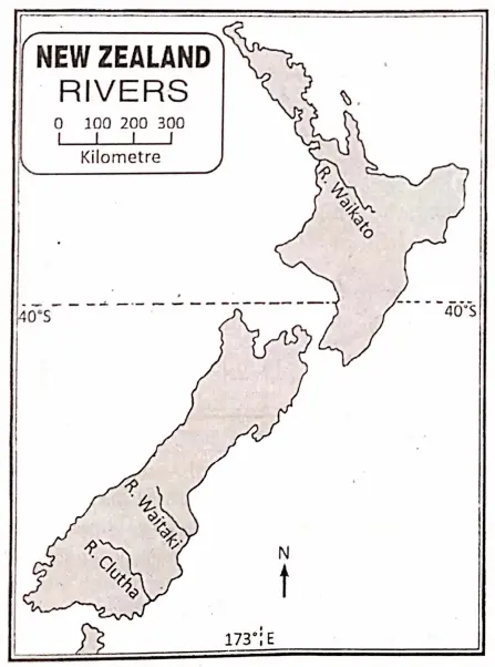
| New Zealand | Waikato (425 km) | Benmore Lake | Pacific Ocean | The longest river of New Zealand |
| Clutha (320 km) | Wanaka Lake | |||
| Papua New Guinea | Fly(1045 km) | Victor Emanuel Range | Gulf of Papua | The largest and most important river of New Guinea |
The rivers of Oceania may be described as follows:
Rivers of Australia: The rivers of Australia can be grouped into the following four categories.
- The rivers drained into the Southern Ocean.
- The rivers drained into the Pacific Ocean.
- The rivers drained into the Indian Ocean.
- Inland rivers.
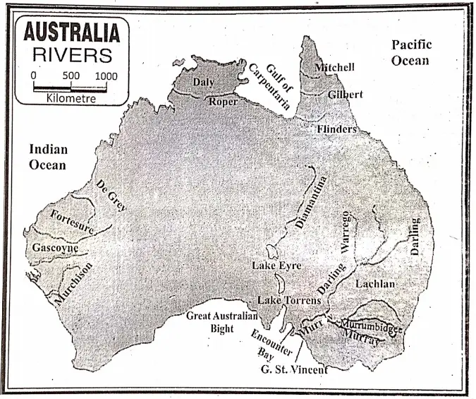
- The rivers drained into the Southern Ocean: The major rivers of this region are the Murray, the Murrumbidgee, the Darling, the Lachlan etc.The Murray (2589 km): The river Murray is the principal river of Australia. It rises in the Australian Alps in Victoria and flows westward. It forms the major part of the boundary between New South Wales and Victoria. Then it enters South Australia.Before entering Encounter Bay on the Great Australian Bight, the Murray passes through Alexandria-a shallow lake. Being Snow fed the river is navigable throughout the year. Mildura and Wentworth are two important towns on the Murray.The Murray with its tributaries-the Darling, Murrumbidgee, Lachlan, and the Goulburn-forms the largest river system of Australia. The combined flow of Murray-Darling is the longest river (3718 km) of Oceania.The Darling (2739 km): The Darling is the chief tributary of the Murray. It rises in the New England Range and flowing southwestward, meets the Murray at Wentworth. The Darling is fed by the Warrego and a few rivers flowing from the Eastern Highlands.On account of the very gradual slope, the Darling flows sluggishly across the hot and dry plain where evaporation is very rapid. So the river partially dries up in summer and its course is marked by pools of water in places.The Murrumbidgee (1579 km): The Murrumbidgee is another tributary to Murray. It rises in the Snowy Mountains and joins the Murray. The Lachlan is its main tributary.The Lachlan (1550 km): The Lachlan is the main tributary of the river Murrumbidgee. It is a snow-fed river but the volume is small in dry seasons.
- The rivers drained into the Pacific Ocean: Some other rivers of the continent of Oceania are the east flowing. Hawkesbury and Burdekin rivers rise from the Eastern Highlands and flow to meet the Pacific Ocean. Mitchel and Flinders flow towards N.W. and fall into the Gulf of Carpentaria.
- The rivers drained into the Indian Ocean: The Murchison, Gascoyne, Fortescue, De Grey etc. are the rivers of Australia which are rise in the Northern part of the Western plateau flow westward and enter into the Indian Ocean. The Fitzroy, Victoria and Ashburton are also three important rivers flowing into the Indian Ocean.
- Inland Rivers: There are a few inland rivers such as the Cooper, and Eyrein Australia.
The Cooper or Barcoo (1420 km): It is also called Cooper’s Creek is an intermittent stream. It rises from Warrego Range in Queensland and flows into Lake Eyre only during the rainy season.
The rivers of New Zealand: The longest river of Newzealand is Waikato (425 km). It rises from the Benmore Lake flows towards north and west and enters into the Pacific Ocean.
- The river Wang a nui (290 km) rises in Tongariro Nation Park flows west and southward falls into the northern part of the Cook strait.
- The river Clutha (320 km) rises in Wanka lake flows towards the southeast and enters into the Pacific Ocean.
Other important rivers of New Zealand are the Wainsakariri, Rangitata, and Rakaia which form the Canterbury Plains of the South Island and the Waikato and Rangitaiki of the North Island.
The rivers of Papua-New Guinea: The Fly (1045 km) is the largest and most important river of New Guinea. It rises in the mountains of Papua in the Victor Emanuel range and flows over the southwestern plain to enter the Gulf of Papua.
Lakes of Oceania: There are a number of big lakes in Oceania, such as
- Eyre (10000 sq. km)
- Gairdner,
- Torrens and
- More, in Australia,
- The Anau and
- Taupo (616 sq. km) in New Zealand.
Lake Eyre is the largest lake in Oceania. Lake Taupo is the largest volcanic lake on the North Island of New Zealand.
Artesian well: The presence of Artesian wells is the most important natural feature in Australia. Rainwater collected in the impermeable syncline rock comes up by normal water pressure. These are called Artesian wells which are scattered over extensive areas in Australia.
Chapter 11 Oceania: Climate Of Oceania
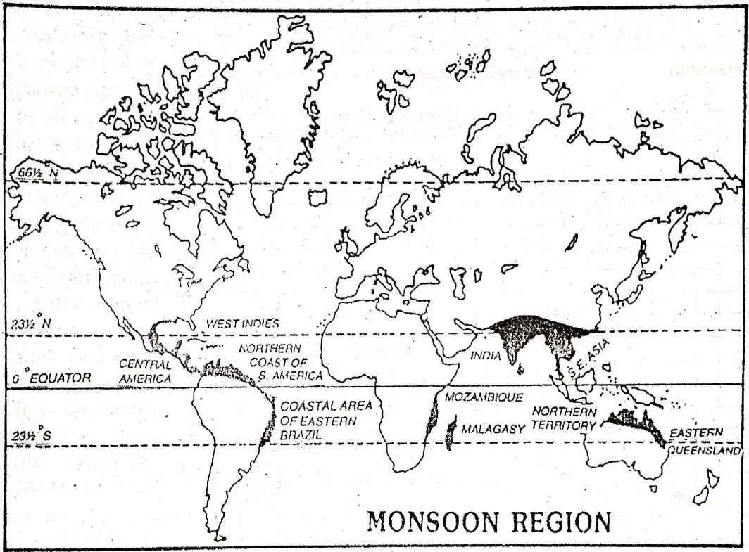
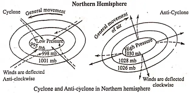
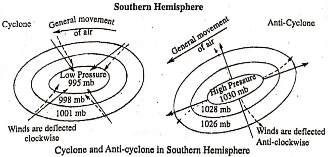
The climate of Oceania is very much diversified. Different parts of the continent have a great variety in the character of climates. The important characteristics of the climate of Oceania are as follows:
- Generally, there is less rainfall occurs in the continent of Oceania, but there are some small islands where much rainfall occurs throughout the year.
- The seasonal climatic characteristics are different in the northern and southern parts of this continent due to their location in the Southern and Northern hemispheres. When summer occurs in the Northern hemisphere, then winter occurs in the Southern hemisphere.
- A vast tract of Australia is covered by deserts but most of the small islands of the Pacific Ocean have moderate and comfortable climate is found due to their size and nearness location to the ocean.
- Different controls or factors of climate have played an important role to diversify the climate of Oceania.
The factors of climatic variations in Oceania are as follows:
Latitudinal extent: The continent of Oceania extends from 28°N latitude (the northern boundary of Hawaiian islands) in the north to 47°S latitude (Stewart island) in the south. Due to many differences of latitudes, different types of climate are seen in different parts of Oceania.
The equator passes through the northern parts of Oceania and the Tropic of Capricorn (23° 30°) passes through the middle of Australia, as such climate of the northern part of Oceania is equatorial (hot and humid) and the climate of Australia is warm in the north and is temperate in the south.
All of New Zealand lie in the temperate zone, its climate is also temperate. In the northern part warm temperate and in the southern part cool temperate.
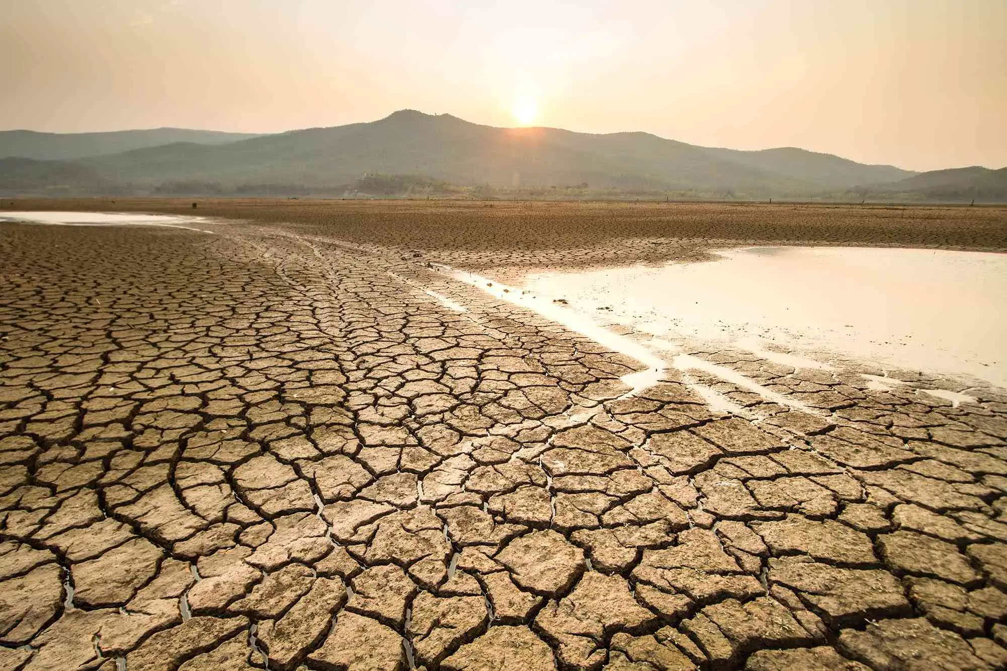
Distance from sea/continental location: By virtue of its vast size and extent, the interior part of Australia belongs continental location as such middle and northern parts of Australia, extreme climatic conditions prevail. Due to the extremity of climate less rainfall and high temperature arid and semi-arid desert-type climate is found there.
Altitude: The effect of altitude on the climate of Oceania is experienced in lofty mountainous areas. Due to the increase of altitude temperature decrease and as such the peak regions of the mountains become snow-covered.
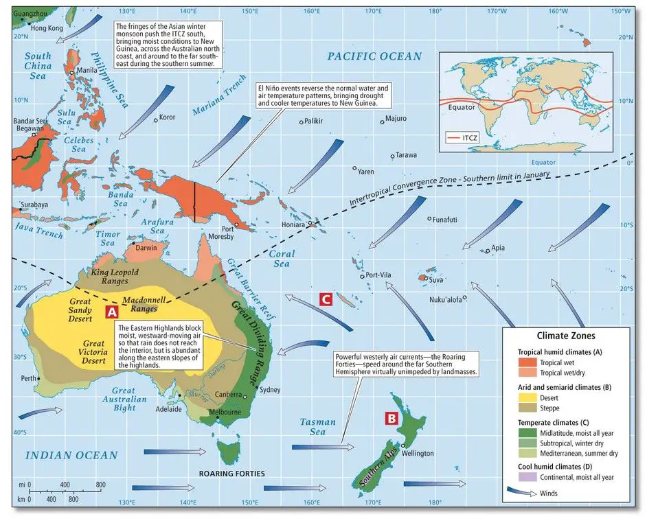
Ocean Currents: Some ocean currents, such as the cold Antarctic current, cold West- Australian current, warm Australian current etc. influenced the climate of the coastal areas of Oceania. However, droughts associated with the El Nino phenomenon have been frequent in recent decades in northern Australia and Papua New Guinea.
“WBBSE Class 8 Geography Chapter 11 notes, Oceania PDF”
Oceanic or Maritime Influence: Most of the island countries of the Pacific and small islands of Oceania are dominated by maritime influence. Due to this effect moderate climate and more rainfall humid climate is found in the small islands and the coastal areas of Oceania. New Zealand, being surrounded by the sea has a mild maritime climate.
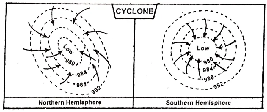
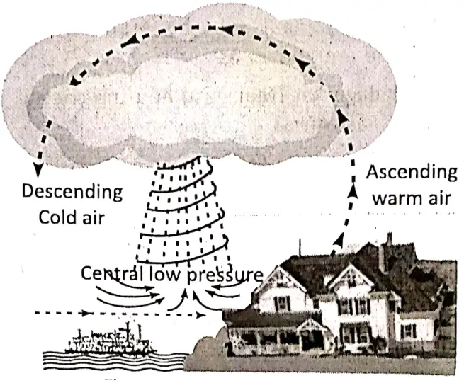
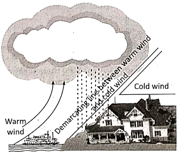
Wind Persistent trade winds dominate much of Oceania, and Tropical. Cyclones often cause considerable damage.
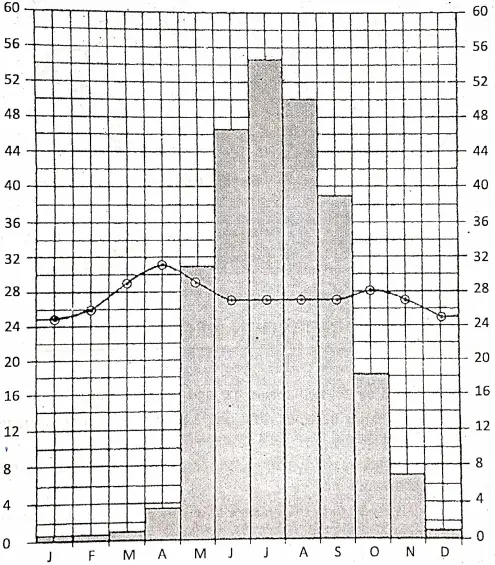
Seasonal conditions of the important elements of climate in different parts of Oceania:
Temperature: There is differences in the temperature of the northern and southern part of Oceania. In the regions which are located in the southern hemisphere, seasons are reversed then the regions which are located in the northern hemisphere.
So in the southern hemisphere, January is a summer month while July is a winter month. In summer (December, January, February) nearly the whole of Australia has a temperature of over 27°C and in the interior, the temperature shoots up to well over 35°C.
January and February are the hottest months is Australia. The annual average temperature of New Zealand varies between 11°C and 19°C, snowfall occurs in winter (June, July, and August) in North Island. The temperature of Papua New Guinea is high as it is located near the Equator.
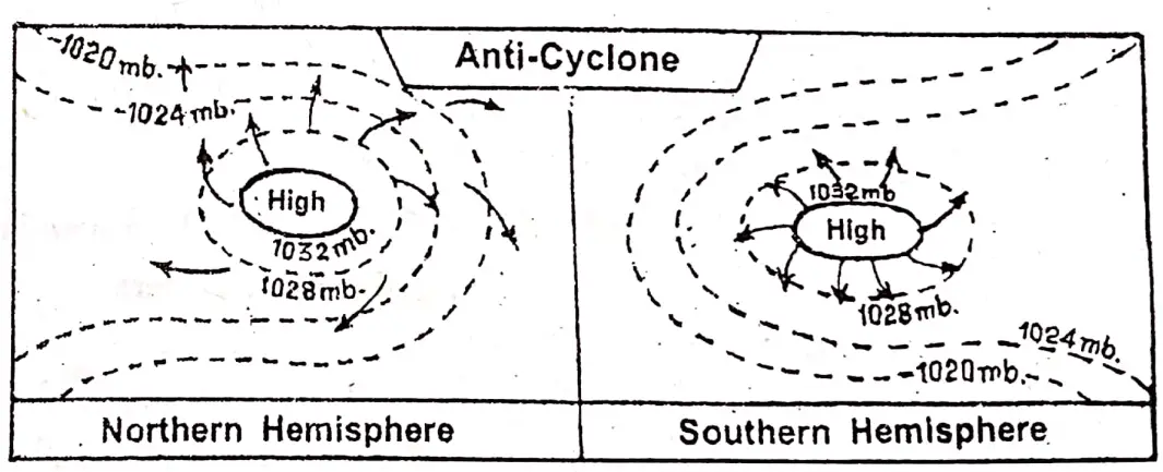
Air pressure and Wind: Moist north-west monsoon wind blows in summer over northern parts of Australia. But, in general, the south-east Trade wind blows in most parts of the continent.
Rainfall: In summer, the southeast Trade winds blow onshore nearly all along the whole east coast of the continent causing heavy rainfall, especially in northeast Australia. In winter, the south-east Trade winds in northern Australia blow towards south-east Asia., Being off-shore winds, they cause no rainfall.
East and North-west coast of Australia, the western part of Tasmania, the western part of New Zealand, and the entire Papua-New Guinea receive an average rainfall of 100 cm Interior and western parts of Australia receive only 25-50 cm. rainfall, as such, a number of deserts have formed there.
Climatic Regions of Oceania: Based on variations in temperature rainfall, air pressure, and wind, the continent of Oceania can be divided into the following climatic regions.
- Tropical Monsoon Climatic region
- Tropical Maritime Climatic region
- Tropical Continental Climatic region
- Equatorial Climatic region
- Warm-Temperate Maritime Climatic region
- Warm-Temperate Continental Climatic region
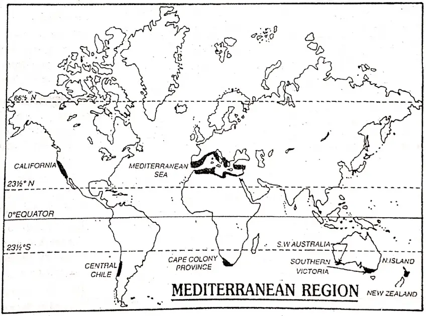
- Mediterranean Climate Region
- Hot Desert type of Climatic region
- Cool Temperate or British type of Climatic region.
Climatic Region Of Oceania:
| Climatic Type | Location | Characteristics |
| 1. Tropical Monsoon Climate | This climate is seen in the eastern and northern parts of Australia. | 1. Rainfall occurs during summer. 2. The winter is mild and dry. 3. Rainfall and climate is influenced by monsoon wind. 4. Amount of annual rainfall is about 100cm. |
| 2. Tropical Maritime Climate | This climate is found in the northeastern part of Australia. | 1. Hot summer. 2. Year-round rain, with summer maximum. 3. Annual rainfall is about 150 cm. |
| 3. Tropical Continental Climate | This is a climate of northwestern and part of Central Australia. | 1. Hot summer. 2. Cool winter. 3. Annual rainfall is 25 – 100 cm, occurring mainly in summer. 4. Semi-arid type of climate. |
| 4. Equatorial Climate | Islands of Micronesia, Melanesia, and Polynesia experience equatorial climates. | 1. Temperature is high (28°C). 2. Annual rainfall is about 200 cm. 3. Rainfall occurs throughout the year. 4. Hot and Humid climate. |
| 5. Warm Temperate Maritime Climate | This climatic region is located in the southwestern part of Australia. | 1. Hot summer. 2. Mild winter. 3. Annual rainfall is 100 – 200 cm. 4. Rainfall occurs mainly in summer. |
| 6. Warm Temperate Continental Climate | This climatic region is situated in the southeastern part of Australia and the western part of the maritime climatic region. | 1. Hot summer. 2. Mild winter. 3. Annual rainfall is less, about 60 cm. 4. Rainfall occurs in Summer. |
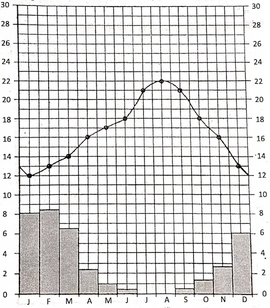
| 7. Mediterranean Climate. | Southern and South-western coasts of Australia and North Island in New Zealand | 1. Hot dry summer. 2. Cool wet winter. 3. Moderate climate throughout the year. 4. Amount of rainfall is 60-75 cm, and mainly occurs in winter. |
| 8. Hot-desert type of Climate | This is the climate of western and Central Australia. | 1. Rainfall is scanty. 2. This region is nearly dry. 3. Rainfall is less than 25 cm. 4. The summer is hot and the winter is cold. |
| 9. Cool Temperate or British type of Climate. | This type of climate is found in southeast Australia, Tasmania, and New Zealand. | 1. Moderately warm summer. 2. Quite a cold winter. 3. The westerlies cause heavy showers throughout the year. 4. Amount of rainfall is 100 cm to 200 cm. |
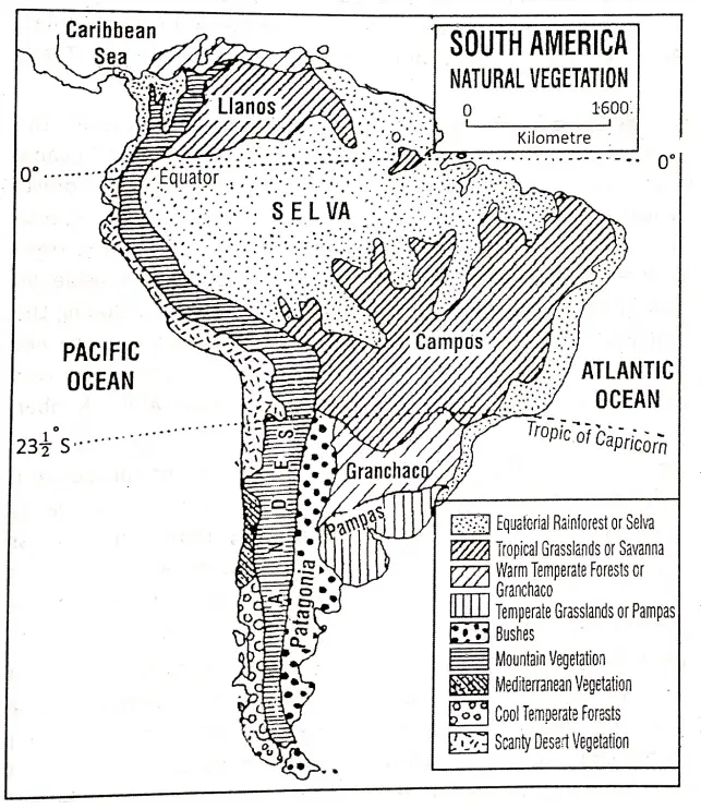
Chapter 11 Oceania Natural Vegetation of Oceania
Natural Vegetation of Oceania:
Natural vegetation is characterized mainly by the influence of climate. As the continent of Oceania has a variety of climates, so due to climatic variation different parts of Oceania have different types of vegetation. The natural vegetation of Oceania can be divided into the following types.
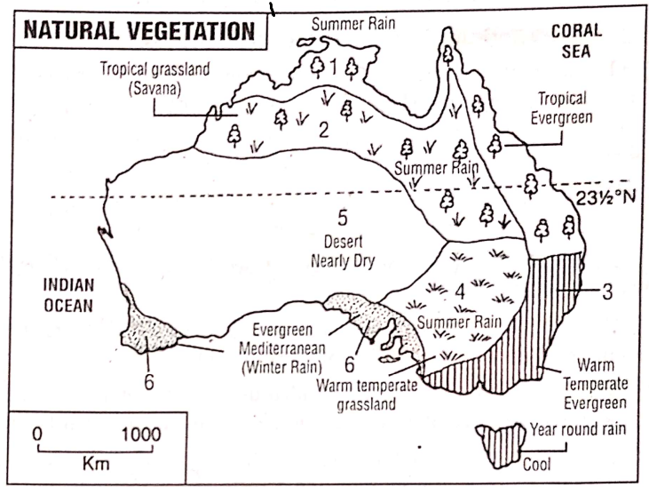
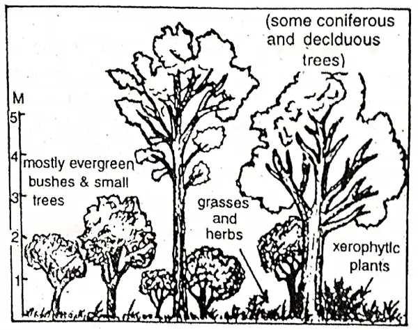
- Tropical Evergreen Forest: Tropical Evergreen Forests are found along the northeastern coasts with hot and humid summer and mild winters where the annual rainfall is 150 cm. Due to high temperature and humidity, the dense evergreen forest grows. Mahogany, Palm, Ebony etc. trees grow here. In different islands of Micronesia, Melanesia, and Polynesia this type of vegetation grows.
- Tropical Grassland: In the north-central part of Australia tropical grasses grow as there the temperature is high and rainfall is scanty. In Australia, this grassland is known as ‘Parkland Savana’. Eucalyptus and jarrah trees are scattered is this grassland.
- Temperate Evergreen Forest: In the southern part of east coast of Australia, Tasmania, and in New Zealand temperature is low but rainfall is high as such trees are evergreen like ash and eucalyptus. Varieties (about 400 species) of Eucalyptus grow here. The common trees are oak, poplar, and elm.
- Temperate Grassland (Downs): To the west of the Great Dividing ranges, an extensive grassland of small grasses is found. This grassland is known as ‘Downs’. Small grasses grow in the temperate weather and scanty rainfall areas of the Murray-Darling river valleys of Australia.
- Desert Vegetation: In the true desert of western and central Australia, the vegetation consists of very hard thorny grass called ‘porcupine’ grass and ‘spiny’ grass or ‘spinifex’. Surrounding this, there is a broad ring of scrublands consisting of saltbush, mulga, and mallee.
- Mediterranean Vegetation: This type of vegetation covers the southwestern corner of Australia (New South Wales and Victoria) and Tasmania. Evergreen trees like Jarrah, Karri, grow in the Mediterranean Climatic region of southwestern Australia.
- Tropical Deciduous Forest: In the western and northwestern part of Australia dominance of monsoon winds give rise to deciduous forest. Cedar, Birch, Palm and bamboo grow here.
- Mountainous Vegetation: Due to the altitudinal effects the climate of the eastern mountains of Australia and the lofty mountains of New Zealand is changed as well as the vegetation of this region is also changed. In the lower mountain region mulga and mallee, in the middle Eucalyptus and above more different types of Pine is available.
Characteristics of Natural vegetation of Oceania:
- Australia’s as well as Oceania’s long isolation of around 50 million years from the other parts of the world and its increasing aridity, caused its natural vegetation to change, adapt and evolve unique characteristics in order to survive. So vegetation of this region is predominantly different from that found in other parts of the world.
- Because of hot and dry conditions, most of the vegetation is xerophytic and plants can live for long periods without water.
- Eucalyptus usually called ‘gum trees’, and acacias such as the Golden Wattle are the two characteristic forms of vegetation.
- The most typical tree is the eucalyptus of which there are more than 450 varieties adapting to an amazing variety of environments.
- Some soft varieties of eucalyptus yield paper pulp some. yield oil and some wet eucalyptus like Jarra and Karri of the southwest provide hard timber.
- Following the rainfall pattern, the vegetation belts occur in concentric circles with the desert scrub in the interior and forests and woodlands on the interior and forests and woodlands on the outer margins. In between these two lie the grassland.
- The trees vary from very tall (100 metres) types to dwarf branching trees called ‘melee’ which grow taller than 2-3 meters.
- Coniferous trees grow over the mountainous region and cocoanut and mangrove vegetation grow in the coastal areas.
Chapter 11 Oceania: Murray Darling Basin
Murray-Darling basin is the most economically prosperous area of Australia as well as the continent of Oceania. The almost flat land of the south-eastern part of Australia which is drained by the rivers of Murray-Darling and their tributaries is known as the ‘Murray-Darling Basin’.
This is the richest, most densely populated, and most developed area of Australia. This region is also famous for cattle rearing and agriculture.
Location: The latitudinal and longitudinal extent of this region are as follows. Latitudinally it extends from 25° south latitude on the north to 39°S latitude on the south. Longitudinally this region extends from 138°E longitude on the west to 150°E longitude on the east.
Boundary: This region is bordered on the north-east and south-east by the Great Dividing Range, on the west by Gray Range and Barrier Range; on the south-west by the Gulf of St. Vincent, Gulf of Encounter, and the Great Australian Bight. The bain covers a sizeable portion of New South Wales and small sections of Sn. Queensland, Victoria, and South Australia.
“WBBSE Class 8 Geography Chapter 11, Oceania important questions”
Area: Covering about 20% of the total area of Australia, the Murray-Darling Basin occupies about 1-14 million square kilometers of area.
Physiography: The Murray-Darling basin is almost a low depositional plain land. For a long period, Murray-Darling deposited sediments forming this plain land. The average elevation of the basin varies from 100-200 meters.
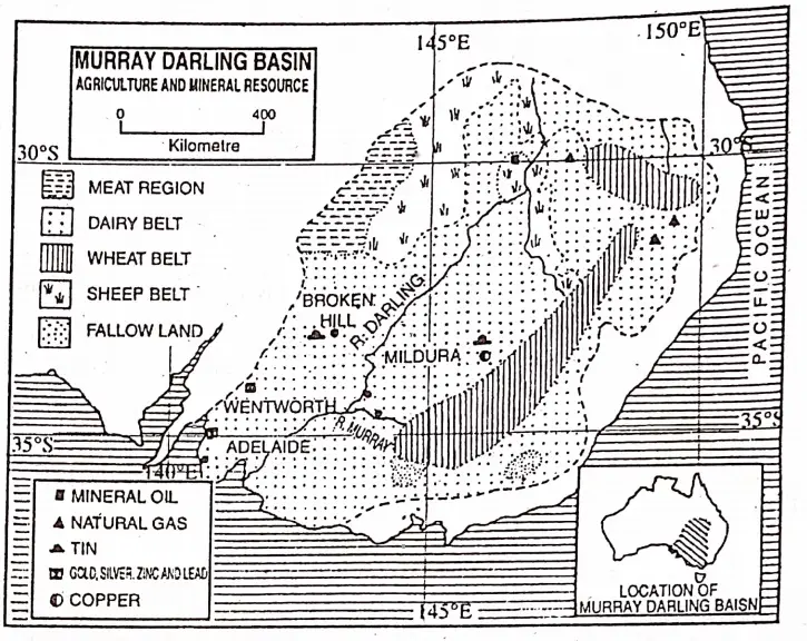
Being bounded by highlands on all sides of 35°S excepting the southwest the central plain rises gradually towards the west-east and northeast. However, the slope, in general, is from northeast to southwest.
River/Drainage: Murray-Darling is the principal river of this basin. The Murray (2589 km) originates from the Australian Alps and its main tributary Darling (1163 km) originates from the New England Range. These are snow-fed rivers, as such they are perennial.
The Confluence of the two rivers is near Wentworth city. Thereafter their joint channel flows southwest and drains out at Encounter Bay. Murrumbidgee is another important tributary to Murray. Lachlan is a tributary to Murrumbidgee. Pars, Warrego, Barron, etc. are tributary to Darling.
Climate: The climate of the Murray-Darling basin is generally temperate. The climate of the southern part (coastal areas) of the basin is Mediterranean type i.e. wet winter and dry summer. But it is an extreme type in the central and northern parts of the basin.
Rainfall is scanty in the central part of the basin. The average temperature during summer is 25°C and that in the winter months is 20°C. To the west of the Great Dividing Range, rainfall is less (50 to 75 cm).
“Class 8 Geography Oceania notes, WBBSE syllabus”
Soil: Soil of this region is mixed alluvial and chernozem type. This type of soil is suitable for agriculture because it is fertile.
Natural Vegetation: Due to scanty rainfall, the central part of the basin is occupied by grasslands called ‘Downs’. Evergreen trees like Eucalyptus, Jarrah, Karri, and blue-gum grow in the southern part of the basin when rainfall is. high.
In the semi-arid west grow the Mulga/Serub while the Mallee scrub consisting chiefly of dwarf eucalyptus grows in the Mediterranean. regions. In a few places, oak, poplar, birch, etc. deciduous trees are seen.
“WBBSE Class 8 Geography Chapter 11, Oceania summary”
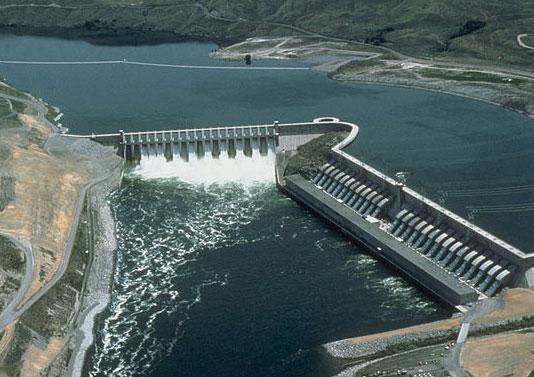
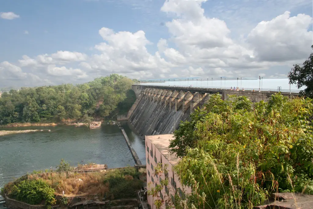
Irrigation: The Murray-Darling basin is the most agriculturally prosperous area in Australia and needs only irrigation to yield rich crops. Dams such as the Hume on the Murray and the Burrinjuck on the upper Murrumbidgee are important for irrigation and hydel power.
The Snowy river has been dammed and its water is delivered by a tunnel through the mountains to increase the water supply in the basin. Artesian wells are also used to a great extent to tap underground water for irrigation purposes in the basin.
Agriculture: Murray-Darling Basin is agriculturally rich. This is a region of Intensive Farming. It is a type of farming where cultivable land is limited. Due to extensive plainland, fertile soil, temperate climate sufficient supply of water, capital, and use of modern technology Murray-Darling Basin is agriculturally developed.
“WBBSE Class 8 Chapter 11 Geography, Oceania solutions”
This region is one of the important wheat-producing areas of the world. The wheat farms extend across the basin from Adelaide to New South Wales. Important crops are wheat, barley, oat, tobacco, etc. Large quantities of wheat are exported to other countries.
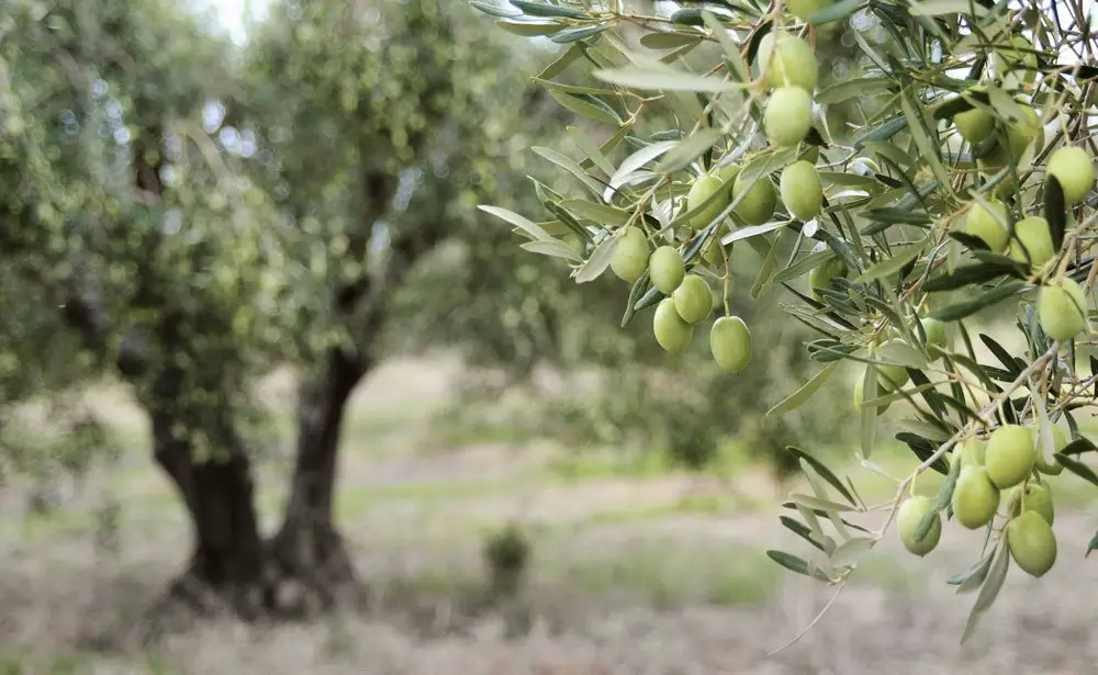
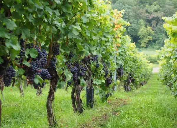
Fruits, particularly grapes, oranges, lemons, apples, pears, apricots, and peaches are grown mainly for export. Grapes are mainly dried to make raisins and currants.
Sheep and Cattle Rearing: The Murray-Darling Basin is the biggest sheep-rearing area of Australia which is the world’s largest producer of wool. Extensive Downs grassland, temperate climate, less population, and modern technology help to develop Live-stock farming.
Merino sheep, once imported from Spain, yield the best wool. Lincoln, marsh, etc. are also reared in the Downs of Murray Darling Basin. Sheep stations of this area are large and a sheep farm or Squatter is helped by laborers called Jackaroos’.
Cattle are reared in the eastern grasslands for beef and as well as dairy products. This region is also famous for dairy products.
Mineral Resources: Minerals are produced from the marginal regions of the Murray- Darling Basin, such as silver, lead, zinc, copper, gold, and tin. Broken Hill is famous for its silver deposits. So ‘Broken Hill’ is popularly called ‘Silver City’.
Copper is the most important mineral of the basin and is mined at Cobber in New South Wales, Broken Hill also has deposits of lead and zinc. Bendigo of Victoria is famous for its gold mine.
Industries: Murray-Darling Basin is not developed in industries. Industrial development is limited only to
- Food processing,
- Engineering,
- Chemical,
- Dairy and
- Meat processing etc.
Due to the lack of mineral deposits metallurgical industries have not flourished here. Depending on animal and agricultural resources wool, textile, flour, and bakery industries are also developed.
Important industrial centres are-Adelaide, Broken Hill, Mildura, Port Pirie, Morgan, Renmark and Albury.
“WBBSE Geography Class 8 Oceania, Chapter 11 key concepts”
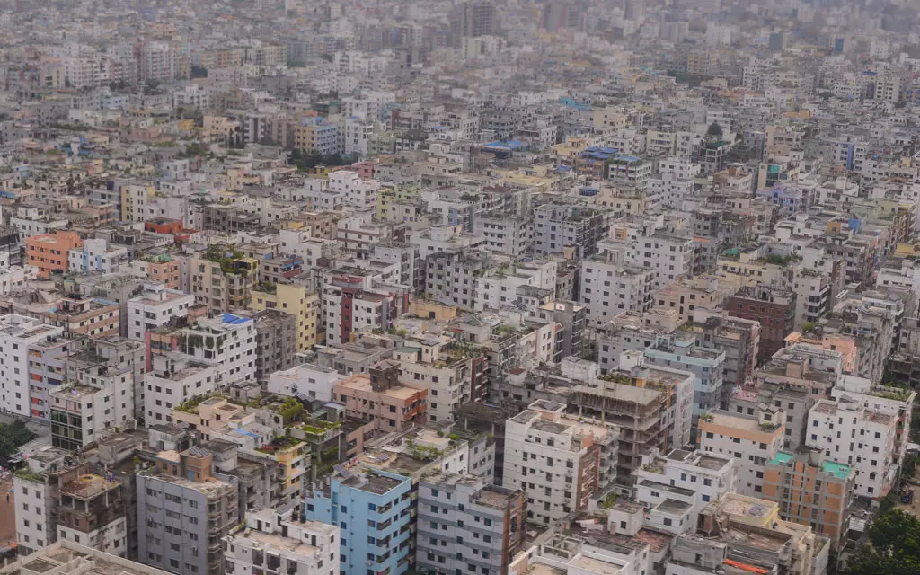
Population and cities: The region is one of the most prosperous regions of Australia. So, settlement is uniform and the population by Australian standards, is fairly dense-about 4-6 persons/ sq. km. The population is concentrated in the coastal area.
Adelaide, the capital of South Australia and an important port and industrial center located near the Gulf of St. Vincent is the largest city and only a million cities in this basin. Other important cities of this basin are Broken Hill, Mildura Wentworth, etc.
WBBSE Notes For 8 Class Middle School Geography
- Chapter 1 Interior Of The Earth Notes
- Chapter 2 Unstable Earth Notes
- Chapter 3 Rocks Notes
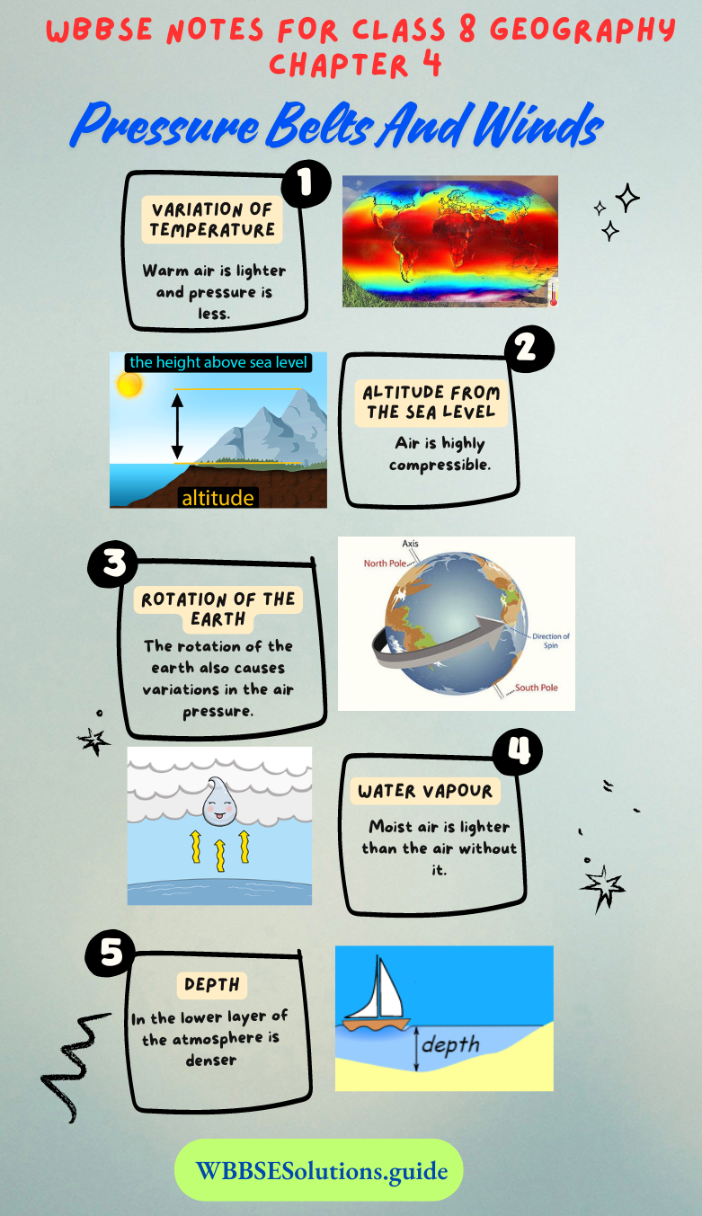
- Chapter 4 Pressure Belts And Winds Notes
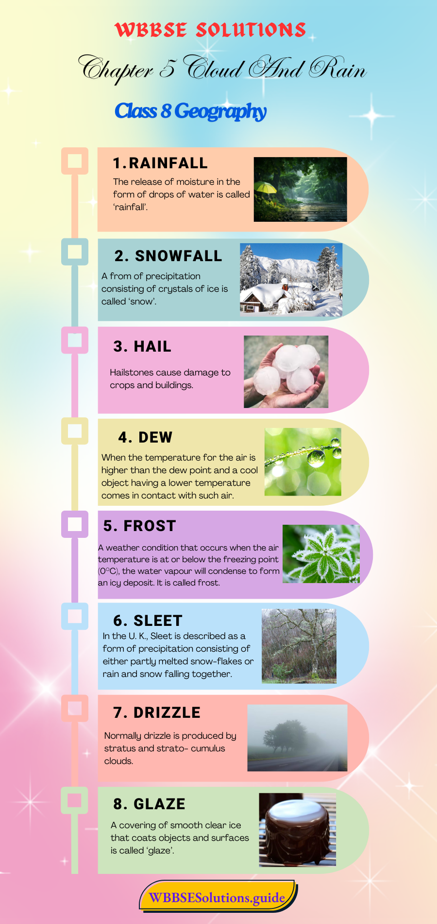
- Chapter 5 Cloud And Rain Notes
- Chapter 6 Climatic Regions Notes
- Chapter 7 Human Activities And Environmental Degradation Notes
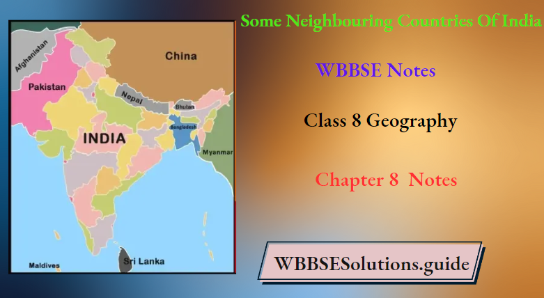
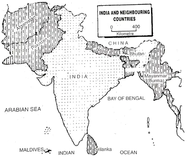
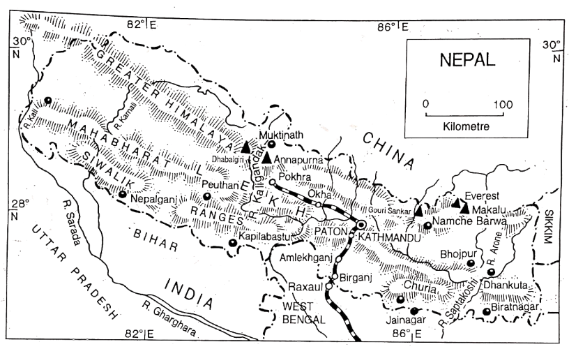
- Chapter 8 Some Neighbouring Countries Of India Notes
- Chapter 9 North America Notes
- Chapter 10 South America Notes