Chapter 7 Resources Of India Multiple Choice Questions With Answers :
Question 1. The first nuclear power station of India is
(1) Trombay
(2) Kalpakkam
(3) Tarapur
(4) Jaipur
Answer: (3) Tarapur.
Question 2. An atomic power station of Rajasthan is
(1) Trombay
(2) Tarapur
(3) Rana Pratap Sagar
(4) Bombay Hight
Answer: (3) Rana Pratap Sagar.
Read and Learn all WBBSE Solutions for Class 9 Geography and Environment
Question 3. Rangapur is noted for
(1) copper
(2) bauxite
(3) mica
(4) iron ore
Answer: (1) copper.
Question 4. _______ is the largest producer of coal.
(1) Jharkhand
(2) Bihar
(3) Rajasthan
(4) Andra Pradesh
Answer: (1) Jharkhand.
WBBSE Solutions Guide Class 9
Question 5.______ is noted for lignite coal.
(1) Neyveli
(2) Bokaro
(3) Ranihati
(4) Trombay
Answer: (1) Neyveli.
Question 6. _______ is the largest coal mine.
(1) Jharia
(2) Raniganj
(3) Trombay
(4) Kalpakkam
Answer: (1) Sharia.
Question 7. Pollivasal Power Station is in
(1) Kerala
(2) Karnataka
(3) Arunachal Pradesh
(4) Haryana
Answer: (1) Kerala.
WBBSE Class 9 Geography Chapter 7 Resources Of India Solutions
Question 8. Shivsamudram is in
(1) Tamil Nadu.
(2) Karnataka
(3) Haryana
(4) Kerela
Answer: (2) Karnataka.
Question 9. Loktak Power Station is in
(1) Manipur
(2) Nagaland
(3) Kerela
(4) Karnataka
Answer: (1) Manipur.
Question 10. Gandhi Sagar is in
(1) Rajasthan
(2) Madhya Pradesh
(3) Haryana
(4) Arunachal Pradesh
Answer: (2) Madhya Pradesh.
Question 11. Kankrapara is a ___________ station.
(1) atomic power
(2) hydel power
(3) thermal power
(4) solar power
Answer: (1) atomic power
Question 12. One of the natural resources is
(1) Money
(2) Factory
(3) Skill
(4) Mineral.
Answer: (4) Mineral
Question 13. The natural resources which are found everywhere is called
(1) Ubiquities
(2) Commonalities
(3) Rarities
(4) Uniquities.
Answer: (1) ubiquities
WBBSE Solutions Guide Class 9
Question 14. Give an example of a tangible resource
(1) Work abilities
(2) Talent
(3) Knowledge
(4) Water.
Answer: (4) Water
Question 15. Social resource is
(1) Water
(2) Land
(3) School
(4) Soil
Answer: (3) School
Question 16. The inexhaustible resource is :
(1) Coal
(2) Mineral
(3) Oil
(4) Wind
Answer: (4) Wind
Question 17. Non-renewable resource is
(1) Natural gas
(2) Wind
(3) Rainfall
(4) Water
Answer: (1) Natural gas
Question 18. A renewable resource is
(1) Sunshine
(2) Iron one
(3) Natural gas
(4) Mineral oil
Answer: (1) Sunshine
Question 19. Technology is a type o’
(1) Cultural resource
(2) Human resource
(3) Organic resource
(4) Inorganic resource
Answer: (1) Cultural resource
Question 20. Resource refers to thing or a substance.
(1) False
(2) True
(3) Partly false
(4) None of these
Answer: (1) False
Question 21. Which of the following is not a natural resource-
(1) Air
(2) Coal
(3) Soil
(4) Agricultural technology.
Answer: (4) Agricultural technology.
Question 22. Which of the following is a biotic resource –
(1) Iron
(2) Soil
(3) Manganese
(4) Natural vegetation.
Answer: (4) Natural vegetation.
WBBSE Solutions Guide Class 9
Question 23. Non-renewable resource is –
(1) Coal
(2) Soil
(3) Water
(4) Natural vegetation.
Answer: (1) Coal
Question 24. Unique resource is –
(1) Uranium
(2) Gold
(3) Coal
(4) Natural gas
Answer: (1) Uranium
Question 25. Fund resource is –
(1) Productive land
(2) Water
(3) Coal
(4) Natural gas
Answer: (3) Coal
Question 26. Flow resource is –
(1) Mineral
(2) River water
(3) Fertility of soil
(4) Mineral oil.
Answer: (2) River water
Question 27. An example of ubiquitous resources is –
(1) Coal
(2) Cryolite
(3) Sunlight
(4) Mica.
Answer: (3) Sunlight
Question 28. Which one of the following is not characteristic of resource?
(1) Utility
(2) Universal demand
(3) Limited supply
(4) Unlimited supply
Answer: (4) Unlimited supply
WBBSE Solutions Guide Class 9
Question 29. Coal, Petroleum are
(1) Commonalities
(2) Rarities
(3) Unique
(4) None
Answer: (2)Rarities weapon
Question 30. Man’s skill is a
(1) Organic resource
(2) Inorganic
(3) Natural
(4) None
Answer: (1) Organic resource
Question 31. Which among the following is not a natural resource?
(1) Coal
(2) Forest
(3) Land
(4) Population
Answer: (4) Population
Question 32. lron-ore is a resource because
(1) It has limited supply
(2) It is found in nature
(3) It is accessible to man
(4) All the above
Answer: (4) All the above
Question 33. Fund resource are those resources
(1) Which are exhausted once they are used.
(2) Which can never be used.
(3) Which have a relatively adequate recycling ratio.
(4) Which can be used again and again.
Answer: (1) Which are exhausted once they are used?
Question 34. Rare resources are those resources
(1) Which are not available to everyone everywhere.
(2) Which are available at some places.
(3) Which are available at one or two places.
(4) Which are generally available to everyone everywhere.
Answer: (2) Which are available at some places?
Question 35. Coal is a
(1) Flow resource
(2) Fund resource
(3) Neutral stuff
(4) None of these
Answer: (2) Fund resource
Class 9 Geography Chapter 7 WBBSE
Question 36. Petroleum is an example of
(1) Flow resource
(2) Fund resource
(3) Neutral stuff
(4) Resistance
Answer: (2) Fund resource
Question 37. The concept of resources is
(1) Static
(2) Dynamic
(3) Changeable
(4) None of these
Answer: (2) Dynamic
Question 38. Which of the following is a fund resource?
(1) Coal
(2) River
(3) Wind
(4) Culture
Answer: (1) Coal
Question 39. Which of the following is a cultural resource?
(1) Agriculture
(2) Sunlight
(3) Hail
(4) Rainfall
Answer: (1) Agriculture
Question 40. More than 90% of the total coal reserves and production in India is of :
(1) Tertiary type
(2) Gondwana type
(3) Lignite type
(4) Granite
Answer: (2) Gondwana type
Resources Of India Class 9 WBBSE Question Answers
Question 41. The Jog hydel power station is located in :
(1) Tamil Nadu
(2) Karnataka
(3) Kerala
(4) Suran
Answer: (2) Karnataka
Question 42. Kudremukh in Karanataka has the largest deposit of :
(1) Haematite ore
(2) Magnetite ore
(3) Siderite ore
(4) None of these
Answer: (2) Magnetite ore
Question 43. A thing or a substance will be considered a ‘resource’ if it has :
(1) Reserves
(2) Utility
(3) Potentiality
(4) High-cost price
Answer: (2) Utility
Class 9 Geography Chapter 7 WBBSE
Question 44. Magnetite is an important ore of
(1) Copper
(2) Iron
(3) Aluminium
(4) Tin
Answer: (2) Iron
Question 45. In coal production India holds
(1) Third
(2) Fifth
(3) First
(4) Seventh position
Answer: (2) Fifth
Question 46. The largest oil mining centre in India is
(1) Lakhimpur
(2) Digboi
(3) Mumbai High
(4) Hugrijan
Answer: (3) Mumbai High
Question 47. One important conventional power source is
(1) Hydro-electricity
(2) Solar energy
(3) Wind energy
(4) Geothermal energy
Answer: (1) Hydro-electricity
Question 48. The power produced by burning coal, petroleum etc., is called
(1) Hydel power
(2) Atomic power
(3) Thermal power
(4) Solar power
Answer: (3) Thermal power
Class 9 Geography Chapter 7 WBBSE
Question 49. India ranks _____________ in coal production in the world.
(1) 1st
(2) 2nd
(3) 3rd
(4) 4th
Answer: (3) 3rd
Question 50. India ranks _________ in iron ore
(1) 3rd
(2) 4th
(3) 5th
(4) 6th
Answer: (3) 5th
Question 51. India is the __________ largest exporter of iron ore in the world.
(1) 1st
(2) 2nd
(3) 3rd
(4) 4th
Answer: (3) 3rd
Class 9 Geography Chapter 7 WBBSE Resources Of India Short Questions With Answers
Question 1. What is Thermal Power?
Answer: The electricity generated by the heat of coal, natural gas, etc. is known as Thermal power.
Question 2. What is Hydel Power?
Answer: The electricity generated by waterfalls are called Hydel power.
Question 3. In which place of this country is petroleum extracted from beneath the sea floor?
Answer: Mumbai High region in the Arabian Sea (152 km north-west of Mumbai city)
Question 4. Name the windiest site in India.
Answer: Kappata will in Karnataka.
Question 5. Where is the headquarter of ONGC located?
Answer: Dehradun.
Question 6. Why is Trombay famous?
Answer: Trombay is famous for its atomic power plants.
Question 7. Name the first hydel power plant in India.
Answer: Shivsamudram in Karnataka.
Question 8. Name a nuclear power station in India.
Answer: Narora in Uttar Pradesh.
Question 9. Cite a thermal power station in India.
Answer: Talcher in Odissa.
Geography Class 9 West Bengal Board
Question 10. Name the largest oil mining centre in India.
Answer: Bombay High.
Question 11. Which mineral is known as ‘Liquid gold’.
Answer: Petroleum.
Question 12. Name a place in India where Lignite coal is found.
Answer: Neyveli in Tamil Nadu.
Question 13. Why petroleum in known as rock oil?
Answer: Petroleum is called rock oil as it is found in the layers of sedimentary rocks.
Question14. From where does the word petroleum has been derived?
Answer: Petra— Rock
Oleum — Oil.
Question 15. Name the state which is the largest producer of coal.
Answer: Jharkhand.
Question 16. Name the state which is the leading producer of iron ore.
Answer: Karnataka.
Question 17. Which type of iron ore is mostly found in India?
Answer: Hematite ore.
Question 18. Give an example of a natural resource.
Answer: Sunlight.
Question 19. Give an example of a national resource.
Answer: River Ganga.
Question 20. Name two Public sector undertaking engaged in the exploration And production of crude oil.
Answer: Oil and Natural Gas Corporation (ONGC) and Oil India Limited (OIL).
Question 21. What do you mean by human resources?
Answer: The resources which involve man are called human resources, e.g. population.
Question 22. What type of resource is called solar energy?
Answer: Sun-heat.
Question 23. Give some examples of flow resources.
Answer: Sun, heat, air, water, etc. are examples of flow resources.
Question 24. What do you mean by Personal Resources?
Answer: These include individual material possession like cash, land, buildings, etc. and non-material possessions like moral character, knowledge and skill, sound health, etc.
Question 25. What do you mean by National Resources?
Answer: Resources owned collectively by the nation such as railways, minerals, forests, climate, soil, etc. and good government, and national character.
Question 26. Write about Ubiquitous Resources.
Answer:
Ubiquitous: These resources occur everywhere.
Example: oxygen in air.
Question27. Write about Fund Resources.
Answer:
Fund resources: These are exhaustible resources. For some of the fund resources, the declining trend can be arrested for a short period.
Question28. What is meant by tangible resources?
Answer: Materials which can be felt by touch are known as tangible resources. For example, coal, petroleum, etc.
Question29. What do you mean by intangible resources?
Answer: Resources which does not have a material existence in other words we cannot touch them, are known as intangible resources. For example — knowledge, skill, etc.
Geography Class 9 West Bengal Board Chapter 7 Resources Of India True Or False Type
Question 1. Koyali is the largest oil refinery in India.
Answer: True
Question 2. Jharkhand is the largest producer of coal.
Answer: True
Question 3. Lohardaga is noted for bauxite.
Answer: True
Question 4. Jadugudda is noted for uranium.
Answer: True
Question 5. Talcher is noted for coal.
Answer: True
Question 6. Srisailam is a hydel power station.
Answer: True
Question 7. Loktak is a hydel power station of Manipur.
Answer: True
Question 8. Chukha is a hydel power station of Bhutan.
Answer: True
Question 9. Hydel power is pollution free.
Answer: True
Question 10. Most of the power centres of India belong to thermal power.
Answer: True
Question 11. Bhivpuri Power Station is in Maharastra.
Answer: True
Geography Class 9 West Bengal Board
Question 12. Narora is an Atomic Power Station of U.P.
Answer: True
Question13. Bhatinda Power Station is in Punjab.
Answer: True
Question14. Karnataka is the leading producer of iron ore in India.
Answer: True
Question15. Kalapakkam in Tamil Nadu is a thermal power station.
Answer: False
Question16. The heat energy obtained from the earth is called geothermal energy.
Answer: True
Question17. Burning fossil fuel minimizes environmental pollution.
Answer: False
Chapter 7 Resources Of India Fill In The Blanks
Question 1. Petroleum is referred to as_____ ________.
Answer: Liquid, gold.
Question 2. The atomic power station in Maharashtra is ________.
Answer: Tarapur.
Question 3. The first hydel power plant in India was established in 1902 in Karnataka at _____ on the river Cauvery (Kaveri).
Answer: Shivsundaram.
Question 4. The resources available everywhere on earth are called _________resources.
Answer: Ubiquitous.
Chapter 7 Resources Of India 2 Marks Questions And Answers
Question 1. Name some important Thermal power stations of India.
Answer:
Some important Thermal power stations are –
(1) West Bengal – Durgapur, Bandel, Kolaghat.
(2) Jharkhand – Bokaro
(3) Chattisgarh – Korba
Question 2. Name some important hydel power stations of India.
Answer:
Some important Thermal power stations are –
(1) East – Jaldhaka, Panchet, Jaldhaka, Kurseong.
(2) West – Ukai, Kadana, Gandhi Sagar, Bhola.
(3) North – Bhakra, Dehar, Binwa, Jawhar Sagar.
(4) South – Saravati, Lower sileru, Nagarjun Sagar.
Question 3. What are the principal power resources of India?
Answer:
Principal power resources of India are –
1. Coal ave
2. Mineral oil or Petroleum.
3. Water Power.
4. Atomic power.
Question 4. Why is Nunmati famous?
Answer: Nunmati is a petroleum centre. So it is famous.
Question 5. What is Sagar Samrat ?
Answer:
Sagar Samrat
Sagar Samrat is the name of a vast platform which is used to extract oil from the Mumbai High in the Arabian Sea.
Question 6. Why is the generation of non-conventional energy being emphasized in present India?
Answer:
Due to the following reasons the generation of non-conventional energy is being emphasized in present India:-
(1) Cheaper and renewable,
(2) Scarcity of fossil fuels,
(3) Rural area needs renewable sources of energy,
(4) They can be constructed anywhere because there is no question of carrying raw materials for power production.
WBBSE Class 9 Geography Chapter 7 Solved Exercises
Question 7. Mention the names of coal and petroleum mining centres of India.
Answer:
The coal mining centre is Jharia and the Petroleum mining centre is Ankleshwar.
Question 8. What is renewable energy? Give example.
Answer:
Renewable energy:- Renewable energy resources are those resources which are not fully exhausted after use. These resources can in used several times after and are not completely finished.
Examples:- Hydroelectricity, Solar energy, Biogas, Wind energy etc.
Question 9. Name the important centres of fuel minerals in West Bengal and Maharashtra.
Answer:
In West Bengal:- Asansol, Raniganj.
In Maharashtra:- Ballarpur, Tandur.
Question 10. Name any two oil-producing fields of Gujarat.
Answer: Lunez and Ankleshwar.
Question 11. Name four by-products derived out of coal.
Answer: Coal tar, Charcoal, Coke, Naphthalene.
Question 12. Name three principal mineral oil-producing centres in North-Eastern India.
Answer: Digboi, Naharkatiya and Hugrijan.
Question 13. What is meant by non-conventional energy sources?
Answer: The non-conventional energy sources are the new sources of energy that are used in place of traditional sources of energy like coal.
Examples: Solar energy, Wind energy, Biogas etc.
Question 14. Name three petroleum-producing regions of India.
Answer: Three major petroleum-producing states of India are Assam, Maharashtra and Gujarat.
Question 15. Name three leading iron ore-producing states of India.
Answer: Three states leading in the production of iron ore are
(1) Gova,
(2) Madhya Pradesh,
(3) Orissa.
Question 16. Mention two major characteristics of resources.
Answer:
Major characteristics of resources
(1) Utility.
(2) Functionality.
Question 17. What is meant by resource?
Answer:
Resource: Anything that has utility and can satisfy human wants may be termed as a resource.
Prof. Zimmerman, however, has given it a special meaning by adding the functionality clause. So, the non-functioning or dormant gifts of nature are termed as neutral stuff.
Question 18. Classify the resources Pine to supply and durability.
Answer:
According to mode of supply and durability, resources can be classified as
(1) Flow or inexhaustible resources,
(2) Fund or exhaustible or Non-renewable resources,
(3) Renewable resources.
Question 19. What do you mean by organic and inorganic resources?
Answer:
Organic and inorganic resources
(1) Organic Resources are derived from the flora (plants) and fauna (animals); i.e., forest, natural grassland, wildlife, fish and marine life.
(2) Inorganic Resources are inanimate resources, e.g. land, water, minerals, soil, metals, building stones and mineral fuels.
Question 20. What is meant by cultural resources?
Answer:
Cultural resources: The resources which is result from the progress of civilization are considered as cultural resources, e.g. science, seg literature, technical know-how, etc.
Question 21. What is a social resource?
Answer:
Social resource: Social resource is the resource which evolves out of the interaction of social and cultural feelings and by their development. It is a joint product of human endeavour and elements of nature.
Question 22. What is Fund or Exhaustible or Non Renewable Resources?
Answer:
Fund or Exhaustible or Non-renewable Resources: Fund resources are those which have only fixed and limited stock. They get exhausted as we use them.
Examples: coal, mineral oil, natural gas, iron ore, etc.
Question 23. What are Renewable Resources?
Answer:
Renewable Resources: The supply of some natural resources is intermittent. These resources are self-renewable, but their supply ceases for some time. Trees of the forest, grasses of the grasslands, and fertility of soil are examples of this resource.
Question 24. ‘Resources and development are interdependent’. Discuss.
Answer:
‘Resources and development are interdependent’.
Resources are the bases of both security and opulence; they are the foundations of power and wealth. At every stage of development, resources play a critical role. But for them, human survival and development would be impossible; without land, water, and air, we cannot have agriculture and without minerals, we cannot have industries.
Question 25. What do you understand by flow resources?
Answer:
Flow or Inexhaustible Resources: The supply of some natural resources is permanent. These resources are self-renewable and are known as Flow Resources, these are inexhaustible and ubiquitous. Examples are sunshine, wind, rainfall, river water etc.
Chapter-7 Resources Of India 2 Marks Questions And Answers (Short Notes)
Question 1. Importance of non-conventional energy.
Answer:
Importance of non-conventional energy
1. In contrast to conventional sources of energy, non-conventional sources of energy (solar energy, tidal energy, geothermal energy, wind energy etc.) are not used frequently and in a large scale (commercially). Their uses are comparatively more recent.
2. The sources of non-conventional energy are flow resources. There is no anxiety for their exhaustion.
3. The generation of non-conventional energy does not produce air pollution.
4. Comparatively, non-conventional energy is much cheaper.
Question 2. ONGC.
Answer:
ONGC
The oil and Natural Gas Commission is briefly known as ONGC. It was first established on 14th August 1956 to investigate the presence of mineral oil in different parts of India.
Several oil fields in India were recognised through ONGC since its initiation, such as the deltas of the rivers Godavari, Cauveri, Mahanadi and Krishna, continental shelf of the Andaman and Nicobar island, parts of Ganga plain, the continental shelf near the Sundarban etc.
Chapter 7 Resources Of India 3 Marks Questions And Answers
Question 1. What are the principal power resources of India?
Answer:
The principal power resources of India are –
(1) Coal
(2) Natural gas
(3) Hydro-electric power
(4) Mineral oil
(5) Solar energy
(6) Atomic energy
(7) Wind power
(8) Tidal energy.
Question 2. Give a comparative account of hydel power and Thermal power.
Answer:
Comparative account of hydel power and Thermal power
| Thermal Power |
Hydel Power |
| (1) It is generated with coal. |
(1) It is generated with the force of running water. |
| (2) It is an exhaustible source of energy. |
(2) It is inexhaustible. |
| (3) Cost of electricity generated from the thermal power is higher. |
(3) Cost of electricity generated from hydel power is cheaper. |
| (4) Thermal power creates large-scale pollution of air. |
(4) Hydel power is environment friendly and does not create any kind of pollution. |
| (5) In India almost 55% of power generated is of thermal power. |
(5) Only 5% of the power generated is from hydel power. |
| (6) Thermal power plants can be located at any place far away from the market. |
(6) Hydel power should be located at places where there is steady de- mand. |
Question 3. Why are the rivers of South India more favourable for the generation of hydel power?
Answer:
The rivers of South India are more favourable for the generation of hydel power due to the following reasons :
(1) The rivers of South India flowing over the undulating plateau and rugged topography gain momentum, and they become swift flowing for generating hydel turbines and producing hydroelectric power.
(2) The rivers of South India produce a number of rapids and waterfalls; they are favourable for hydroelectric power generation.
(3) Heavy rainwater of the monsoon season, sometimes, gives impetus for the generation of hydel power in South India.
Question 4. Why are the South Indian rivers conducive for the generation of hydel power?
Answer:
In spite of the scarcity of year-round water supply, the South Indian rivers are more conducive for the generation of hydel power. The reasons are as follows :
1. Floods are less dominant and relatively harmless.
2. Earthquakes, subsidence and snowfall are absent in entire South India.
3. Rivers are of high velocity because of the relief of the plateau.
4. Bedrocks are granitic or gneissic, on which heavy constructions are possible. Resultant, sediment is low also.
5. Sources of alternate energy is absent.
6. Industrially rich South India creates a high demand of electricity.
Question 5. Write the reasons for the development of hydroelectricity production in South India. (S.Question)
Answer:
South India is developed in hydro-electricity because of the following reasons :
(1) The region is producing mountain surfaces along with a number of gorges and canyons which are suitable for constructing dams and barrages.
(2) The region is made up of hard impervious rocks. So, there is less possibility of seepage of water.
(3) The region is not rich in coal and mineral oil
(4) Coal is found nearby. So there is a demand for power.
(5) Soil erosion is not common here as the rivers flow through hard surface.
(6) Climatic condition is suitable for the production of hydel power. The temperature of this region always remains above the freezing point.
(7) Transmission facility is also good. Produced power can easily be transmitted to the neighbouring regions.
Question 6. Describe the distribution of earthquakes. Or, Give an account of the earthquake belts of the world?
Answer:
Distribution of earthquakes
Earthquakes occur in almost every part of the world, but they are frequent in two well-defined belts.
(1) Mid.- World Mountain Belt :
This belt is located along the edges of the Pacific ocean. This belt experiences 68% earthquakes of the world. It includes North and South America, island groups of Eastern Asia and the Philippines.
(2) Mid-World Mountain Belt :
It extends along the fold mountains of Europe and Asia. It runs through the Alps, the Caucasus and the Himalayas. About 21% of earthquakes of the world originate in this belt.
(3) Other areas :
About 11% of earthquakes of the world originate in other areas such as mid – the Atlantic, Rift valley of East Africa, and Central Siberia.
Question 7. Discuss the advantages of using non-conventional energy.
Answer:
The following are the merits or advantages of using non-conventional energy over conventional energy resources :
(1) Conservation of Fund energy resources :
The utilization of non-conventional energy resources paves the way for the conservation of funds: energy resources like coal, petroleum and natural gas.
(2) Reduction in air pollution :
The uses of non-conventional energy resources prevent air pollution. It does not emit gas, bad odour, dust or debris. Thus, air pollution can be averted by the use of these energy resources.
(3) Endless energy flow :
Sun, wind, waves, and tides supply an endless flow of energy. If they can be tapped on a commercial scale, they can supply lot of energy.
(4) No recurring expenditure :
After the installation of this power plant, there is little or no expenditure for the collection of raw materials or for the payment of wages. Hence, the recurring expenditure is small.
Question 8. Classify resources on the basis of supply and durability.
Answer:
According to mode of supply and durability, resources can be classified as follows :
(1) Flow or Inexhaustible Resources :
The supply of some natural resources is permanent. These resources are self-renewable and are known as Flow Resources, these are inexhaustible and ubiquitous. Examples are sunshine, wind, rainfall, river water etc.
(2) Fund or Exhaustible or Non-renewable Resources :
Fund resources are those which have only fixed and limited stock. They are not self-renewable. They get exhausted as we use them, e.g., coal, mineral oil, natural gas, iron ore etc.
Fund resources may be further classified as (1) exhaustible and (2) revolving fund resources. Coal is an exhaustible fund resource; because once it is used, it is used up, it cannot be replaced. On the other hand, iron ore is a revolving fund resource, as it is not lost forever; it can be used again.
Class 9 Geography Resources Of India WBBSE Notes
Question 9. Compare renewable with non-renewable resources.
Answer:
Renewable Resources :
The supply of some natural resources is intermittent. These resources are also self-renewable, but their supply ceases for some time. The supply revives again after an interval. Trees of the forest, grasses of the grasslands and fertility of soil are examples of this resource.
Non-renewable Resources :
Fund resources are those which have only fixed and limited stock. They are not self-renewable. They get exhausted as we use them.
Examples: coal, mineral oil, natural gas, iron ore etc.
Fund resources may be further classified as
(1) Exhaustible and
(2) Revolving. Coal is an exhaustible fund resource, as once it is used up, it can not be replaced. On the other hand, iron ore is a revolving fund resource, as it is not lost forever and it can be used again.
Question 10. Briefly discuss the uses of petroleum and name its by-products.
Answer:
Uses of petroleum are:-
(1) Source of industrial power.
(2) It is used in transportation (cars, buses, lorries etc.).
(3) It is used in the generation of hydel power.
(4) It is used for domestic fuel (Kerosene oil).
(5) It provides raw materials for the chemical industry, e.g. asphalt, dyes, points, terylene, synthetic, rubber etc.
The by-products of petroleum are – petrol, gasoline, diesel, PVC, Acetic acid, polystyrene, ethyl, alcohol, acetone, glycols, phenols, epoxy resins, styrene, butadiene, rubber, butyl rubber, lubricating oil, kerosene, naphtha, benzene, paraffin, vaseline, tar etc.
Question 11. State the uses of iron ore.
Answer:
Uses of iron ores :
Metallic iron is obtained from iron ores by smelting. The lump of iron obtained in this way is known as pig iron. Pig iron is reprocessed in different ways.
(1) Cas iron is formed by melting the pig iron and pouring it into a mould. It is a fragile form of. iron and can be used for making castings but cannot be shaped by hammering and pressing.
(2) Wrought iron is pure iron mixed with a little slag (iron oxide or silicate). Wrought iron resists rust and is very tough but can be hammered into shape; it is used for pipes, chains, etc.
(3) Stell is the most important product which is made by reheating the pig iron, removing impurities and adding a controlled amount of carbon and ferro-alloys.
(4) Alloy steel includes special types of steel which are made by adding a significant amount of ferroalloys like manganese, nickel, chromium, tungsten, etc.
Question 12. Explain the by-products of petroleum and their chemical uses.
Answer:
By-Products of Petroleum and their industrial uses :
By-products of petroleum have varieties of uses in petrochemical industries. These by-products are obtained by using various methods of oil distillation like fractional distillation, thermal cracking, catalytic cracking and polymerisation. Industrial uses of some of these by-products may be mentioned as follows :
(1) Ethylene :
It is also known as ethene gas which is obtained from petroleum as well a from natural gas. It is used in the synthesis of polyethene and PVC and the consuming industries are plastics and films. Ethylene oxide is used for the manufacturing of polyester fibres and detergents.
(2) Propylene :
It is an important by-product of oil refining and is also known as propane. It is used in the manufacture of many organic chemicals including polypropylene which is used in plastics and glycerine which is a raw material for nitroglycerine, printing inks, etc.
(3) Butadiene :
It is derived from butane gas obtained by refining crude oil. Synthetic rubber is manufactured by polymerisation of butadiene with sodium.
(4) Benzene :
It is obtained both from coal as well as from petroleum. It yields styrene, which is used in plastics and foams and phenol, which is used in nylons.
Question 13. Give the distribution of hydroelectric power in India.
Answer:
Distribution of hydroelectric power in India
The First hydel power plant in India was established in 1902 in Karnataka at (1) Shivasamudram on the river Kaveri. The country’s major hydro-electric power stations are located at
(1) Shivasamudram, Sima and Jog (at present Mahatama Gandhi Hydel Power Station) in Karnataka,
(2) Mettur and Papnasam in Tamil Nadu
(3) Idikki, Sabarigiri and Pallivasal in Kerala,
(4) Sileru, Manchkud, Nagarjuna Sagar in Andhra Pradesh,
(5) Vira, Vivpuri, Koyna and Khopali in Maharashtra,
(6) Rihand, Ramganga, Bhola, Sumera-Nangal in Himachal Pradesh,
(7) Hirakud and-Manchkud in Odisha and Tilaiya, Maithan, Panchet and Massanjore hydro-power station of Jharkhand, Bihar and West Bengal.
Question 14. Name some hydroelectric power projects in India.
Answer:
Major Hydroelectric Power Projects: The main projects are :
(1) The Bhakra-Nangal
(2) The Damodar Valley Corporation (DVC) based on the TVA (Tennessee Valley Authority) of the USA.
(3) The ‘Hirakud Project.
(4) The Tungabhadra Project
(5) The Rihand Project
(6) The Kosi Project
(7) The Nagarjunasagar Project
(8) The Chambal Valley Project.
Question 15. State few advantages and disadvantages of Nuclear power.
Answer:
Advantages Of Nuclear power :
(1) Small proportions of radioactive minerals are capable of producing large quantities of power.
(2) Does not produce greenhouse gases that pollute the atmosphere.
Disadvantages Of Nuclear power:
(1) Problem of radioactive waste disposal.
(2) Extremely expensive project.
(3) In case of explosions, radioactive materials can create far-reaching damages to the life of people.
Question 16. State the uses of solar energy.
Answer:
Uses of solar energy:
(1) Solar water heating system :
In this system water is heated up, it keeps the house warm in cold countries.
(2) Solar Cooker :
By this system sun’s heat is used for cooking.
(3) Solar Drier :
To remove humidity from any material, it is widely used. It is also used for drying.
(4) Solar Distillation :
Solar distillation is used to distil drinking water.
(5) By using solar heat we can boil water or dry the grains.
(6) By using solar electricity i.e., by solar cell sun rays are converted into electricity.
(7) Solar energy is becoming popular in various parts of the country and can be used for cooking, pumping, heating of water, refrigerator and street lighting.
Geography Class 9 West Bengal Board Chapter7 Resources Of India 5 Marks Questions And Answers
Question 1. Classify the major types of coal and mention the uses of coal.
Answer:
Coal is classified into major 4 types on the basis of concentration of carbon –
(1) Anthracite – (contain more than 85% carbon) –
Used for heating in cold countries.
(2) Bituminous – (Contain 50% – 85% carbon) –
It is the most important type of coal. It is most commonly used in industry for making power, melting metals.
(3) Lignite – (contain 35% to 50% carbon) –
Used for generation of thermal power.
(4) Peat – (contain less than 25% carbon) –
Used for domestic cooking.
Uses of Coal –
(1) 73% of coal produced is used for generating thermal power in India.
(2) In the production of Iron and steel coal is used as raw material.
(3) 3% produced coal is used in the production of cement.
(4). Coal is used as a domestic fuel for cooking.
(5) From coal by-products are obtained which are basically the products of chemical industries.
(6) Coal earlier was used as a transport fuel, especially for the running of railway steam engines but now steam engines have come down significantly.
Question 2. Describe in brief the coal mining regions of India.
Answer:
Coal is divided into 2 types on the basis of its age –
(1) Gondwana age Coal (Formed 250 million yrs. ago)
(2) Tertiary age coal (formed 50 million yrs. ago)
(1) Gond wana coal mining regions are -+
(1) Chattisgarh and Madhya Pradesh – Korba, Umaria, Singrauli, Pench, Chirimini, Raigadh etc.
(2) Jnakhand – Jharia, Giridh, North and South Karanpusa, Daltonganj, Ramgarh etc.
(3) Orissa – Talcher, Rampur, Himgiri etc.
(4) Andra Pradesh – East and West Godavari, Kurnool, Warangal, Adilabad, Krishna etc.
(5) Maharastra – Wasdha, Chand, Balkalpur, Nasik
(6) West Bengal – Raniganj, Asansol.
(2) Tertiary coal mining regions are –
(1) Assam – Makum, Duliajaan, Jorhat, Nowgaon, Sikhar etc.
(2) Nagaland – Bojan.
(3) Arunachal Pradesh – Namchik.
(4) Meghalaya – Langrin, Bapunj and Jaintia hills.
(5) Jammu and Kashmir – Udhampur and Kaisi.
(6) Tamil Naidu – Neyveli and Arcot.
Question 3. Classify the major types of iron one and mention their uses.
Answer:
lron ore can be classified into 4 major types on the basis of iron content. They are-
(1) Haematite –
It is a superior quality of iron ore consisting of 60% – 70% of iron. It is reddish in colour.
(2) Magnetite –
It is the most superior quality ore consisting of 72% iron but it is less available.
(3) Limonite –
It is an inferior quality ore consisting 50% – 60% iron. It is brown in colour.
(4) Siderite –
It is an inferior quality ore consisting of 30% – 40% iron. It is grey in colour.
Uses of iron ore – The following are the main uses of iron ore.
(1) Iron ore is used to make pig iron and wrought iron.
(2) Iron ore is used for the construction of buildings, bridges, railway lines and other materials for construction.
(3) Pig iron can be moulded.
(4) Iron ore is the most useful metal in the engineering industry.
(5) Iron has also got a number of domestic uses like making utensils, knife and other household items etc. Thus it can be said that “Iron is the backbone of modern civilization”.
(6) Slag obtained from iron ore is used to make furniture and also in the manufacture of cement.
Question 4. Where are thermal power stations located in eastern India? What are the factors for their growth?
Answer:
Major thermal power stations of eastern India are. –
(1) West Bengal – Durgapur, Santaldihi, Bandel.
(2) Bihar – Barauni, Chandrapur.
(3) Jharkhand – Bokaro.
(4) Orissa – Talcher.
Class 9 Geography Chapter 7 Notes WBBSE
The major reasons for the growth of Thermal power stations are –
(1) Easy availability of raw material –
The best quality of coal can easily be achieved from the neighbouring areas (coal mines of Asansol, Raniganj, Bokaro, Giridh, Talcher etc.). Mineral oil is also get through pipelines.
(2) Transport facility –
The region is well-connected by roadways, railways and National highways.
(3) Demand –
There is a high demand of power in this region as the region is ideal for industrial set – up. The region is densely populated. So there is a high demand of power.
(4) Presence of Industries –
The Hugli Industrial region, Asansol – Raniganj Industrial region, Durgapur industrial region, Jamshedpur, Industrial region etc. need a huge amount of power. So, their necessity brings the opportunity to install more thermal power stations.
(5) Dearth of other power stations –
Here there is no atomic power station. A little hydroelectric power are trapped. Hence for the large demand, thermal power stations. have been grown up by using coal.
Question 5. Why is the Chhotanagpur region called the ‘Store house of minerals’?
Answer:
Chhotanagpur plateau accounts for nearly 40% to 80% of minerals produced in the country. The main minerals are coal, iron ore, mica, bauxite, chromite, uranium, fire clay, limestone, feldspar, asbestos etc.
Coal:-
All the famous coal fields of India are found in the Damodar Valley region of this plateau. The fields are located at Jharia, Karanpura (North and South), Bokaro, and Ramgarh. The coal is of high quality.
Iron ore:-
High-grade iron ore is found in this plateau area. The mines are situated at Goa, Noamundi, Rajoriburu, and Budhaburu.
Mica:-
High-grade mica resources are located in Kodarma (Hazaribagh district of Jharkhand). Other mines are found in Giridih, Singur, Jnumri-Talaiya, and Domchanchi.
Class 9 Geography Chapter 7 Notes WBBSE
Limestone:– In the districts of Singhbhum, Hazaribagh and Ranchi.
Bauxite:- Ranchi and Palamau districts (largest mining region is Lohardaga)
Copper Ore:- Rakha, Mosabani and Sarda in Southern Jharkhand.
Uranium:- Jadugoda (in Singhbhum district).
Dolomite:- Palamau.
Vanadium :- Dublabera (Singhbhum).
Asbestos:- Singhbhum district (near the villages of Nurda, Kalimati, Bichabaru, Jojohatu and Roro Buru).
Fire clay :- Rajahara and Latehar (Palamau district).
Kyanite :- Lapsa Buru (Singhbhum).
Feldspar :- Near Crichaki Bagardih, Bendro and Kubadih (Hazaribagh) and Hundru Hill (Palamau district).
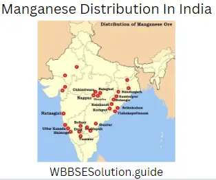
Manganese:- Chaibasa (Singhbhum district).
So, the Chhotanapur region is regarded as the storehouse of minerals.
Class 9 WBBSE Geography Chapter 7 Important Questions
Question 6. What are the effects of earthquakes?
Answer:
The major effects of the earthquakes can be explained under the following heads –
(1) Destructive effects –
(1) Damage to property and Lives :
Earthquakes mainly cause damage to property and life. In this concern the earthquake of 1976, 27″ July in east china, Jangshan region is of special mention which caused heavy damage, i.e., nearly ig, lakh people died.
(2) Destruction of the communicative system –
The earthquake causes heavy damage to communication and transportation systems by causing damages to railways, rail lines.
(3) Tsunami –
When there is a jerk in the ocean bed very tremendous strong high waves rise above the water’s surface. This water wave is known as Tsunami. It causes damage to the coastal regions.
(4) Break out of Fire –
Due to dislocation of electric wiring and other reasons caused due to earthquakes, fire breaks out which also causes a great loss of life and property.
Class 9 Geography Chapter 7 Notes WBBSE
(5) Change the course of a river –
An earthquake may change the course of rivers flowing in that area. The destructive earthquake of 1950 in Assam changed the course of the Brahmaputra river and its tributaries.
(6) Rise and sink of rock bed –
Earthquakes may cause the ground to sink or rise up. This causes cracks in the rock bed and soil structure.
(2) Constructive effects –
(1) Sometimes earthquakes cause the formation of hot springs which are very useful to people.
(2) Earthquakes sometimes cause a lake to turn into a river.
(3) Sometimes earthquakes cause the submergence of the coast and bring fertile shore out of the water to give chance to develop crop production.
(4) Earthquakes sometimes turn deep rivers and bays to shallow which helps in fishing.
Question 7. Describe in brief the meaning and definition of resources.
Answer:
Meaning and Definition of Resources: ‘Resource’ is a word which means valuables. Generally, resources mean wealth, money, gems, jewels or valuable things. But these are not considered as resources in Economic Geography.
The things, which have some utilities or functionalities to perform some duties to satisfy human and wants, i.e., the workability and functionality of things in satisfying human wants, are considered as ‘resources’ in Economic Geography.
Class 9 Geography Chapter 7 Notes WBBSE
Definition :
The term ‘resource’ in Economic Geography [or in Resource Study] does not necessarily mean a valuable thing or a substance, but it means the functionality of a thing (within human knowledge) which renders service or job in satisfying human needs.
Prof. E. W. Zimmermann, an eminent geographer and scholar in the field of resource studies, defines the term ‘Resources’ by saying: The word ‘resource’ does not refer to a thing or a substance but to a function which a thing or a substance may perform or to an operation in which it may take part, namely the function or operation of attaining a given end such as satisfying a want.
Thus, according to his opinion, all matters of the environment which serve and perform in satisfying human wants, their capabilities and the act of performance, may be considered as resources.
The Encyclopedia of Social Science defines, ‘Resources are those aspects of man’s environment which render possible services to facilitate the satisfaction of human wants and the attainment of social objectives’.
Thus, an inert matter or a substance or anything of the environment is not a resource but the function which it performs to attain a given end, i.e., to satisfy human needs, be considered as a resource.
Question 8. Classify the resources according to supply and durability.
Answer:
According to mode of supply and durability, resources can be classified into three groups :
(1) Flow or inexhaustible resources.
(2) Fund or exhaustible or non-renewable resources and
(3) Renewable resources.
[1] Flow or Inexhaustible Resources :
The supply of some natural resources is permanent. These resources are self-renewable and are known as Flow Resources;
they are inexhaustible and ubiquitous. Examples are sunshine, wind, rainfall, river water, etc.
Class 9 Geography Chapter 7 Question Answer WBBSE
[2] Fund or Exhaustible or Non-renewable Resources :
Fund resources are those which have only fixed and limited stock. They are not self-renewable. They get exhausted as we use them. Examples: coal, mineral oil, natural gas, iron ore, etc.
Fund resources may be further classified as (1) exhaustible and (2) revolving fund resources. Coal is an exhaustible fund resource, as once it is used, it is used up; it cannot be replaced again. On the other hand, iron ore is a revolving fund
resource, as it is not lost forever; it can be used again.
[3] Renewable Resources :
The supply of some natural resources is intermittent. These resources are also self-renewable, but their supply ceases for some time. The supply revives again after an interval. Trees of the forest, grasses of the grasslands, and fertility of soil are examples of this resource.
Question 9. Classify the resources on the basis of the nature of ownership.
Answer:
According to the nature of ownership, resources can be classified into three types:
(1) Personal or Individual resources.
(2) National resources and
(3) International resources.
(1) Personal or Individual Resources are one’s material things, such as, money, land, factory, property, etc. and personal qualities like skill, knowledge, good health, character etc.
(2) National Resources are the sum total of the personal resources of all citizens plus resources collectively owned by the nation, such as, minerals, natural vegetation, climate, soil, good government, national character, etc.
(3) International Resources are the sum total of all the resources of all nations, such as, minerals, climates, natural vegetation of the world, resources of the seas, etc.
None of these classifications is considered as justified in the light of the functional theory of resources; because in this theory, functionality is the main criterion in recognizing a resource. But it is very difficult to classify resources according to functionality. Hence, material things are classified here according to utility and functionality, based on different opinions.
Class 9 Geography Chapter 7 Question Answer WBBSE
Question 10. What is the main component of coal? Classify coal based on it. Discuss the main uses of coal. :
Answer:
Main component of coal
Coal is a black or brown rock. It is hard, but not very heavy. It supplies more than 50 percent of the total energy resources. Coal consists mainly of carbon and is known as carbonaceous rock. It is formed by the compressed vegetative remains of past ages.
It is a fossile fuel. Most coal deposits are of carboniferous age; i.e., about 300 million years old. Recent deposits of Tertiary age are usually composed of lignite or brown coal and They represent an early stage of coal formation and they are still being formed today.
Classification of coal :
Coal can be classified into the following types according to their composition and stage of formation:
1. Peat.
2. Lignite or Brown Coal.
3. Bituminous Coal.
4. Anthracite Coal and
5. Graphite.
Main uses of Coal:
Coal is a versatile mineral. Even today it is the prime source of power. Today coal is not only used as a fuel, but as an essential raw material for various industries. The uses of coal can be outlined in the following ways :
(1) Coal in the production of steam power :
Coal is burnt as a fuel. Its heat energy raises steam and by its power wheel and machineries are run. It provides power to rail engines (locomotives) and steamships. Nowadays, the use of coal has been replaced by mineral oil and electricity.
(2) Coal in the production of electric power :
Coal is burnt to make the thermal generators active to produce thermal electricity. Thermal generators are the largest consumers. They consume about one-third of coal output.
(3) Coal as domestic fuel :
In many parts, coal is still used as very important domestic fuel. Nowadays, coal gas is produced for domestic use and for use in small industries. It has become popular.
(4) Coal as metallurgical coke :
Coke is made from coal. Even today, coking coal is essential for the metallurgical industry, particularly in the smelting of iron
and steel. It consumes about 60 per cent of the world’s coal.
(5) Coal in Chemical Industry :
The use of coal in chemical industry is of great importance. Besides supplying fuel and power, coal provides a wide range of raw materials for chemical industry.
Question 11. Describe the advantages and disadvantages of hydroelectricity.
Answer:
Advantages and disadvantages of hydroelectricity: Electricity generation is becoming more and more important in the world economy because electric power is very convenient for both domestic and industrial importance.
If coal, oil and natural gas reserves were ever exhausted, electricity could still be obtained from nuclear plants. HEP is particularly important in this respect for it is inexhaustible. Since it is generated by running water, it is a flow resource.
It is an invisible fuel which is clean and easily for consumers to use, whereas coal and oil are bulk and dirty. It is highly adaptable and is ideal for use in complex modern industries where extreme precision is required in the control of machines heaters, computers or other equipment.
HEP may have the advantage of reaching areas where the import of coal or oil would be difficult or uneconomic. HEP is indispensable in the rapidly expanding field of telecommunications. Radio, television, radar, telephone and telegraphic links including satellite links all depend on electricity.
Class 9 Geography Chapter 7 Question Answer WBBSE
The disadvantages are the short-distance transmission of HEP and electricity cannot be stored. It is uneconomic to transport electricity over long distances. Unlike coal, oil or gas electricity supplies cannot be kept in resource, they must be used as they are generated.
This makes the management of electricity supplies very difficult, since if a power station ceases to function. There are no reserves to fall back on and electricity cuts are inevitable hydropower is the power generated by utilising the energy potential of running water.
Generation of hydropower requires a difference in height between the place where water is found and the place where it can be let down. The height may be secured in three ways :
(1) By building oe across the rivers,
(2) By taking advantage of drops or falls or steep gradients in the river bed, and
(3) By diverting the water from one river basin into, another river basin to a place at a lower level. Running water from streams, rivers and painting glaciers has long been utilised by men as a motive power.
Question 12. Briefly discuss two major non-conventional sources of energy.
Answer:
(1) Tidal Energy :
Tidal energy is a flow resource. It is tapped to produce electric power. France is the forerunner in harnessing tidal power to convert electric energy. A tidal power plant is installed (1961) at La Rance Estuary in France. Its generating capacity is about 8 million Kilowatts.
Tapping power from tidal energy is no doubt a tremendous success in the history of energy and power development. Russia has also set up a tidal power plant at Murmansk. The Bay of Fundy and Passamaquoddy Bay in Canada have been selected for the installation of tidal power plants.
In India, tidal power plants can be set up at a number of places, such as the peninsular coast of Kachchh and Kathiawar, near Cape Comorin (Kanyakumari) and Vivekananda Rock in South India.
(2) Solar Energy :
Using a photovoltaic cell, solar energy has been harnessed (captured) to produce electric power. A number of nations have long been on the way to set up solar power plant. France has the largest solar oven and it is installed at Odeillow on the Pyrenees.
Britain, Germany, the U.S.A., Isreal, Australia and India have made some progress in the development of solar energy plant. Britain has installed a large solar power plant on Ford Engineering Farm at Wales in Britain.
Hindustan Spinning and Weaving Mill, Mumbai, in India has been running by the solar power. A large number of pump sets have been working to irrigate arable land in western India. For furnishing light in Sagar Mela in Sagar Island of West Bengal, solar energy has been tapped. UNO and other international organisations have been encouraging the research and promotion of solar energy investigation.
Class 9 Geography Chapter 7 Question Answer WBBSE
Question 13. Discuss the physical conditions favourable for the generation of hydel power.
Answer:
Physical conditions :
(1) Warm humid climate :
Humid climate and well-distributed rainfall throughout- out the year are important for the nourishment of the rivers. Long drought period is highly unfavourable for hydropower generation. Similarly, power generation is affected if river beds are frozen during winter due to very low-temperature condition.
Climatic conditions control the volume of water. As the rotation of the turbine depends on water flow, the catchment area must receive either heavy rainfall or snowmelt water throughout the year.
(2) Rugged topography :
Mountainuous or undulated topography provides the necessary height difference for hydropower generation. As a result high initial cost of the construction of dams can be avoided. Higher force of water accelerates turbine movement and finally power generation increases.
(3) Narrow gorges and deep valleys with hard rocks are favourable factors, so that the dams can be constructed cheaply and easily.
(4) Perenniality of the rivers :
Maintenance of a steady flow of river throughout- out the year is a very important conditions for hydropower generation. Rivers which originate from the glaciers can maintain this flow because during the summer season of melting of ice.
It the source gives the required volume of water. This is particularly important in the areas where the rainfall is seasonal. In India major North Indian rivers are perennial because they originate from the Himalayan glaciers.
(5) Forest Cover :
The presence of forest cover in the catchment area of a river is indirectly helpful for hydropower generation. Forest cover reduces soil erosion and rivers are not silted up quickly. Siltation in the reservoir often restricts water flow. As a result flow of the rivers are not maintained and if dams and reservoirs are constructed, these are not choked up by the silts.
(6) Geological Structure :
Earthquake-prone areas are not suitable for the development of hydropower generation because earthquakes can change the course of a river. Construction of big dams in these areas way even induce earthquakes.
The rock structure of the hydel power lease should not be porous or permeable so that it can retain or hold the stored water and prevent any large-scale seepage. This is the main arrangement against the development of Tehri Dam project in Uttaranchal.
(7) Large space and sparse population :
These two factors are prerequisites for hydel projects. Construction of dams and machinery installation require large areas. So, the uninhabited region is favourable. Otherwise, rehabilitation of displaced people will pose problems.
(8) Presence of Lakes :
The presence of natural lakes along the course of a river is often a great advantage in HEP development, especially in areas with a seasonal rainfall distribution. They help to store flood waters and regulate river flow naturally and render the construction of dams either unnecessary or atleast easier.
Resources Of India Class 9 WBBSE Short And Long Answers
Question 14. Discuss economic importance of coal.
Answer:
(1) Industrial fuel :
Coal is the prime factor for the genesis and sustenance of industrial civilisation in the world. Industrial revolution started with the large-scale use of coal as a source of power for the industry.
As a result, major industrial activities, particularly metal-based industries have been concentrated in the coal-producing areas. Examples can be cited from eastern part of U.S.A., Ruhr valley of Germany and the Durgapur-Asansol region of India.
WBBSE Geography Class 9 Chapter 7 Question Answers
(2) Raw material and fuel for iron and steel industry :
Coke, which is obtained from cooking coal, is an essential raw material for the manufacturing of steel. Besides this, coal is also used as fuel for the smelting of iron ores.
So, availability of cooking coal as well as high-grade non-cooking coal is most important for the development of iron and steel industry. Pittsburg in the U.S.A., which is located in the North Appalachian coalfield and Bokaro in India, which is located at the heart of the coalfield area can be cited as examples.
During the last 30 years, use of coal directly as fuel for iron and steel industry have rapidly declined in the developed countries due to the introduction of electric furnaces.
(3) Transport fuel :
Development of railways started by using coal as fuel for steam engines. Shipping services were also modernised by using coal as fuel at the early stage of modernisation.
So, coal played the most vital role in the initiation and expansion of modern transport system at the early stage of modernisation of economic activities. But these uses have now become obsolete not only in the developed countries but also in many of the developing countries of the world.
(4) Thermal power generation :
This is the most significant use of coal in the world in terms of the volume of consumption. Power generating sector accounts
for 2/3rd of the total consumption of coal in India.
In U.S.A., this figure is around 90% of the total coal consumption. Lignite coal, which is unsuitable for direct use in industry, can conveniently be used for thermal power generation. But coal types with high sulphur and high ash content are unfavourable for power generation.
Development of thermal power plants becomes a key factor for the development of industrial and commercial activities in many areas of the world.
(5) Domestic fuel :
Domestic use of coal, although limited, has great significance in the developing countries. In these countries, coal is used for domestic cooking and heating, and generally medium grades of bituminous coal are used for this purpose. In some places of northern temperate region, anthracite coal is also used for domestic heating during winter season.
Question 15. Mention the different sources of non-conventional energy and state their importance.
Answer:
Major non-conventional sources of energy are :
(1) tidal energy.
(2) solar energy.
(3) wind energy.
(4) geothermal energy.
(5) biogas energy and so on.
Importance of non-conventional energy —
(1) Conservation of fund energy resources :
The utilization of the non-conventional energy resources paves the way for the conservation of fund energy resources like coal, petroleum and natural gas.
(2) Reduction in air pollution :
The use of non-conventional energy resources prevents air pollution. It does not emit gas, bad odour, dust or debris. Thus, air pollution can be averted by the use of these energy resources.
(3) Endless energy flow :
Sun, wind, waves, tides supply endless flow of energy. If they can be tapped on commercial scale, they can supply lot of energy.
(4) No recurring expenditure :
After the installation of this power plant, there is little or’no expenditure for collection of raw materials or for the payment of wages. Hence, the recurring expenditure is small.
Question 16. State the major uses of petroleum.
Answer:
Uses of Oil :
Mineral oil serves as a fuel, a lubricant, an illuminant and a raw material for a wide range of industries. Its by-products are many and used in the chemical, pharmaceutical, textile and many other industries.
It is the feedstock for number of useful petrochemicals. They are of great uses of mankind. A number of useful products and by-products are obtained at time of refining the crude oil.
They are Petrol, Gasoline, Diesel, PVC, Acetic acid, Polystyrene, Ethyl alcohol, Acetone, Glycols, Phenols, Epoxy resins, Styrene butabiene, Rubber, Butyl rubber, Lubricating oil, Kerosene, Naphtha, Benzene, Paraffin, Vaseline, Tar, etc. The major uses of mineral oil in its many different forms may be summed up as follows :
WBBSE Geography Class 9 Chapter 7 Question Answers
(1) Transportation :
Petrol (gasoline) and diesel are used to drive vehicles.
(2) Industrial Power :
Nowadays boilers and furnaces use fuel oils (and natural gas) instead of coal.
(3) Heating and Lighting :
Kerosene is widely used for lighting, heating and cooking. Some of the petroleum-derived gases, especially propane and butane
are gaining popularity as domestic fuel.
(4) Lubricants :
Vehicles and machineries of all types need lubricants and greases which are the processed products of mineral oil.
(5) Other uses :
Asphalt, pitch or tar are used for road surfacing, petroleum wax for making candles and so on.
Question 17. Classify Resource.
Answer:
Classification of Resource :
| Basis of Classification |
Type of Resource |
Salient Features |
Examples |
| 1. Resource creating |
(1) Natural resource |
Directly available from the nature |
Forest, minerals, water |
| factors |
(2) Human resource |
Ability of man to develop resource |
Physical power and brainpower |
|
(3) Cultural |
Material and non-material culture |
Knowledge, skill, |
|
resource |
used for resource development |
initiative |
| 2. Nature of |
(1)Flow |
Inexhaustible or renewable |
Sunlight, running water |
| availability |
(2)Fund |
Stored-up supply and exhausted after the use |
Coal, petroleum, iron ores |
| 3. Frequency |
(1) Ubiquitous |
Available everywhere |
Sunlight, air |
| of occurrence |
(2) Common |
Available in many places |
Soil, water |
|
(3) Rare |
Available in a few places |
Coal, petroleum |
|
(4) Unique |
Available only in one place |
Cryolite in Greenland |
| 4. Existence |
(1)Tangible |
Material existence of resource (something which can be felt by touch) |
Copper, coal |
|
(2) Intangible |
Identified only by its functionality (cannot be felt by touch) |
Teachingskillofa teacher |
| 5. Ownership |
(1) Individual |
Functionality enjoyed on the basis of individual ownership |
Agricultural land of a farmer |
|
(2) National |
Ownership belonging to a country |
River Ganga |
|
(3) World |
Benefits enjoyed by all the people |
Marine resources in the open sea |
Question 18. Explain the types of resources.
Answer:
(1) On the basis of resource-creating factors :
Nature, man and culture are three resource-creating factors. Accordingly, resources may be classified as natural resources, human resources and cultural resources.
(1) Natural resource :
Resources which are directly available from nature are called natural resources. These include sunlight, minerals, water, forest, etc.
(2) Human Resources:
The physical power and brain power of man comprise human resources. Development of human resource is considered as a key to eco-
nomic and social development of a country.
(3) Cultural resources:
This resource is developed by the brain power of man. It includes knowledge, skill, literacy, religion, etc.
(2) On the basis of the nature of availability (or renewability) :
On the basis of the nature of availability, resources may be classified as follows :
 (3) Flow Resource :
(1) Inexhaustible flow :
If the supply of a resource is continuous and the total availability remains unchanged irrespective of the rate of utilisation, then it is termed as an inexhaustible flow resource; for example, sunlight, salinity of the seawater, tidal waves, etc.
Availability of this type of resource is totally time-independent. For this reason, efforts are being made all over the world to develop the utilisation of inexhaustible flow resources.
(2) Renewable flow :
Supply of this resource is also continuous, but the continuity is maintained due to the natural process of self-renewal; for example, forest, running water of a river, fish, fertility of the soil, etc.
It may increase or decrease with time depending on natural conditions and the rate of exploitation. When the exploitation of a renewable for resource is greater than the renewability itself, then the availability gradually declines.
After a certain period of time it may be totally exhausted. In this case, a flow resource becomes a fund resource and it is known as interrupted flow or ‘choked’ flow resource. Examples may be cited from the completely deforested area of some parts of the lower Himalayan region in the western Himalayas. ‘
WBBSE Geography Class 9 Chapter 7 Question Answers
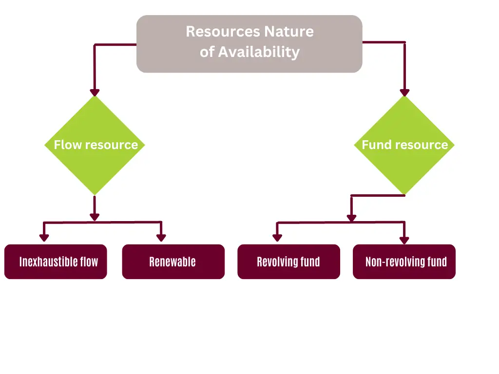
(4) Fund resource :
(1) Revolving fund :
Fund resources, by definition, is an exhaustible resource. But there are some fund resources which can be recycled up to a certain limit and hence the declining trend can be arrested fora short period. For example, lron is a fund resource. But if the iron scraps are recycled in an iron and steel industry, then it becomes a revolving fund resource.
(2) Non-revolving fund :
Non-revolving fund resource may simply be described as a fund resource, the availability of which will decline with time and the rate of decline will be proportional to the rate of exploitation; for example utilisation of coal and petroleum as fuel.
Question 19. Give an account of the fund and flow resources in India.
Answer:
(1)On the basis of frequency of occurrence :
On the basis of frequency of occurrence, the resources may the classified as follows :
(1) Ubiquitous occurrence :
These are the resources which are available everywhere on the earth; for example, oxygen in the air. These resources do not
influence the locational pattern of any economic activity.
(2) Common occurrence :
These are the resources which are available in many places; for example, agricultural soil, water, etc.
(3) Rare occurrence :
These are the resources which occur in few places of the earth; for example, petroleum, coal, etc. Availability of these resources may significantly influence the locational pattern of economic activities.
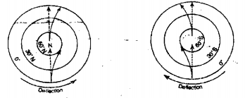
(4) Unique occurrence :
It is the resource which occurs only in one place; for example, cryolite in Greenland.
(2) On the basis of existence :
On the basis of existence, may be classified into two types :
(1) Tangible resource :
Something which can be felt by touch is known as tangible. In other words, tangible resource has a material existence. For example, coal is a material. When it is used as a resource, it is called tangible resource.
(2) Intangible resources:
A resource which does not have a material existence is known as an intangible resource. In other words, it cannot be felt by touch. It is identified by its functionality. So, it is an on-material resource. For example, the knowledge and skill of a teacher are considered as non-material or intangible resources.
(3) On the basis of ownership :
On the basis of ownership, three types of resources may be identified:
(1) Individual resource :
When the functionality of a resource is enjoyed by an individual on the basis of ownership, it is known as an individual resource. For example, agricultural land owned by a farmer is an individual resource.
(2) National resource :
When the ownership of a resource belongs to a country and the people enjoy its functionality as the citizens of the country, it is known as national resource. For example, river Ganga is our national resource.
Question 20. Make a comparison between coal, petroleum And hydropower.
Answer:
Comparison between coal, petroleum And hydropower
| Attributes |
Coal |
Petroleum |
Hydropower |
| 1. Type of resource |
Fund resource which is exhausted with use |
Fund resource which is exhausted with use. |
Renewable flow resources which does not decline with use. |
| 2. Importance as energy source. |
2nd largest source of primary energy and accounted for 25.6% of the world’s total in 2004. |
largest source of primary energy and accounted for 37% of the world’s total in 2004. |
4th largest source of primary energy and accounted for 6.6% of the world’s total in 2004 |
| 3. Exploitation of energy source |
It is used after mining. |
It is used after mining and reigning. |
It is used directly by constructing dams and reservoirs. |
| 4. Storage |
Coal can be stored when it is not used. |
Petroleum can be stored when it is not used. |
Hydropower cannot be stored. |
| 5. Transport |
It is buly and can be transported by rail or road transport |
It is liquid and can be transported by pipeLInes. |
Power source (running water) cannot be transport but electricity is transmitted by transmission cables. |
| 6. Cost |
Cost of production is HIGH |
Cost of production is high. |
Cost of production is low due to very low recurring cost It is described as ‘dean’ source of power. |
| 7. Cleanliness |
It is most unclean. |
It is deaner than coal. |
It is non-polluting source of power. |
| 8. Pollution |
It causes high degree of environmental pollution. |
Environmental pollution is high, but less than coal |
Market should be located near the hydropower generating stations |
| 9. Market |
Market may be located far from the mining areas and transport cost becomes high. |
Market may be located far from the mining areas but transport cost is less than that of coal. |
It is used only domestically. |
| 10. Trade |
Export and import trades are found. |
Export and import trades are found. |
Only in certain cases, surplus power may be sold to the neighbouring countries. |
| 11. Use |
Other than energy source, it is also used as source of’ raw materials c; seme Chemical industries. |
It is a soiree of fuel and non-fuel products. |
It is used only for the generation of electricity. |
| 12.Future prospect |
It is declining importance as a source of power, primarily due to the environmental reasons. |
It is not expected to last for a long time due to its increasing consumption. |
Only 15% of hydropower potential is presently used and it has a great future as a ‘dean’ source of power. |
WBBSE Class 9 Geography And Environment Chapter 7 Summary
Question 21. State the significance of non-conventional sources of energy.
Answer:
Significance of Non-conventional sources of Energy :
Non-conventional energy sources include those which are not commonly used as energy sources. a With the exception of coal, petroleum, natural gas, hydropower and nuclear power all other sources of energy may be regarded as non-conventional as these are not listed as commercial sources.
But for the practical purpose, major non-conventional sources of energy include in exhaustible energy resources like solar energy, tidal power, geothermal energy and wind energy. Emphasis on the development of these sources of energy is significant due to the following reasons :
(1) These non-conventional energy resources are inexhaustible flow resources. So, availability of these sources is constant irrespective of the utilisation patterns. This is highly significant in view of declining reserves of the fossil fuels.
Class ix Geography Book WBBSE
(2) Non-conventional energy resources are regarded as the energy resources of the future because it is estimated that the supply of conventional sources will fail to keep pace with the increasing demand for energy resources. So, the gap has to be filled up by non-conventional sources.
(3) Environmental pollution is a major threat to the mankind and burning of fossil fuels has been increasing the pollution level. But non-conventional sources are non-polluting and hence the development of these sources is essential to save the environment.
(4) Increase in the use of non-conventional energy will extend the lifespan of conventional fund energy resources.
(5) Non-conventional energy resources are cost-efficient in the long run as the material cost is nil.
Question 22. Explain the major iron ore-producing regions in India.
Answer:
Distribution: The main iron ore deposit areas in India are :
Chhattisgarh: The important areas are Bailadilla, Bastar district; Durg district. These deposits are supplied to the iron and steel factory at Bhilai.
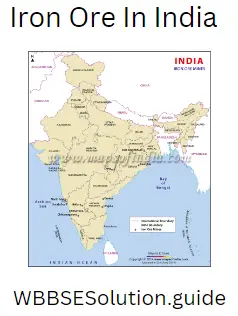
Jharkhand :
A large deposit of iron ore estimated at 1,500 million tonnes has been recently found at Chiria in Singhbhum district of Jharkhand. Singhbhum and Palamau are the important districts.
Orissa :
The Iron ore deposits in Orissa belong to the haematite variety containing 55 to 68 per centurion content. Keonjhar, Mayurbhanj, Sambalpur, Sundargarh, Cuttack, Koraput have iron ores. The steel plants located at Asansol, Bokaro, Durgapur, Jamshedpur and Rourkela receive their supplies of iron ore from these deposits in Orissa.
Class ix Geography Book WBBSE
Karnataka :
It has large reserves of magnetite and haematite. Bababudan hills in Chikmaglur district, Sandur, Bellary and Hospet districts as well as Shimoga and Chitradurga districts in Karnataka are important areas for iron ores. Kudremukh, which means horse’s mouth, has estimated deposits of 1,000 million tonnes. These deposits provide raw materials for the Bhadravati Ironworks.
Goa :
Goa has vast deposits of iron ore. It supplies iron for domestic use as well as for export. However, the iron ore of Goa is of inferior limonite and siderite variety. In Goa, the richer and larger deposits are confined to north Goa.
Andhra Pradesh :
In Andhra Pradesh, the iron ore-producing areas are scattered through Anantpur, Khammam, Krishna, Kurnool, Cuddapah and Nellore. The iron content in these deposits vary from 55 to 62 per cent.
Class 9 Geography Resources Of India WBBSE MCQs With Answers
Tamil Nadu :
Iron ore is found in Salem, North Arcot, Tiruchirapalli, Coimbatore and Madurai.
Maharashtra :
Iron ore deposits are found in the Ratnagiri and Chandrapur districts.
The other areas where minor deposits of iron ore are prevalent include Assam, West Bengal, UP, Punjab and Jammu and Kashmir.
Question 23. Explain the major petroleum-producing region in India.
Answer:
Distribution :
The entire oil production of India so far comes from the Assam- Arakan belt, the Gujarat Cambay belt and the Bombay High offshore zone. The first belt runs from extreme northeast of Assam to the eastern border of the Brahmaputra and Surma Valley. The second belt extends from Mahesana (Gujarat) in the north to the continental shelf off the coast of Ratnagiri (Maharashtra) in the south.
In order of importance, the main areas of mineral oil deposits are :
(1) Mumbai High :
In Maharashtra, about 176 km of Mumbai in the Arabian Sea, a huge oil deposit, known as Mumbai High, was struck in 1974. Mumbai High is the most productive oilfield and has a reserve of 5 crore tonnes of oil.
Mumbai High is so called because of the height of the syncline of the rock structure in which the oil has been struck. It is higher than the normal height and oil is taken from the depth of over 1,400 metres with the help of a specially designed platform known as ‘Sagar Samrat’. It is a self-propelled jack-up type of drilling platform.
Class ix Geography Book WBBSE
(2) Oilfields of Eastern Region :
India’s oldest important oil-bearing area in the eastern part of the Himalayas is Assam. Digboi oilfield situated in the Lakhimpur district of upper Assam is the biggest oilfield in India. Moran, Bappapung, Hausanpung and Hugirijang also have oilfields.
(3) Oilfields of Western Region :
In Gujarat, Cambay basin is the site of the main oil-bearing sand. The other oilfields of importance are Kalol, Koyali, Kosamba, Sanand, Kathana, Ankleshwar and Navgaon in Gujarat.
Besides these oilfields, a number of potential oil-bearing fields have been discovered in the states of Tripura, Punjab, Nagaland, Gujarat, West Bengal and Jammu and Kashmir and also in the Cauvery, the Krishna and the Godavari basins in the south.
Question 24. Explain the coal-producing regions in India.
Answer:
Distribution :
Resources-wise coal occupies the place of pride in the list of mineral resources in India. India ranks third in the world after the USA and China in coal production.
In India, coal occurs in rock sequences mainly of two geological ages, namely, Gondwana, little over 200 million years in age and in Tertiary deposits which were found at a much later geological epoch i.e., about 55 million years ago.
India does not have extensive deposits of the highest grade (90% carbon) anthracitve coal. The coal of the Gondwana fields of bituminous quality (50% to 80% of carbon) is mostly available in India.
(1) Gondwana Coal Fields :
It accounts for 98 per cent of the total reserves of coal in India. Gondwana coal is almost free from moisture and contains sulphur and phosphorus in small variable quantities. The important coal-bearing formations are collectively known as Damudas and belong to the lower Gondwana system.
Gondwana coals are largely confined to the river valleys like those of Damodar, Mahanadi and Godavari. The major resources of Gondwana coal are located in coalfields occupying the Indian heartland in the states of West Bengal, Jharkhand, Orissa, Chhattisgarh, Madhya Pradesh, Maharashtra, Uttar Pradesh and Andhra Pradesh. These coalfields account for four-fifths of India’s coal reserves.
(2) Tertiary Coal Fields :
The Tertiary coal fields of India as compared to the Gondwana coal, usually possess a higher moisture content, more sulphur and are associated with marine sediments. They are found in Assam, Arunachal Pradesh, Meghalaya and Nagaland.
Besides, brown coal or lignite occurs in coastal areas of Tamil Nadu, Gujarat and inland basin of Rajasthan. The Neyveli lignite field in Tamil Nadu is the largest lignite deposit in South India.
Question 25. State the types of coal.
Answer:
On the basis of fuel value and other characteristics, coal can primarily be divided into three types :
(1)Lignite
(2)Bituminous and anthracite.
(1) Lignite :
It is a soft and brown-coloured coal with high moisture and high volatile matter. Carbon content varies between 35% to 50%. Spontaneous combustion and breaking up during drying make the transport of this coal difficult. This coal is not suitable as industrial fuel due to the lack of coking constituents, low carbon content and other disadvantageous properties.
Major uses of this coal include generation of electricity and raw material for chemical industry. In 2004, lignite accounted for 16% of the world’s total coal production.
(2) Bituminous :
The colour of this coal varies from dark brown to black and the carbon content varies from 50% to 85%. This coal ranges between high volatile to low volatile groups and low volatile high-grade coal possesses coking constituent which is essential for making steel.
Bituminous coal has the most wide-ranging uses depending on the grades of bituminous coal. High-grade bituminous coal is used as fuel for industries and as raw material for iron and steel industries.
Other grades are used as household coal, gas coal, steam coal and as raw materials for chemical industries. In 2004, bituminous coal accounted for 78% of the world’s total coal production.
Class ix Geography Book WBBSE
(3) Anthracite :
This is the hardest type of coal with 95% carbon content and insignificant volatile matter. It does not possess coking property. It does not ignite easily, but once lighted, it burns for a long time.
This coal does not have much of industrial importance. It is best used for domestic heating in the temperate countries. In 2004, anthracite accounted for only 6% of the world’s total coal production.
Question 26. Write a note on Geothermal energy.
Answer:
Geothermal Energy :
In volcanic regions of the world, the underground rocks get very hot. They represent a very useful source of energy that is beginning to be tapped. It is known as geothermal (earth-heat) energy. The Geological Survey of India has also identified 340 hot springs in the country where geothermal energy can be exploited.
Geothermal energy has been used for centuries all over the world, even to heat public baths and health spas. Sometimes the water trickling down into the hot rocks is heated so much that it turns to steam, which may be forced back to the surface and erupt as a geyser. This steam is harnessed to drive electricity generators in the forms of geothermal power plants, e.g. the hot springs at Manikaram in Himachal Pradesh.
The thermal energy, stored in the crust of the earth up to a depth of 3 km is manifest in the form of hot springs in geothermal gradients, particularly in thick sedimentary basins like the upper Brahmaputra valley in Assam and the Sabarmati valley in Gujarat.
There are three ways in which geothermal energy can be utilized. First, the hot waters and superheated dry steam can be directly conveyed to power plants to operate the generator turbines as is done in coal-based thermal plants Second, the surface water penetrates the fractured rocks in the deep interior of the geothermal area through deep wells in order to heat and vaporize it.
It is then brought back to run the turbines. Third, the heat exchange, containing liquid having a low boiling point, is immersed in the underground well. The liquid vaporizes and returns to the surface and runs the generator.
The Regional Research Laboratory in Jammu in Puga Valleys is using geothermal energy in poultry farming, mushroom growing, heating homes, offices, factories, and even greenhouses. A similar programme is being held in Parvati Valley in Himachal Pradesh.
Question 27. Write a note on Wind Energy.
Answer:
Wind Energy :
Definition: The energy which produces from wind is called wind energy.
Generation of wind energy :
The USA is the first one for using and generating of wind energy. In 1997, approximately 300-megawatt wind energy produced from here. 75% wind energy of the world is produced from California. India is in the 5th wind energy-producing country. There are 208 wind-energy plants are in India till now.
Lamba of Gujarat is the biggest wind-energy-producing centre in Asia. The process of wind plant at Sundarban is going on. Wind energy is a cheap and clean energy resource. This energy requires only initial cost on the establishment of the wind farm. Our country has a wind power potential of 20,000 MW.
About 85 sites with a potential of 4500 MW have been identified in the country. The major wind power plants are located at Muppandal and Nagercoil in Tamil Nadu. Wind power plant at Lamba in Gujarat in the Gulf of Kutchh is the largest in India and third largest in Asia.
Question 28. Differentiate between conventional and non-conventional sources of energy.
Answer:
Difference between conventional and non-conventional sources of energy
| Subject |
Conventional Energy |
Non-conventional Energy |
|
|
|
| Definition |
The energy resources which are widely used in modem ages called conventional energy. Ex- Thermoelectric, Hydro-electric, Nuclear energy. |
The energy resources which have Utie uses called non-conventional energy. Ex- Solar energy, wind energy, organic energy etc |
| Source |
Minerals are the main sources of conventional energy Ex-coal, petroleum, etc. |
Unlimited and renewable energy of nature are the sources of norKom«national energy. Ex-Sunkght, wind flow; ocean wave etc |
| Supply |
Sources of conventional energy are not renewable. Ex-coal, petroleum. |
Sources of nonconventional energy or renewable resources. Ex- Sunlight, wind flow, etc |
| To be used by |
This type of energy has great possibility to be exhausted up for huge uses of it Ex-some important coal mines of the world is empty now. |
This type of energy is produced unlimitedly and renewable resource. So it has a minor or no chance to be spent up. |
| Pollution |
Except hydroelectric power conventional resources pottutethe atmosphere. For instance, during the production of thermal energy and atomic energy the air is polluted entensjvety |
This type of energy doesn’t pollute the environment |
| Producing cost |
Production cost is very high. So, it is |
Production cost is comparatively very low. So, |
|
|
|
| Extension |
This energy is widely used in our modem |
The extension of this energy is very little. |


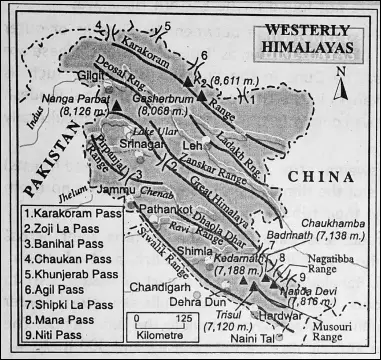

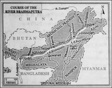
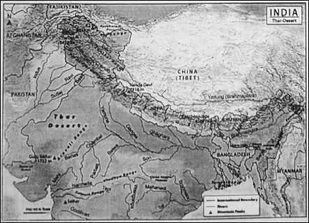


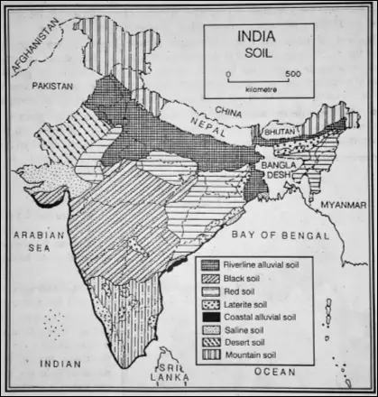
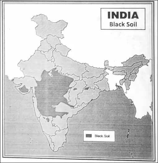

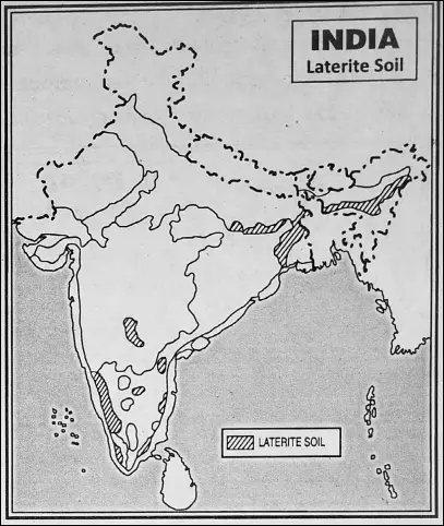
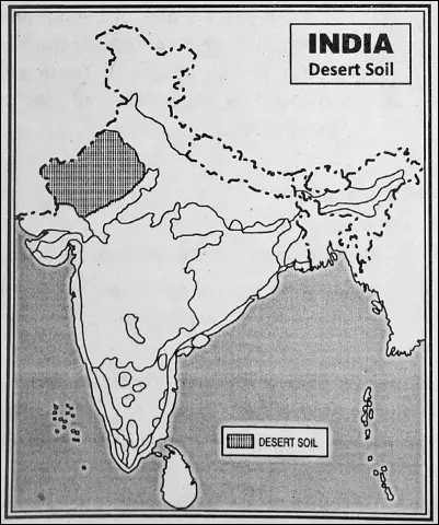
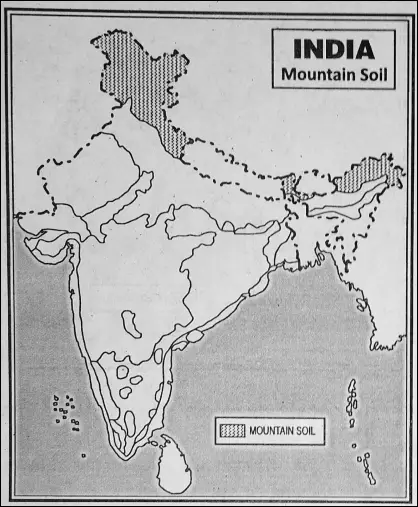
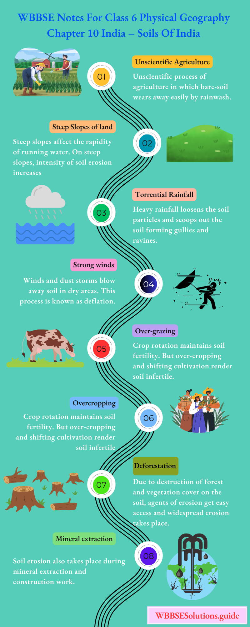


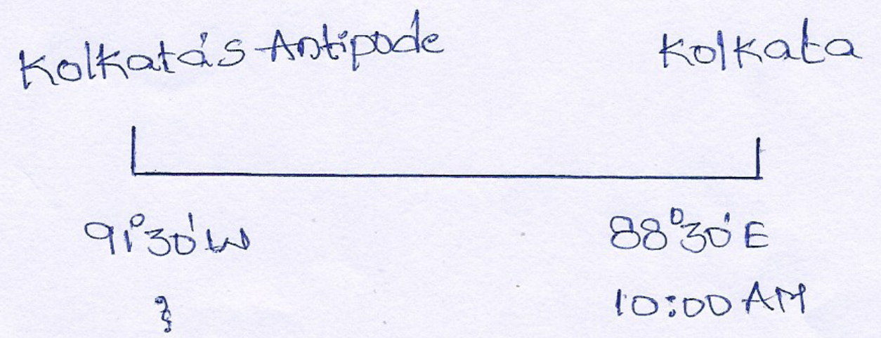


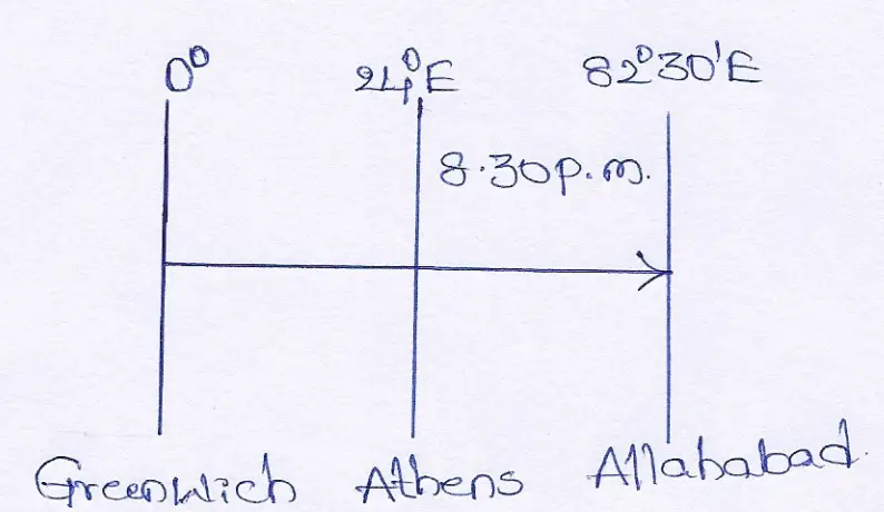


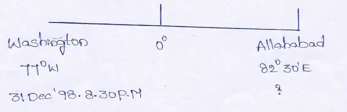
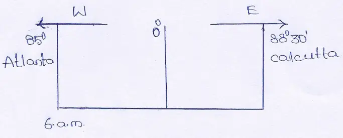


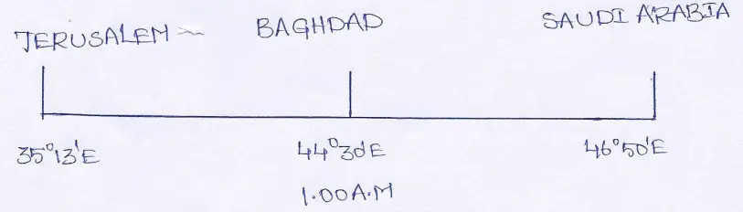
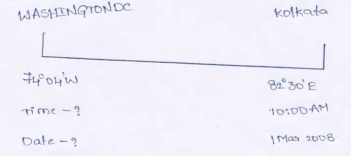


 Answer: The time difference between the 2 places is 2 hours 15 minutes 40 seconds or 135 minutes 40 seconds


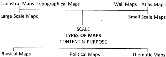
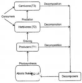


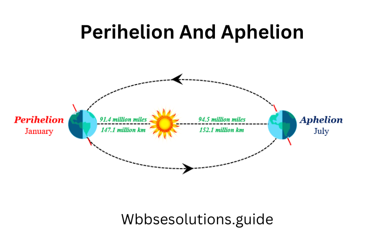

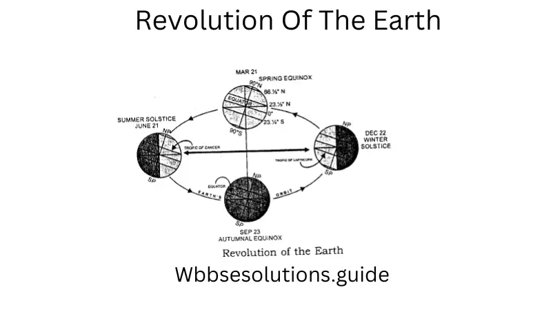


 .
.