
Chapter 6 Climate Regions
Climate Regions Meaning:
The climate is the aggregate of atmospheric conditions over a wide area or a time (Say at least 35 years). The natural division of the earth according to e characteristic features of climate is called a ‘Climatic region’. There is a certain world each of which has its own climatic characteristics especially, identical emp rainfall conditions.
Again, temperature and rainfall play a great role in natural vegetation type and human activities. A climatic region, thus, includes an area that as a m natural vegetation and a human lifestyle.
Read and Learn all WBBSE Notes For 8 Class Middle School Geography
The characteristics of Climatic Regions: The characteristics of climatic regions are as follows:
- A climatic region, generally, spreads over the different parts of the earth’s surface and is almost similar in respect of the climatic condition
- The boundary or the limit of a climatic region is not definite. It gradually changes to another climatic type.
- For the difference of the geographical location, landform, and soil character, some dissimilarities may be found in a particular climatic type and therefore sub-divisions may be referred to.
- The limit or boundary of a climatic region does not depend on man’s discretion. A change in the political condition does not affect the boundary of a climatic region.
- Soil, natural vegetation, biodiversity, and even human lifestyle vary with climatic regions.
The Major Climatic Regions of the World:
| Climatic Zone | Latitude | Climatic Type |
| 1. Equatorial or Hot-Humid Climatic Zone | 0° – 10° N and S | 1. Equatorial Climate |
| 2. Torrid Zone or Tropical Zone. (Warm Climate) | 10° – 30° North and South | 2. Tropical Monsoon Climate.3. Tropical Savanna Climate (Sudan type).4. Tropical Hot Deserts Climate. |
| 3. Warm-Temperate Zone | 30° – 45° North and South | 5. Mediterranean Climate (Western Margin). 6. Steppe type or Central Continental type.7. China type of Climate (Eastern Margin) |
| 4. Cool-Temperate Zone | 45° – 60° North and South | 8. Western Margin Marine Climate.9.Siberian or Taiga Climate. 10. Eastern Margin or Laurentian Climate. |
| 5. Frizid Zone (Cold Climate) | 60° – 90° North and South | 11. Tundra Climate. 12. Polar Climate. |
| 6. Alpine or Mountain Zone | 13. Tropical and Temperate Mountainous Climate. |
Human Resources Geography
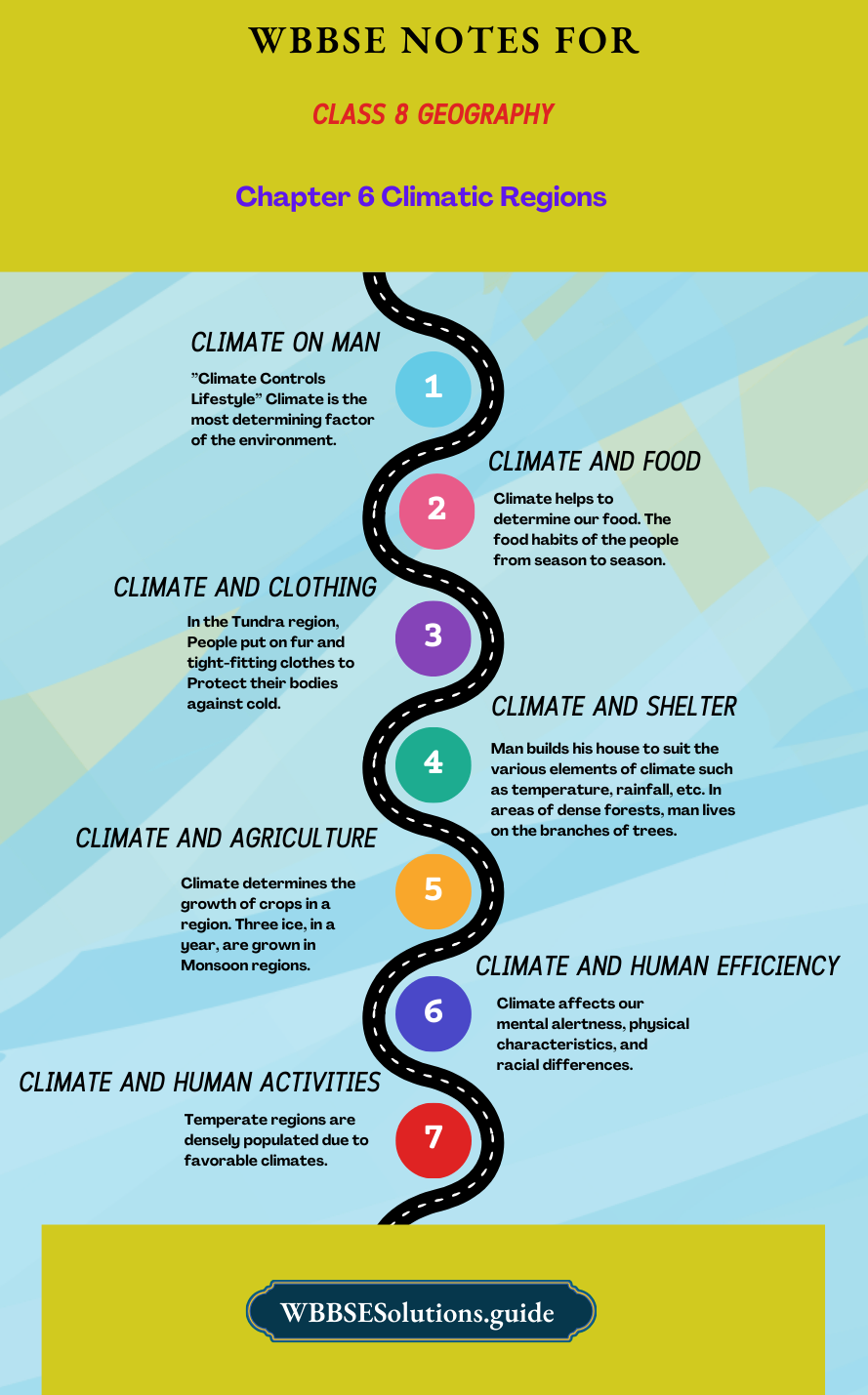
The Effects of Climate on Man: ”Climate Controls Lifestyle” Climate is the most determining factor of the environment. Climate, directly on indirectly affects the different human activities in his daily life. Climate determines our food, clothing, shelter, and general mode of life.
Climate and Food: Climate helps to determine our food. The food habits of the people from season to season. In cold areas, people depend on animal food to keep themselves warm. Rice is the staple food in the Monsoon climate. In hot and humid lands, people depend on vegetables and food called vegetarians.
| Class 8 General Science | Class 8 Maths |
| Class 8 History | Class 8 Science LAQs |
| Class 8 Geography | Class 8 Science SAQs |
| Class 8 Maths | Class 8 Geography |
| Class 8 History MCQs | Class 8 History |
“WBBSE Class 8 Geography Chapter 6 notes, Climatic Regions”
Climate and Clothing: The type of clothing varies according to the changes in the weather and the climate in hot humid equatorial regions, man lives half-naked and wears cotton clothes. In cold areas, people use the right woolen clothes. In the Tundra region, People put on fur and tight-fitting clothes to Protect their bodies against cold.
Climate and Shelter: Man builds his house to suit the various elements of climate such as temperature, rainfall, etc. In areas of dense forests, man lives on the branches of trees. In polar regions, igloo houses are built by the Eskimos. In mountainous regions, sloping roofs are built to Protect against snow and heavy rain as in Kerala. Flat-roofed houses are built in hot regions while in cooler regions, glass panes are used for doors to allow more sunlight. In the Mayan region, south-facing slopes are preferred for houses.
Climate and Agriculture: Climate determines the growth of crops in a region. Three ice, in a year, are grown in Monsoon regions. In the Tundra region, agriculture is not possible due to the short growing season and vegetables are grown in glass houses.
In arid areas, irrigation is used to grow crops. Farmers and their crops are still at the mercy of climate and weather. Sugarcane, cotton, and rice are the crops suited to Tropical regions only.
Climate and Human Efficiency: Climate affects our mental alertness, physical characteristics, and racial differences. In cold areas, people are hard-working and efficient. In hot areas, people are easy-going and lazy.
Due to many fatal diseases and insects, the people in the equatorial region have poor health and the region is known as the “region of debilitation”, climate affects the growth of fungi and diseases. Agricultural Bulletins help farmers to take precautions against frost, hail, drought, etc.
Climate and Human Activities: Climate influences the location of industries Cotton textile in humid areas, fruit processing industries in the Mediterranean climate, his industry in dry areas are some of the examples.
“Class 8 WBBSE Geography Chapter 6 notes, Climatic Regions study material”
Temperate regions are densely populated due to favorable climates. Climate (direction of winds) also affects the location of the trade routes. Modern air transport, military operation, and geographical expeditions depend on meteorological reports.
Thus, it can be concluded that climate has both direct and indirect influences on human activities, civilization, and mode of life. It is one of the fundamental components of nature and the environment. Man has learned to adjust and adapt himself to the varying climatic conditions.
Chapter 6 Climate Regions: Hot-Humid Equatorial Climatic Region
The Equatorial Regions are known by several names depending on the types of climate or local natural vegetation. The regions are described as ‘Hot-Humid/Wet Equatorial Region’, “Equatorial Rainforest Region’ or “Tropical Rain Forest Region’.
The region experiencing a hot, wet equatorial climate has high temperatures and much rainfall throughout the year. So dense forests grow here. The region is hence called the ‘Equatorial/Tropical Rainforest Region’.
The uniqueness of the Equatorial Region: The Equatorial Regions have several distinctions to their credit—
- They are the lands of the overheating sun.
- They receive very high insolation.
- The difference between the durations of day and night is the least.
- The periods of dawn and dusk in the region are the shortest.
- They are the lands with the highest relative humidity all through the year.
- They have only one season—simultaneously hot and humid.
- With ascending air it is a region of calm or doldrums. Thus the Equatorial Regions are unique in themselves in ways more than one.
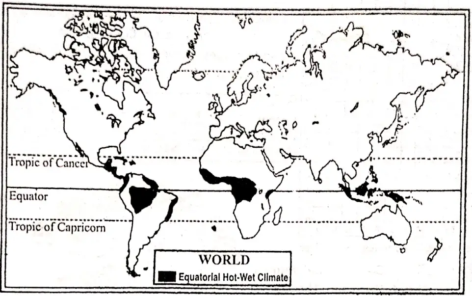
Location: The Equatorial Region extends generally between 10″ North and 10″ South latitudes on both sides of the Equator. The region includes parts of the Amazon Basin and Guianas in South America. Zaire Basinand Guinea coastjn Africa.
In Asia, the main areas are Malaysia Indonesia, Papua and New Guinea, Southern Philippines, and peninsular parts of Thailand.
Chapter 6 Class 8 Geography
The characteristics of Equatorial Climate: High temperature, heavy rainfall, and perpetual summer without any change of seasons characterize the equatorial type of climate. They can be summed up in the following:
- The Equatorial Region receives vertical rays of the sun all year round and therefore temperature remains high.
- Throughout the year temperature remains almost the same.
- The average temperature all around the year ranges between 25°C to 27°C.
- The range of temperature between day and night is minimum [2° to 5°C].
- There is no change of season.
- Rains fall all year round. It occurs in heavy downpours.
- The annual rainfall averages between 200 cm to 300 cm.
- There is no dry month. Generally, rainfall occurs every day. It comes at a particular hour.
Conditions of the important elements of climate in the Equatorial Region:
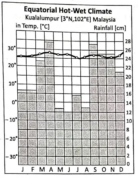
Temperature: Temperature conditions range between 25°C and 30°C during the year. The annual range of temperature is usually less than 5°C. If the maximum temperature during the day is about 30°C, the minimum temperature at night may be about 25°C.
Cloudy skies Prevent the loss of radiation in the night and cooling of the atmosphere. The difference between maximum and minimum temperature among the different months of the year is so small.
Air pressure and wind: Intense low-pressure forms over the Equatorial Region due to high temperatures throughout the year.
“WBBSE Class 8 Geography Chapter 6, Climatic Regions study guide”
The location of this type of climate coincides with that of the Equatorial low-pressure belt and the ‘Inter Tropical Convergence Zone’ (ITCZ). NE and SE trade merge here. Equatorial calm/Doldrums has formed here.
| Place Kualalumpur | J | F | M | A | M | J | J | A | S | O | N | D |
| Temp, in °C | 26.1 | 26.1 | 26.6 | 26.6 | 26.6 | 26.6 | 26.1 | 26.1 | 26.1 | 26.1 | 25.5 | 26.6 |
| Rainfall in cm. | 16.7 | 16.7 | 23.2 | 27.5 | 12.5 | 10.2 | 15.5 | 13.2 | 27 | 25 | 25 | 22.7 |
Rainfall: Convection rainfall occurs throughout the year. The sky is generally clear in the morning, but rainfall occurs in the afternoon between 2 pm to 4 pm. with thunders in torrential form. So, this rainfall is known as ‘4 o’clock rain’. The sky clears up again at night.
Chapter 6 Climate Regions: Biodiversity
Flora/Natural Vegetation: Due to high temperature, humidity, and rainfall, the flora or natural vegetation of Equatorial Regions is very luxuriant. Tropical or Equatorial rainforests are found in this region. There are four levels of vegetation found in Equatorial forests.
- Some of the trees manage to grow as tall as 40 to 45 meters (above 30 meters). These are Emergent trees.
- The next in order are the trees with medium heights (about 15—30 meters). There is a continuous layer of tree crowns.
- Palms and Palmyra trees open up their crowns at a lower height (In between 7-5 to 15 meters). There were young trees festooned with lianas.
- The ground floor of the layered or multi-storeyed forest consists of the regrowth of ferns and short bushes. The fern-like undergrowth is not dependent on sunshine. Creepers climb up the trees weaving a maze as it were.

Over a small area un reds of different species of trees grow side by side. The trees are so close to each other at their leaves form an overhead layer or canopy. The canopy does not allow sunlight to penetrate and reach the forest floor.
So, this region is known as the “Region of twilight”. The equatorial forests are known for hardwoods. The main trees of these forests are mahogany, rubber, guttapercha, cinchona, sandal wood, rosewood, ironwood, cocoa, palm, oil palm, sago palm, coconut palm, etc. Sal, Teak, and Ablus trees are also found here.
“WBBSE Class 8 Climatic Regions notes, Geography Chapter 6”
Summing up all the features we can conclude the following chief characteristics of these forests.
- The thickest vegetation is found around the Equator. Great heat, abundant rainfall, and bright sunshine are basic factors responsible for thick forest growth.
- Mahogany, ebony rosewood, ironwood, rubber, etc. are found in abundance. These trees are hardwood trees.
- There are great varieties of trees found scattered throughout the whole forest area.
- In marshy lands and river mouths, such as in the Guinea coast, coconut, and palm oil trees are found in abundance.
- There are distinct layers of arrangements in equatorial forests.
Fauna/ Animal Life: The Equatorial forests abound in wildlife. There are varieties of wild animals. They can be categorized as follows:
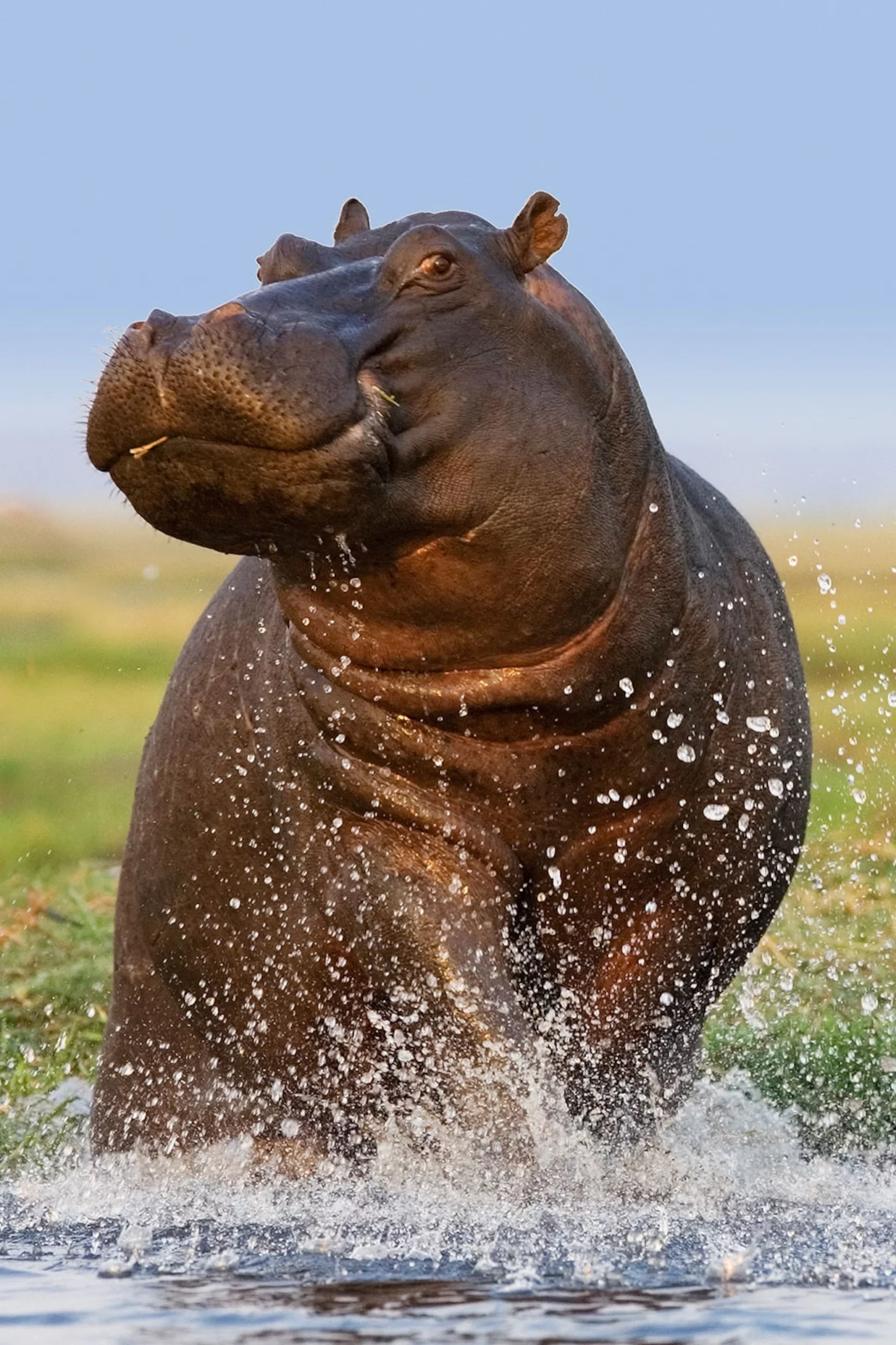
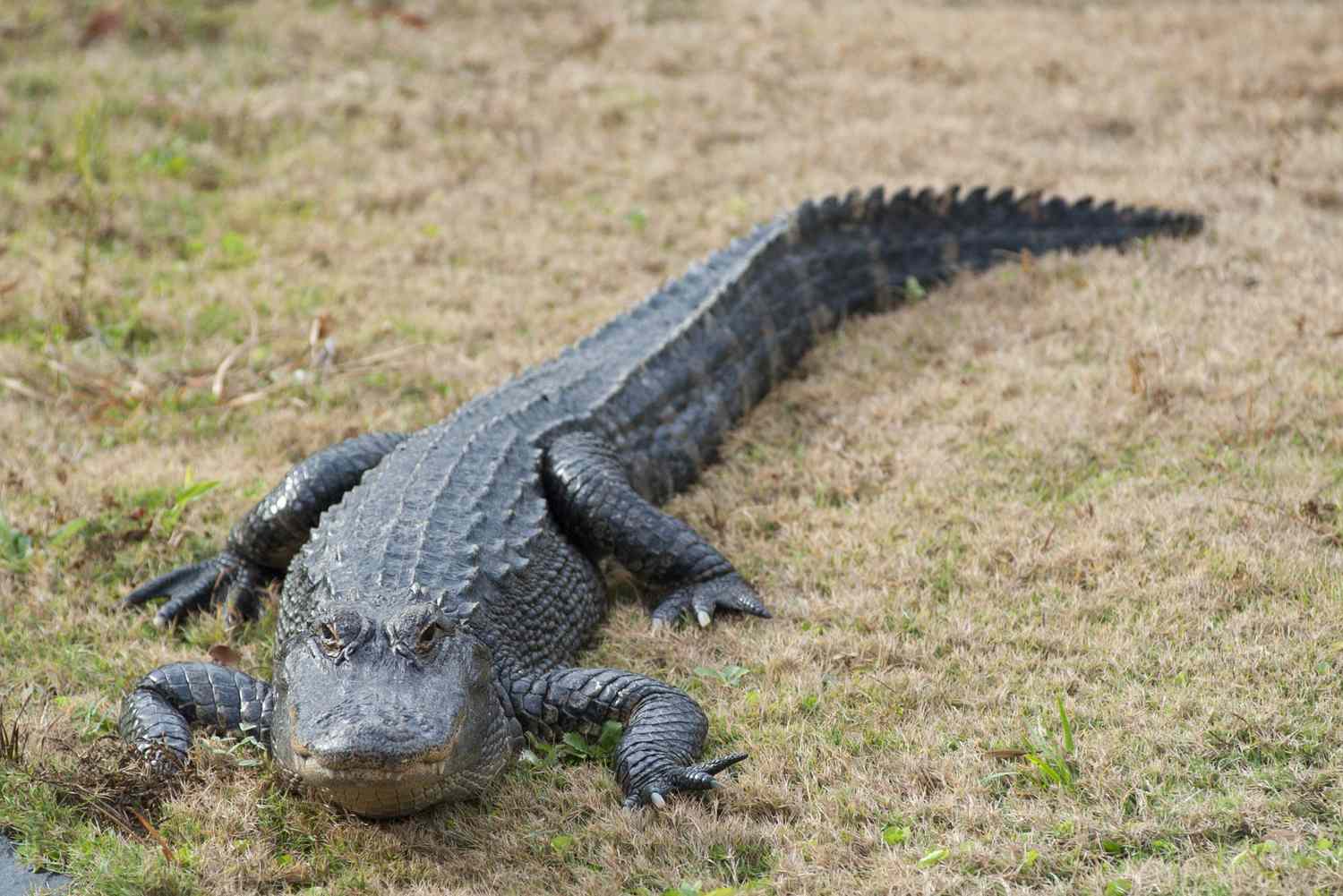
Giant Animals: These types of animals are found in two places. Elephants and Rhinoceroses are found near the edges of open forests where some grasses are also available. Hippopotamus is found in lakes, rivers, and swampy areas. Hippos, crocodiles, turtles, and different kinds of fish are also found in swamps and lakes.
Birds and Anlrpfs pertaining to Trees: These types of animals include monkeys, bats, flying squirrels, tree frogs, tree lizards, tree iguanas, and reptiles. Flesh-eating animals such as snakes and jaguars are also found on trees. Most of these animals live on trees due to marshes.
Insects: In this group of wildlife are included butterflies, termites, spiders, ticks, gnats, mosquitoes, ferocious diver ants, etc.
Chapter 6 Climate Regions: Socio-Economic Environment and Lifestyle
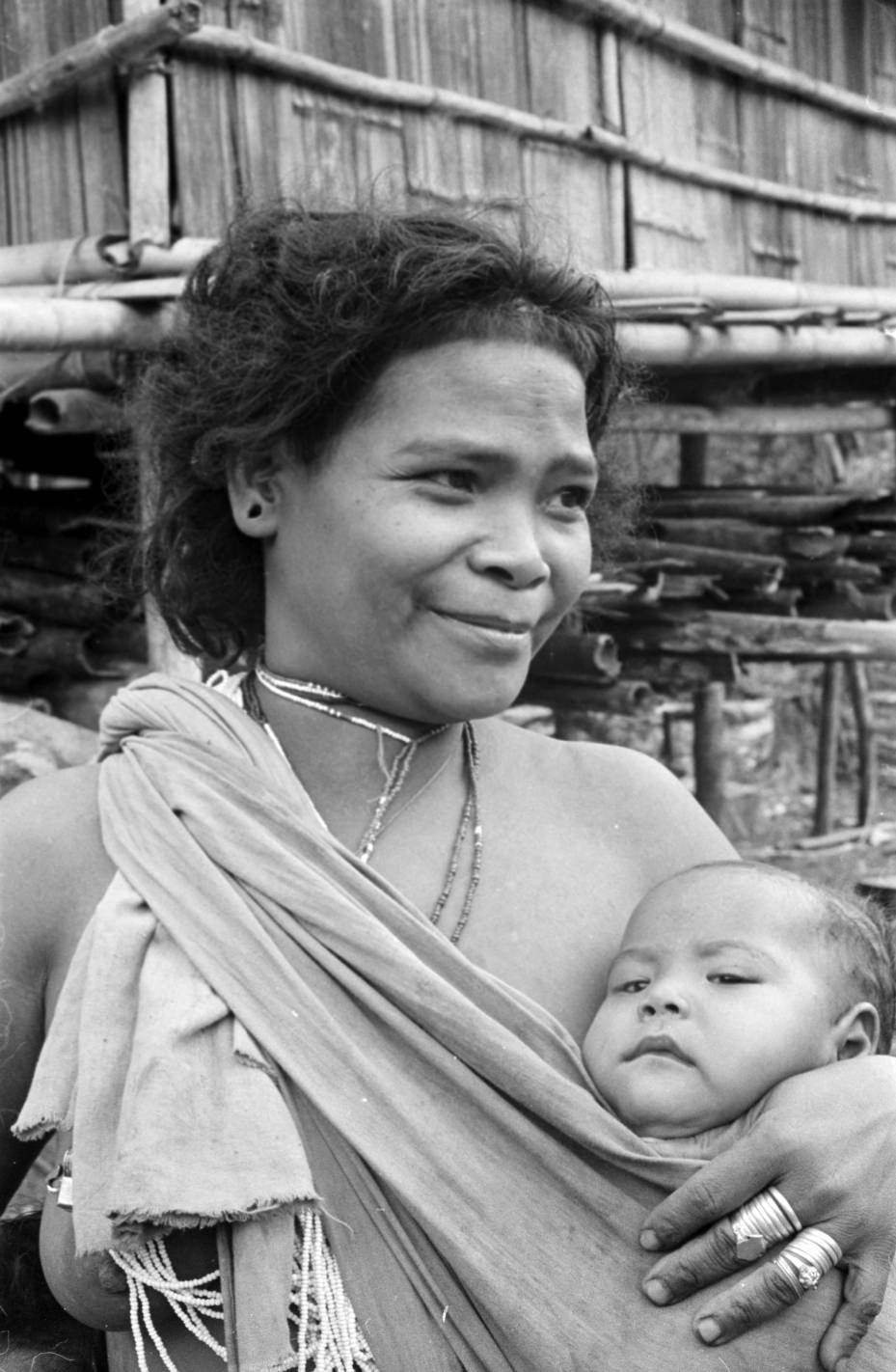
Inhabitants and their lifestyle: In hot and humid climates(Equatorial/Tropical Rain forests) the lifestyle of the indigenous peoples is largely controlled by physical environments. The Pygmies of the Congo (Zairge) basin, Red Indians of the upper Amazon basin, and Semangs of south-east Asia (Malaysia) are the main inhabitants of this region.
They are food-gathering and hunting tribes. The Andamanese and Negrito people ore still in the hunting and food gathering stage because of their oppressive and harsh climatic conditions.
“Class 8 WBBSE Geography Chapter 6, Climatic Regions easy explanation”
The Pygmy: The Pygmies of Congo (Zaire) basin in Africa are primitive people and are one of the most backward tribes in the world; they belong to Mobutiar,d Banbuti tribes. They live in the thickest part of the equatorial forest of the Congo (Zaire) basin since time immemorial. They live in small bands and live on hunting and gathering of fruits and roots of the forest.
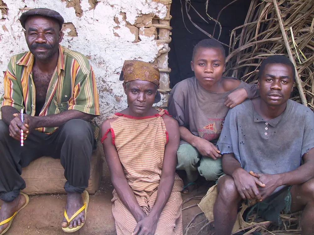
Their mode of life is in perfect harmony with the environment. As the Pygmies roam after games and gather fruits and roots of the forest from one place to another, they have no permanent shelter. They wear little clothes. Their clothes consist of barks or leaves of trees. They also use the skin of animals. The pygmies still lead their Primitive life.
“WBBSE Class 8 Geography Chapter 6 notes, Climatic Regions PDF”
The Red Indians of the Amazon basin: The Red Indians of the Amazon basin are some of the backward tribes of the world. They live in the selva forest of the Amazon river basin of South America.
They are widely scattered over the forest, but they have a similar ways of living. They live on hunting and gathering fruits and roots of the forest. They wear very little clothing and eat all kinds of animals. Little change is found in them.

Semang: Semangs are indigenous peoples of the Malay Peninsula in Southeast Asia. They are of small stature with wide noses, thick lips, and a black complexion. Like their food supply, the clothing of the Semang is supplied mainly from the forest.
They do not build permanent dwellings and live in temporary huts. The mode of living of the Semang is in the hunting stage.
In recent years, some changes have been noticed in their lifestyle. Some of them have come to contact of modern civilization. They flock to the rubber gardens to secure jobs. They are willing to work and join the general flow of living in the modern world.
Other Primitive Tribes of S.E. Asia: There are a number of primitive tribes in eastern Malaysia. Of them Iban, Dasunand Torajaare important. The Andamanese, Jarov/as, Onges, Sentineleesof the Andaman Group of Islands, live on hunting and gathering fruits and roots of the forest.
They still follow their primitive ideas and lead the life of the jungle. Nicoborees and Shompen live in the Nicobar group of Islands. They also live wildlife.
The Equatorial regions are generally the most backward areas of the world. An unhealthy climate and diseases like yellow fever make people lazy. They have poor health and lack energy. Hence, it is called a region of debilitation’.The oppressive climate makes it unsuitable for white settlers. This region is thus called the “white man’s graveyard”.
Occupations of the people:
Hunting: The native people hunt animals, birds, and reptiles with poisoned arrows.
Fishing: People living near rivers and sea, are fishermen. They use a boat named a canoe for fishing.
Limbering: Lumbering is limited. Some valuable hardwood trees are cut for cabinet wood.
Mining: ln some areas, mineral resources are exploited, such as copper in Zaire Basin, tin in Malaysia, petroleum in Indonesia, and gold, bauxite, and manganese in Ghana.
Food gathering: The native people collect many materials from the forests such as fruits, ivory, nuts, rubber, gum, drugs, etc. Quinine is obtained from the Cinchona tree in java.
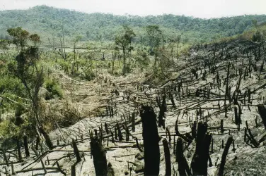
Shifting cultivation: Some native tribes practiced a special type of agriculture. It is known as sffittmg cultivation, ‘Milpa'(Brazil), and ‘Ladang'(Indonesia). Forests are burnt and cleared. Crops of rice, millet, manioc, and bananas are grown. After two or three crops, the fertility of the soil is exhausted and people move on to new plots of land.
Plantation Agriculture: European traders established colonies here in the eighteenth and nineteenth centuries and practiced plantation farming in these regions,
- Rubber in Malay, Java, and Sumatra of south-east Asia,
- Sugarcane and banana in West indies,
- Cocoa and plam on the Guinea coast,
- Tea and coffee in Sri Lanka,
- Spices and coconuts in Sri Lanka were the main plantation crops that provided a livelihood for local inhabitants.
Industry: The dearth of raw materials has prevented the growth of heavy industries in this region. However, some industries have emerged based on local agro-based, forest based and mineral-based raw materials.
Present Scenario: In this region, the environment is unfavorable for human settlement. In recent years uncontrolled growth of the population has led to the emergence of new settlement here.
Vast stretches of evergreen rainforest is being destroyed every day due to the great demand of land for settlements, cultivation, industry, and transport.
Civilization is at a low level in most areas.
Where white men have settled, people have a better mode of living. Lumbering has become an important industry. Sawmilling has also developed. In some parts, margarine, and soap making, sugar-producing, and palm oil extracting are notable.
“WBBSE Class 8 Geography Chapter 6, Climatic Regions important questions”
Future Prospects: Even today, the equatorial region does not show much sign of advancement. With the progress of science and technology, there is a great possibility for the development of the equatorial region:
- Today’s backward regions hold possibilities for the generation of hydroelectric power, which can bring about economic progress.
- Application of atomic energy may help eradicate of various diseases and thereby will pave the way for human habitation.
- Forest clearings will provide ample scope for agricultural practices. The native tribes will come to contact with the civilized people and they all together will build up a new home for a man with modern amenities of life.
Chapter 6 Climate Regions: Warm Climate -Monsoon Climatic Region
The word ‘Monsoon’ is derived from the Arabian word ‘Mousim’ or the Malayan word ‘Mausin’ both of which mean ‘season’. So, the wind that blows following the season is known as ‘Monsoon Wind’, and the climate controlled by that wind is called ‘Monsoon Climate’.
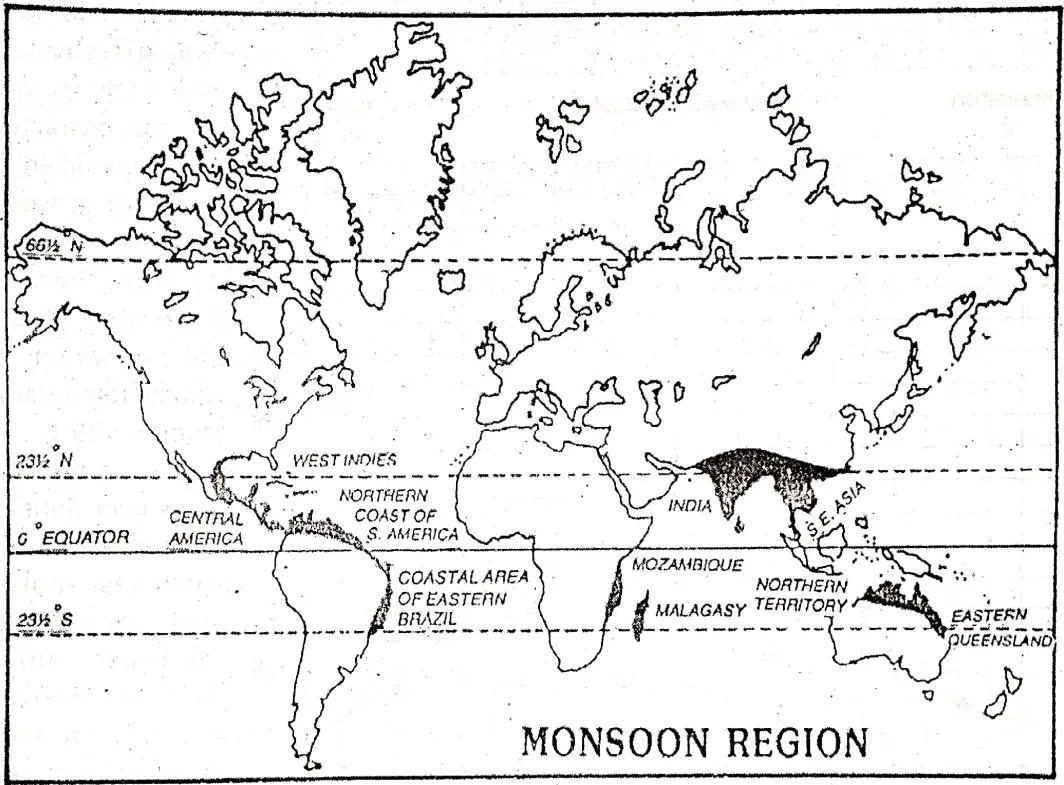
Location: The Tropical Monsoon type of climate occurs in the eastern margins of continents lying 10° to 30° north and south of the Equator. The climate of the south and south-east Asian countries, namely India, Pakistan, Bangladesh,- Myanmar, Thailand, Laos, and Vietnam are monsoon types.
The Phillippines, South China, Queensland of northern Australia, east coast of Africa such as Somalia, Madagascar, Mozambique, Florida coast of U.S.A., east coast of Brazil are also affected by this type of climate.
Climatic Characteristics: The Tropical Monsoon climate is characterized by the following factors:
This type of climate is mainly controlled by the ‘Monsoon wind’.
The climate is influenced by the ‘Tropic of Cancer (23 1/2° North) and the ‘Tropic of Capricorn (23 1/2° South).
The wind blows in opposite direction in summer and winter. In monsoon lands in summer moist south-west monsoon wind blows and in winter dry north-east monsoon wind blows.
- The region is also characterized by hot-humid summer and dry mild winter.
- Average summer temperature varies between 30°C and 32°C and in winter, average temperature ranges between 19°C and 22°C.
- Annual rainfall of monsoon lands varies between 125 cm and 175 cm. But rainfall decreases away from the coasts to the interior.
- The amount of total rainfall is lesser than in the equatorial region. Rainfall occurs mainly in the summer. Winters are generally dry.
- Seasonality is a salient feature of the monsoon climate. ,
- In the Northern and Southern hemispheres seasonal conditions are just reversed.
- The whimsical nature of monsoon ‘Gambling of the monsoons’ causes floods and droughts.
Geography Human Resources Class 8
Seasonal Characteristics of the elements of climate in the Monsoon climatic Region: The monsoon climates are basically caused by the unequal heating or cooling of the land and sea.
This results in differences of pressure. So, winds blow from high-pressure to low-pressure areas as the on-shore wet monsoons in summer and off-shore dry monsoons in winter. The principal characteristic 60 of monsoon climate is a charge of seasons.
In Northern Hemisphere:
- From December to February, it is cold 48 and dry winter. The average temperature is generally 19°C—22°C. South-east trade wind blows over South and Southeast Asia as the North-east monsoon wind. This wind does not cause rain to fall.
- From March to 24 May, it is a hot and dry summer. The average temperature is about 3 0° C. Sometimes temperature exceeds 38°C. Intense heat creates low pressure over the landmass. Some amount of rainfall occurs in Assam, Bangladesh, and Myanmar in the months of March and April.
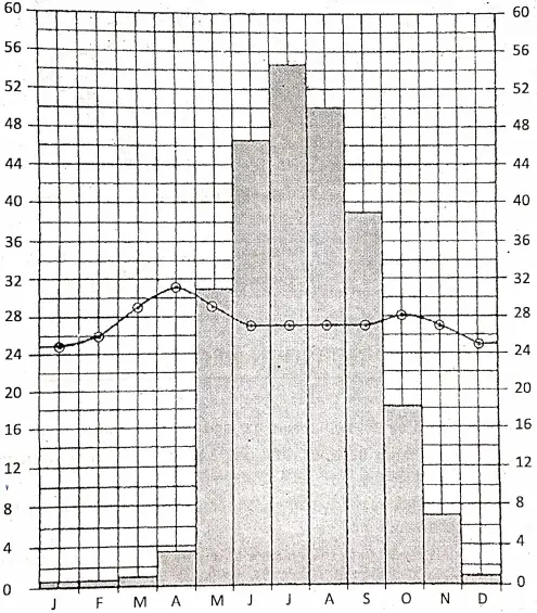
- From June to September, it is the rainy season. When the South-west monsoon comes from the Indian Ocean via the Arabian sea branch and the Bay of Bengal branch enters the Indian Sub-continent then sudden and heavy rainfall occurs with thunder and lightning. It is known as the ‘Burst of Monsoons’. In this season water vapor is maximum in the air an occurs in November Then temperature is decreased due to rainfall.
- From the middle of September, it is Autumn, which is also known as the season of ‘Retreating Monsoon, energy, and cold climate prevail. The formation of a deep depression in the Bay of Benga causes thunderstorms.
| Month | J | F | M | A | M | J | J | A | S | O | N | D | Yearly average Temp./Rainfall |
| Temperature (c) | 25 | 26 | 29 | 31 | 29 | 27 | 27 | 27 | 27 | 28 | 27 | 25 | 27 |
| Rainfall (cm) | 0.5 | 0.5 | 0.8 | 40 | 30.5 | 45.7 | 54.4 | 50.5 | 38.9 | 17.5 | 7.1 | 10 | 251.4 |
Chapter 6 Climate Regions: Biodiversity
Flora/Natural Vegetation: The vegetation of the monsoon region varies with rainfall, is more than 200 cm, Tropical Evergreen Rainforests are found. These forests are more open than the Equatorial Rain Forests (Selvas) and there are fewer species. Ebony Mahogany, Rosewood, Toon, Poon, and Chaplash are some trees of these forests.
Where rainfall is less and there is a marked dry period, deciduous forests of Sal, Mahua, Palash, Teak, Bamboos, Acacia (in drier areas), and varieties of Eucalyptus (in northern Australia) are found. In areas of scanty rain, semi-arid desert conditions prevail.
“Class 8 Geography Climatic Regions notes, WBBSE syllabus”
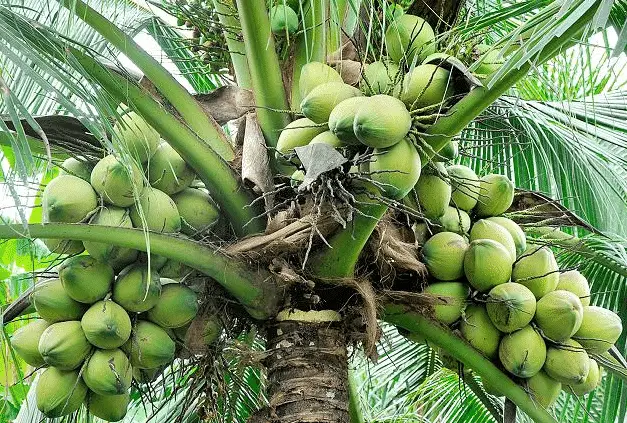
There the vegetation consists of Cacti and Thorny bushes. Fruit trees like Mango, Jackfruit, and Bananas are also common in India and Bangladesh. In the Sundarbans mangrove forests (Sundari, Garan, Geona, Hental, etc.) are found.
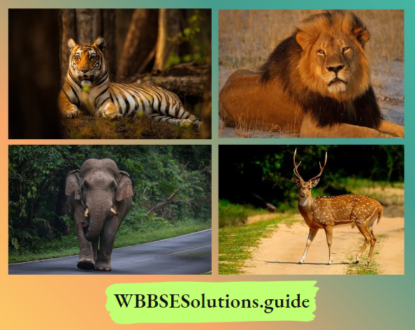
Fauna/Wild Life: Important wild animals of monsoon lands are elephants, Rhinoceros, monkeys, Deer; Jackals, Hyenas, leopards, wolves, bears, foxes, etc. The Sundarbans of India and Bangladesh is the home of the famous ‘Royal Bengal Tiger’ and Gir forest in Gujrat is the home of Lions.
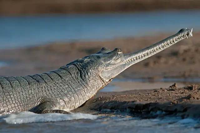
Different types of reptiles like snakes’ are found in this region. At the river estuary of coastal areas crocodiles, Turtles, Crabs, and huge amounts of Fish are found.
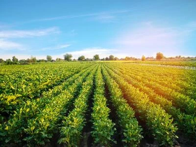
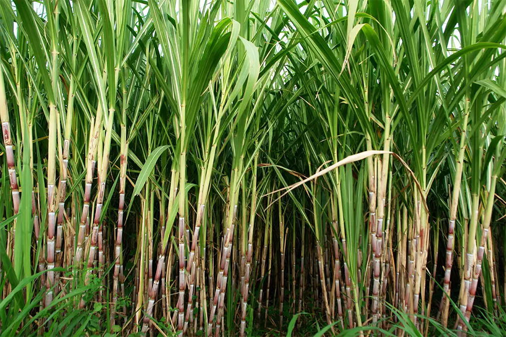
Agriculture: Agriculture is the chief occupation and forms the backbone of the economy of this region. But in this regard, the role of monsoons is very vital. A variety of crops, such as rice, wheat, millets, oilseeds, Jute, Tea, Coffee, and different vegetables are cultivated in monsoon lands. Among these crops, rice is the most important.
Pastoral Resource: Livestock farming is practiced in this region as a subsidiary occupation on a domestic level. These animals are cattle, buffaloes, and sheep. Therefore, large quantities of milk, meat or hides or skins are produced.
Mineral Resources: Certain areas in monsoon lands are rich in mineral resources. Coal, bauxite, mica, manganese, copper, and iron ore is available abundantly in peninsular India. Petroleum and Natural gas are produced in Myanmar, Southern China, and in some parts of India.
Besides these minerals, Thailand produces tin, Myanmar produces tungsten and precious stones and Bangladesh produces natural gas.
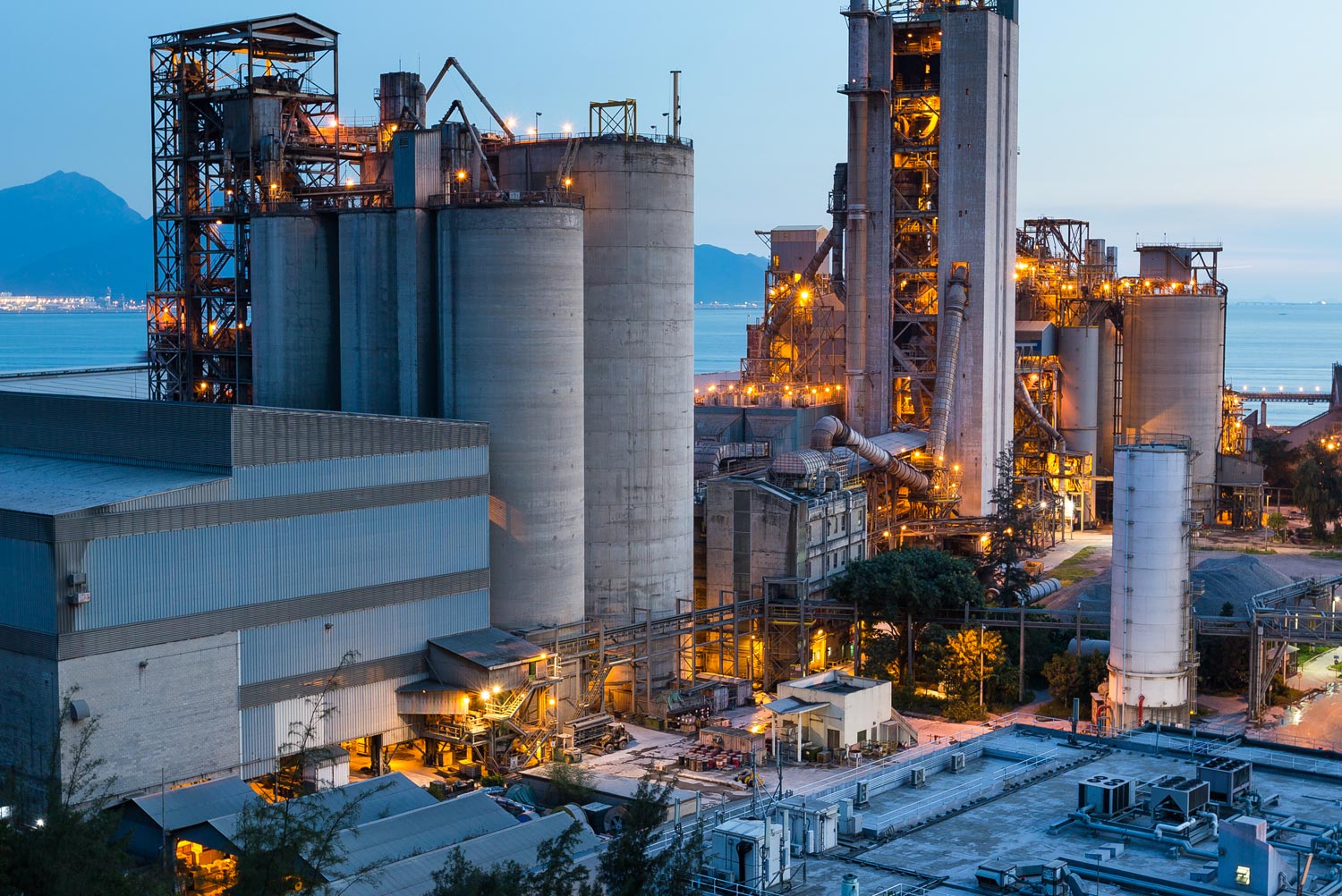
Industry: Industries are developed in those areas where agricultural and mineral resourceslafe available. The important industries of this region are—
- Iron and steel industry Cotton and Jute textile, sugar, and engineering industries in India,
- Jute industry in Bangladesh,
- Oil refining in Myanmar,
- Electronics and engineering industries in Thailand,
- Sugar, cotton, and jute industries in Sn China,
- Cotton textile industry in Pakistan.
“WBBSE Class 8 Chapter 6 Geography, Climatic Regions solutions”
Transportation: Innumerable roadways and railways run through the plains of monsoon lands. Rivers provide cheap waterways. Most of the important and big cities and towns are connected by airways. All the modes have been well developed. But the transport system of the monsoon climatic region in Africa and South America is not developed.
Settlement: Monsoon regions of Asia is the world’s most densely populated area. Due to favorable fertile soil, enriched agriculture, and developed transport network density of the population is very high in the river valleys of the Ganges, Indus, Brahmaputra, Irrawady, Si-kiang, Mekong, etc.
But in the mountainous regions and scanty rainfall areas of monsoon regions are sparsely populated. The density of the population is also very less in the coastal areas of Brazil, northern Australia, and in the eastern coast of Africa.
The lifestyle of the people: The Monsoon climatic region is the best-suited region for human settlements. Monsoon lands have a long history of human occupation. India and China are among the oldest civilizations in the world.
There is a rich diversity of religion, culture, r costumes, and social customs. Monsoon region has an agricultural civilization. Most of the people live in villages. People have a low standard of living. Some of the largest towns in the world are found in this region.
Cities and ports: The important and major populated cities are—
- Mumbai,
- Kolkata,
- Delhi (capital),
- Chennai,
- Bangalore,
- Hyderabad in India
- Karachi in Pakistan,
- Dhaka (capital) in Bangladesh,
- Colombo in Sri Lanka,
- Yangon in Myanmar,
- Bangkok (capital) in Thailand and
- Hanoi (capital) in Vietnam.
Important ports of the Monsoon lands are Mumbai, Chennai, Kolkata, Yangon, Karachi, Chittagong, etc.
Future of the region: There is a bright possibility of rapid economic prosperity in this region through developed infrastructure, technology, and establishment -of modern industry with the abundance of favorable climate, agriculture, forest products, and mineral resources. Though there are different problems, this region is developing gradually. So, this region is called, the “Region of Increment”.
Chapter 6 Climate Regions: Temperate Climate- MediterraneanClimate Region
The Mediterranean climatic region is a special region of a warm temperate zone. The Mediterranean type of climate gets its name because extensive areas abound the Mediterranean sea enjoy this climate. In general, the western margins of the continents in the warm temperate zone have Mediterranean climate.
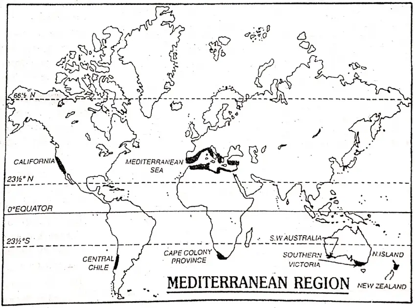
Location: The western portion of the continents lies between 30 to 45 North and South of the Equator. France, Italy, Greece, Spain, Portugal, Albania, Former Yugoslavia of Europe, Turkey, Israel, Syria, Lebanon of Asia, Egypt, Morocco, Libya, and Algeria.
“WBBSE Geography Class 8 Climatic Regions, Chapter 6 key concepts”
Tunisia of Africa—these sixteen countries are mostly influenced by the Mediterranean climate. There are some areas that are not abounded by the Mediterranean sea but there this type of climate can be observed.
These areas are as follows:
- The coastal areas of California in North America,
- Central Chile, 3Q west of the Andes range in South America. It is 28 the most representative form of the Mediterranean 26 type climate.
- Cape Town in South Africa.
- South-east and 20 South-western parts of Australia and Northern 18 Island of New Zealand.
| Month | J | F | M | A | M | J | J | A | S | O | N | D | Yearly average Temp./Rainfall |
| Temperature (c) | 12 | 13 | 14 | 16 | 17 | 18 | 21 | 22 | 21 | 18 | 16 | 13 | 17 |
| Rainfall (cm) | 8.1 | 8.4 | 6.6 | 2.5 | 1 | 0.3 | 0 | 0 | 0.5 | 1.3 | 2.8 | 6.1 | 376 |
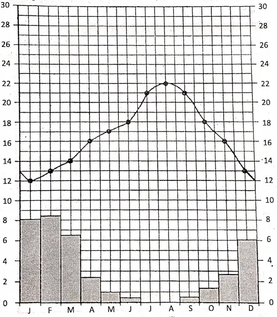
Climatic Characteristics: The chief characteristics of the 12 Mediterranean climates are as follows:
- Moderate temperature prevails throughout the year.
- Rainfall occurs in winter but summer remains dry (reverse of monsoon climate).
- This climate is D 1 influenced by the location of seas.
- During the dry summer, the Mediterranean regions are under the influence of trade winds. During the winter season, this region comes under the influence of the westerlies.
- The total amount of rainfall in this region is about 50 cm. to 100 cm. annually.
- The Mediterranean climate is characterized by bright, sunny weather. Sunshine is always abundant in the Mediterranean lands because the sky is clear almost throughout the year.
- The temperature drops sharply at night because of the clear sky.
- The range of temperature is higher than equatorial climate but less than Tropical Monsoon or Tropical desert type of climate.
Seasonal conditions of the elements of climate in the Mediterranean Climatic Region: In winter the prevailing on-shore westerlies bring much rain from the ocean to the Mediterranean lands. Winter is the rainy season in the Mediterranean lands where annual rainfall varies between 30 cm. and 90 cm. The average winter temperature ranges between 5°C and 10°C.
In summer with the shifting of the westerlies poleward, the Mediterranean lands come under the Trade winds. The prevailing Trade winds are off-shore; as such they are dry and give no rain. The average summer temperature of this region varies between 21°C and 27°C. The range of temperature is about 6°C to 8°C.
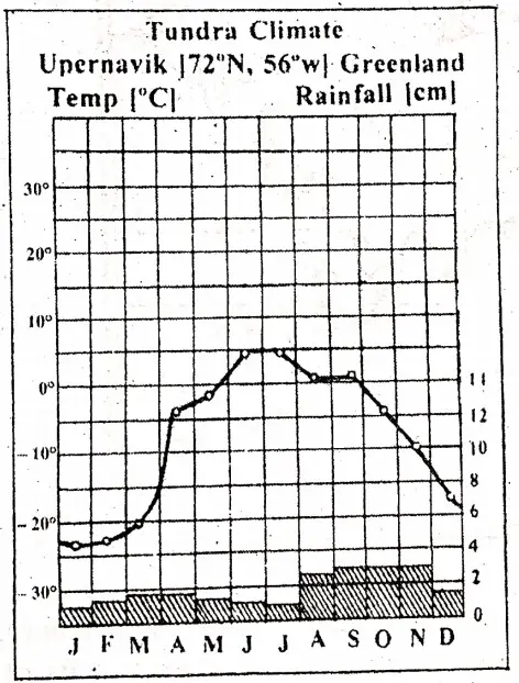
| Place: Upernavik | J | F | M | A | M | J | J | A | S | O | N | D |
| Temp. in C | -22.2 | -22.2 | -21 | -3.8 | -1.6 | 5 | 5 | 1.1 | 1.1 | -3.8 | -10.01 | -17.2 |
| Rainfall in cm. | 1 | 1.2 | 1.7 | 1.7 1 | 1.5 | 1.2 | 2.2 | 2.7 | 2.7 | 2.7 | 2.7 | 1.2 |
Chapter 6 Climate Regions: Biodiversity
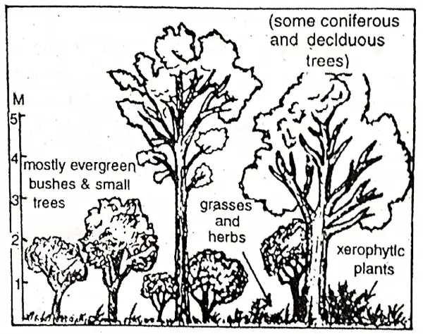
Flora/Natural vegetation: Winter rain and summer drought control the growth of natural vegetation here.
(1)In certain cooler highlands, Evergreen Coniferous trees, such as pine, fir, spruce, larch, cedar, palm, etc. are found.
(2)Evergreen broad-leaved trees are found on low-lying areas. The chief characteristics of this type are as follows:
- The leaves of some plants are leathery. They have capacity to restore water,
- The roots are long, thick, and wide spreading. They draw moisture from deep layers of the earth,
- The barks of some plants are thick and have a narrow opening where they can store water. Cork oak, Olive, Chestnut, etc. are the chief trees. Olive trees are seen in maximum in this region.
(3) The shrubs and bushes are also growing: Typical Vegetation of Mediterranean Lands. ‘ on the hillsides. Rose Mary, Laurel, Mallee, Maquis, Lavender, etc. are the main varieties.
Fauna/Animal life and rearing: Due to rainless dry summer and wet winter here is found little grassland and the lack of lush Greenlands makes this region unsuitable for animal rearing.
Hence donkeys, sheep, goats, and mules are more reared than horses or cattle. Hen and camel are more reared near hot deserts. Sheep rearing is important in Spain. The original home of the merino sheep is prized for wool.
“WBBSE Class 8 Geography Chapter 6, Climatic Regions summary”
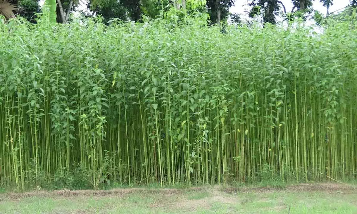
Agriculture: Agriculture is the main economic activity of the people in most parts of the Mediterranean lands. Temperate climates and moderate rainfall enrich this region in agriculture. Important agricultural crops are cereals like wheat, maize, barley, and rice; vegetables like tomato, beans, carrot, etc. and fiber crops like hemp and cotton.
Due to moderate rainfall, and bright and abundant sunny weather in this region grapes, oranges, olives, apples, apricots, peaches, almonds, pears, lemons, walnut, peanuts, plum, and different types of citrus fruits are produced here.
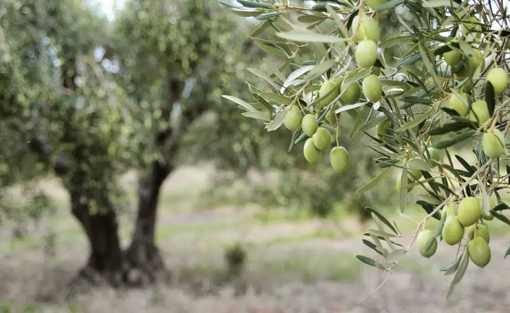
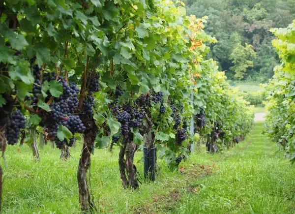
Hence this region is known as the “Basket of fruits” or ” Orchard Farming Lands” of the world. The typically Mediterranean fruit is olive which is used not only as a cooling medium but also used for making olive oil and cosmetic industry.
MineraljResource: This climatic region is not rich in minerals. A few minerals are produced in limited areas, such as iron ore is produced in Spain; Sulpher, mercury, marbles, and granites are available in Italy; Bauxites is mined in southern France; petroleum, natural gas, and gold are produced in California; chromium, lead, and zinc in Turkey and nitrate is produced in central Chile.
Industry: Many countries of the Mediterranean climatic regions are famous for different industries. The major/ important industries are
- Fruit processing industry (Jam, Jelly, Pickle, etc.)
- Wine Production,
- Tourism developed due to bright sunshine, moderate climate, and attractive scenic beauty and
- The film industry of Rome in Italy and Hollywood in California where the clear sky and long hours of bright sunshine are very much favorable for this industry. Other industries
- include,
- Engineering,
- Petrochemical,
- Aluminium and
- Flour industry.
Settlement and Lifestyle of the People: The charming healthy climate of this region is suitable for human settlement. Developed economic infrastructure, the privilege of occupation make this region densely populated and inhabitants are economically enriched.
The Mediterranean shorelands were the ‘cradle of world civilizations’ in the past. These regions were seats of ancient civilizations like Greek, Roman, etc. This region gave birth to great religions of the world. People are highly civilized.
Important Cities and Ports: Important cities of the Mediterranean climatic regions are—Rome (capital of Italy), and Naples in Italy. Athens (capital) in Greece; Cairo (capital) and Alexandria in Egypt, Til Aviv (capital) in Israel; Algiers (capital) in Algeria; Los Angeles in California; Adelaide in Australia; Cape town in South Africa; Llsben in Portugal are the main cities, ports, and industrial centers.
Future of the Region: Mediterranean lands were once the cradle of the civilization of Romans and Greek. For human development, climate plays an important role. It also attracts a large number of tourists.
“WBBSE Class 8 Geography Chapter 6 Climatic Regions, definitions and examples”
Scientific and economic development have helped people achieve a high standard of living. All the countries of this region are highly developed and densely populated. People can easily earn their livelihood with a little effort. Therefore, the Mediterranean region is also called the “Region of Increment”.
Chapter 6 Climate Regions: Cold Climate-Tundra Climate Region
A cold barren plain region lying around the Arctic circle is called the ‘Tundra pimatic Region’. Northern parts of Asia, Europe, and North America are ice-capped and have typical vegetation like algae, such as mosses and lichens which grow only in a few ice-free months.
‘Tundra’ is the name of this type of vegetation, as such the climate is named after its vegetation.
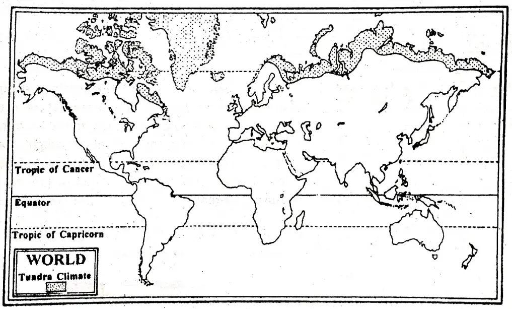
Location: This region is lying beyond 65° north parallel of latitude and on the northern side of the coniferous forest belt. On the map, this location is marked by Isotherm limits of 0° to 10°C. Beyond it there is perpetual snow.
Boundary: The Tundra Climatic region covers the coastal strips of the Arctic Ocean in North America, Europe, and Asia. The main areas are the coastal strips of Canada and the coastal strip of Greenland. In Europe, the Tundra covers Iceland, the northern coast of Scandinavia, and small islands adjoining the coast.
The arctic coast of the Russian Commonwealth has a narrow strip of Tundra. A small part of Antarctica in the southern hemisphere is also in this region.
Characteristics of the climate: The climate of the Tundra region is characterized by the following feature:
- It experiences severe cold and long winters.
- Summer are short and cold.
- Winter temperature remains below the freezing point (average temperature-22)
- Temperatures are very low all year round.
- The range of temperature between the maximum and the minimum is very much wide.
- The rainfall is scanty and it is less than about 25 cm. annually.
- The rainfall is chiefly of cyclonic in origin and falls in the summer
- Heavy snowfall and blizzards are common in Winter.
Seasonal Conditions of the major elements of the climate:
Winters are very long in this region. For about nine to ten months temperatures remain at freezing point. When heavy snowfall and blizzards occur, then the ground becomes frozen. The temperature drops to even from – 30°C to – 40°C. In winter, there is continuous darkness for 2/3 months.
“WBBSE Class 8 Geography Climatic Regions, revision notes”
However twilight stays for long periods when snow reflects the light of different celestial bodies and the glowing red or green curtains of Aurora Borealis are visible in the six months night sky. Summers occur here only for 2/3 months when temperature varies between 0°C and 10°C. The rainfall is light and occurs in Summer.
Chapter 6 Climate Regions: Biodiversity
Flora/Natural Vegetation: The natural vegetation of the Tundra region can be divided into the following groups
- The Bush Tundra,
- The Grass Tundra and
- Flowering vegetation.
- The Bush Tundra: The Bush Tundra has scrubby alders, birches, and willow which grow during short summer when ice melts.
- The Grass’Tundra: The Grass Tundra covers a large area and grows generally under thick snow cover. Moss, lichen, and sedge are these types of vegetation.
- Flowering Vegetation: During the summer, the thick ice cover begins to melt down and the flowering plants start to grow. They are short-lived plants and die after showing their colorful sight for a short period.
Fauna/Animal Life: In the Tundra climatic region most of the land animals are equipped with thick furs or long hairs to protect themselves against the bitterly cold winters. They have also thick layers of fat which provide them with more protection and food reserves for winter.
They are reindeer, polar bear, blue fox, musk-ox, hare, sled dog, caribou, and lemming. In the coastal region of the Arctic seas, there live seals, walruses, whales, and different types of fish. In summer birds migrate to the north and inhabit the Tundra. Penguins are very common in Antarctica.

Chapter 6 Climate Regions: Socio-Economic Environment And Life Style
Inhabitant’s lifestyle: The region is the least developed. The population is sparse. The average density of the population is less than one person per square kilometer. In North America, the number of Eskimos is only about 25000. Agriculture is not possible.
Life is difficult as the means of livelihood are limited. Therefore, this region is called the ”Region of Everlasting Difficulties”.
Occupation of the people:
- Hunting: Most natives are hunters. They depend on hunting for fur and food.
- Fishing: In coastal areas, people are fishermen. Eskimos use a boat named ‘a kayak’ for fishing. A spear named ‘harpoon’ is used for hunting seals.
- Trapping: Trapping for fur-bearing animals is an important occupation.
- Herding: Fur-bearing animals are reared on a commercial scale. Reindeer Farms have been established in Siberia.
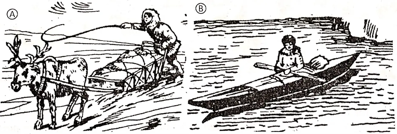
The Lifestyle of the People: People in the Tundra are Nomads. They have to adapt themselves to the harsh environment. Many nomadic tribes are found in different parts of this region such as:
- The Samoyeds, Yakuts in Siberia,
- Laps and Fins in Europe,
- Eskimos in Canada and Alaska.
“WBBSE Class 8 Climatic Regions notes, Chapter 6 worksheet”
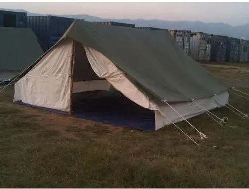
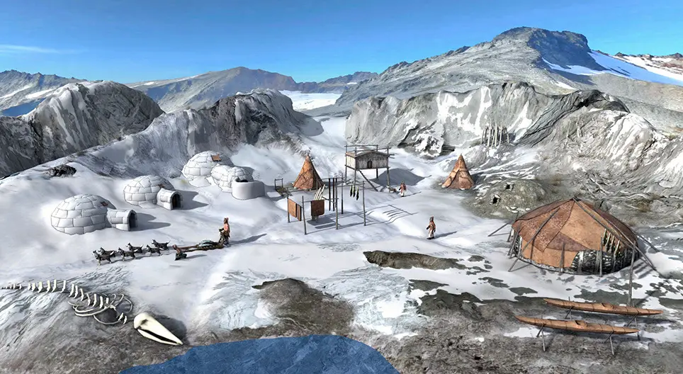
These tribes move from place to place in search of food’ They can hardly maintain a livelihood. So, their number is decreasing. They live in compact snow huts (Igloos) during winter. In summer, they live in portable tents of skin (Topics).
Eskimos are hunters, fishers, and food gatherers. Their food is obtained from berries, fish, seals, and walruses. Reindeer provide a supply of meat, milk, fat, etc. Warm clothes are used in this region.
Recent Developments in Tundra Region: During the last few decades, the lifestyle of the Eskimos has seen many changes due to contact with white men. Log cabins, wooden houses, speed boats, and guns are being used. Women use sewing machines instead of bone needles. Reindeer farms and fisheries have been developed.
“Class 8 WBBSE Geography Chapter 6 Climatic Regions, multiple-choice questions”
Railway lines have been constructed for transporting minerals. Ports like Igarka have been constructed on the Arctic ocean. Fur and Timber is shipped from Siberia. Modern ‘Ice-breakers’ keep the ports free. Many meteorological observatories have been established for the study of weather conditions.
Air transport is increasing in polar areas. Some parts are made ice-free and agriculture is done here with the latest technology by the greenhouse. Recently this region has been developed and inhabitants are habituated to modern lifestyle.
Future of this region: The region, was once regarded as completely useless, but now there is an indication of economic improvement that will be of great.
WBBSE Notes For 8 Class Middle School Geography
- Chapter 1 Interior Of The Earth Notes
- Chapter 2 Unstable Earth Notes
- Chapter 3 Rocks Notes
- Chapter 4 Pressure Belts And Winds Notes
- Chapter 5 Cloud And Rain Notes
- Chapter 7 Human Activities And Environmental Degradation Notes
- Chapter 8 Some Neighbouring Countries Of India Notes
- Chapter 9 North America Notes
- Chapter 10 South America Notes
- Chapter 11 Oceania Notes