
Chapter 8 Some Neighbouring Countries Of India
Neighbouring Countries
A person who dwells near another is called a ‘neighbour’. People living around us are our neighbours. It is very important to keep good relations with neighbours. The adjoining countries or the countries lying near or beside a particular country are called ‘neighbouring countries.
As a good neighbour, a country should maintain a good relationship with its neighbouring countries because of the following reasons:
Read and Learn all WBBSE Notes For 8 Class Middle School Geography
- No country is totally self-sufficient. Every country imports certain commodities and exports its surplus commodities, So there is an exchange of commodities to meet each other’s needs. But trade with the neighbouring countries can be carried only if good relations are maintained with them. So good relations with the neighbouring countries are essential for the growth of trade and commerce.
- A good relationship with the neighbouring countries considerably determines our peace and prosperity; because a strange relationship with a neighbouring country entails high expenditure on defence accounts curtailing expenditures on social and economic uplift of the people.
- Good relation on the other hand not only reduces defence expenditure but can also take advantage of mutual benefits derived from trade, technical know-how and a larger market for selling products.
- Good fences made good neighbours. If good relations are not maintained border disputes arise and cause tension, Indo-Pak and Indo-China wars over our northern borders are good examples. This hampers the economic development of a country. So there should be good relations with the neighbouring countries.
- A country should try to maintain a good relationship with neighbouring countries for the establishment of industries. It helps to collect raw materials and market for its finished products in the neighbouring countries which are not at all developed in industries.
- Friendly neighbouring countries may act as buffer states during wartime’.
- In the international field, a country should follow the policy of life and let live. It stands for international peace and understanding. The formation of SAARC explains the importance of mutual understanding among the nations of the sub-continent.
- A country should maintain a good relationship with its neighbouring1 countries to exchange cultural heritage (education, music etc.) with them. It promotes cultural progress with the spirit of mutual cooperation.
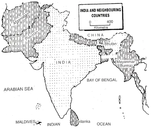
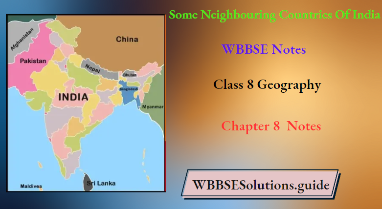
Neighbouring Countries Of India
The neighbouring countries of India:
The neighbouring countries of India are —Nepal, Bhutan, Bangladesh, Myanmar, Srilanka, Pakistan, Afghanistan, China and Maldives. (Afghanistan, China and Maldives are out of the syllabus).
According to the size and population of China is the largest and most populated neighbour of India. The smallest neighbour of India is Maldives Island.
| Class 8 General Science | Class 8 Maths |
| Class 8 History | Class 8 Science LAQs |
| Class 8 Geography | Class 8 Science SAQs |
| Class 8 Maths | Class 8 Geography |
| Class 8 History MCQs | Class 8 History |
“WBBSE Class 8 Geography Chapter 8 notes, Some Neighbouring Countries of India”
Indian Sub-continent: During British rule, the entire areas comprising India, Pakistan, Bangladesh, Sri Lanka, Nepal and Bhutan would form a well-defined geographical and geopolitical unit because they have such similarities. in natural and cultural features.
The then ruler, i.e. the English people would call the entire geographical unit surrounding India a sub-continent. This sub-continent has been separated from Asia by the waters of the Indian Ocean on the south and by the inaccessible mighty walls of mountains on the north, northeast and northwest. After the partition even today in common parlance India is called a ‘sub-continent’.
SAARC: The formation of SAARC explains the importance of mutual understanding among the nations of the sub-continent. For the purpose of peace,-stability,‘and economic progress, India and her neighbouring countries established SAARC (South Asian Association for Regional Co-operation) in 1985.
India, Bangladesh, Nepal, Bhutan, Srilanka, Pakistan, Maldives and Afghanistan, these eight countries are members of SAARC. The Headquarters of SAARC is situated at Kathmandu in Nepal. The main purpose of SAARC are to keep good relations among the member countries. It facilitates increased cooperation in the field of culture and
| Countries | Nepal | Bhutan | Bangladesh | Myanmar | Srilanka | Pakistan |
| Capital | Kathmandu | Thimpu | Dhaka (Dacca) | Naypyidaw (Yangon) | Sri Jayawardena-pura Kotte | Islamabad |
| Area | 140792 sq. km | 47913 Sq.km | 144004 Sq.km | 678500 Sq.km | 65604 Sq.km | 803936 Sq.km |
| Population | 28563000 | 691000 | 156051000 | 48138000 | 21325000 | 176243000 |
| Highest Peak | Mount Everest (8848 m) | Kula Kangri (7554 m) | Keokradong (1232 m) | HKakabo Razi (5581 m) | Pidrutalagala (2627 m) | Tirich Mir (7708 m) |
| Longest River | Kali-Gandak | Manas | Padma-Megana | Irrawaddy | Mahawali Ganga | Indus |
| Main Language | Nepali | Dzongkha | Bengali | Burmese | Sinhala / Sinhalese | Urdu |
| Main Agricultural crops | Rice, Wheat, Jute, Maize, Jowar, Orange | Wheat, Barley, Maize, Apple, Orange, Cardamom | Rice, Jute, Tea, Sugarcane, Wheat, Oilseeds | Rice, Maize, Millet, Tobacco, Oilseeds | Rice, Tea, Rubber, Coconut, Spices, Oilseeds. | Rice, Wheet, Maize, Cotton |
| Main Industry | Paper, Jute Cotton textile, Leather | Lumbering, Jam, Jelly, Drink Processing, the cotton industry | Jute, Paper, Sugar, Pottery, Garments, Handloom. | Jute, Sugar, Silk | Tea, Paper, Garments, Coconut oil | Cement, Sugar, Cotton Textile Leather, Garments |
| Major Cities | Kathmandu, Pokhra, Biratnagar, Janakpur | Thimpu, Paro, Phuntsholing Punakha | Dhaka, Chittagong Srihatta, Khulna | Yangon, Mandalay Mawlamyine | Colombo, Kandy, Jaffna, Ratnapura | Islamabad, Karachi, Lahore Peshawar |
Chapter 8 Some Neighbouring Countries Of India: Nepal
The official name of the Nepal Federal Democratic Republic of Nepal’. After 240 Years under the Shah dynasty, Nepal abolished its monarchy and became a republic in May 2008. Nepal lies between China and India in South Asia.
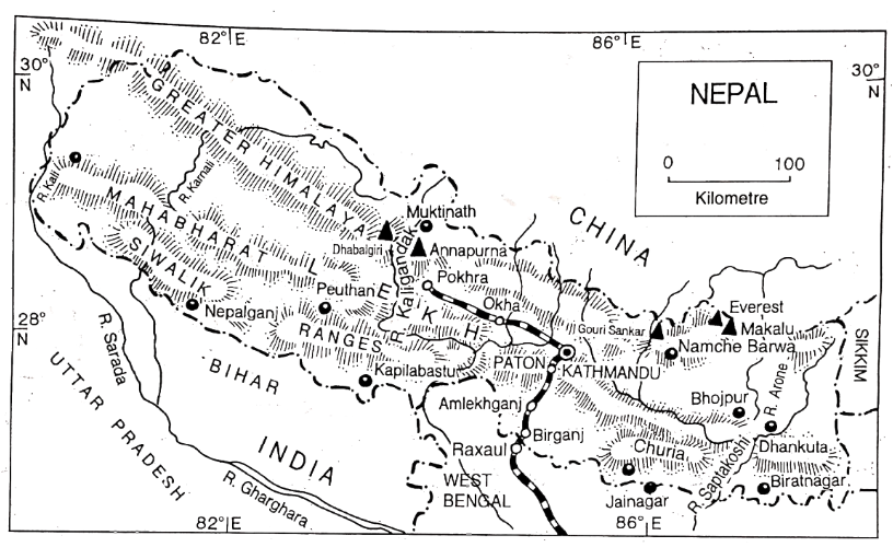
The mountainous heart of Nepal consists of the towering Himalayas (including Everest, the highest peak in the world). There are 16 aks about 8000 metres). There are many beautiful valleys in this region as Kathmandu Pallev Pokhara valley etc.
The climate of Nepal is Temperate Monsoon type. Nepal has covered r forests (over 50% of its area). The majority of the inhabitants are farmers. Industrially Nepal is not developed. The communication system is very underdeveloped.
“Class 8 WBBSE Geography Chapter 8 notes, Neighbouring Countries study material”
Tourism Industry of Nepal: Tourism is the largest industry and main earning source of foreign money of Nepal. There are many beautiful places, gardens, and highways decorating the towns There are ten highest mountain peaks of the world situated in Nepal.
These are attractive to most of tourists. The mountaineers of the world come to Nepal for mountaineering. The most attractive tourist centres are the temple of Pashupatinath, Buddhist monasteries, Tribhuvan University, Durbar house, New Market etc.
The famous archaeological sites oPatan ancPatgaon is located nearby Kathmandu. Kathmandu is also the headquarters of SAARCP Pokhra is also a famous tourist town (The second largest city of Nepal). The white snow-covered peaks of the Himalayas look beautiful from this city. The hotel industry has developed here.
“WBBSE Geography Class 8 Neighbouring Countries, Chapter 8 key concepts”
Tracking can be done from here to Muktinath. Kapilavastu (Lumbini) situated in the Terai region, to the south of Nepal is the famous birth place of Lord Gautam Buddha etc. are attracted tourists.
Tourists coming to trek in the mountain and climb the peaks contribute to national income because Sherpas benefit from the mountaineering boom and tourism in the Everest region, owing much of the lodging and transportation. So, it is truly called that tourism is the largest industry and source of foreign money as well as the main earning source of Nepal.
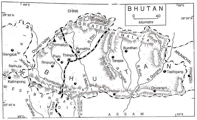
Chapter 8 Some Neighbouring Countries Of India: Bhutan
The official name of Bhutan kingdom of Bhutan. Bhutan is a tiny, remote and impoverished country between two powerful neighbouring countries, India and China. Bhutan’s ancient Buddhist culture and mountain scenery make it attractive for tourists, whose numbers are limited by the government.
Forests still cover nearly 75% of Bhutan’s land area. Almost all trade is with India. Due to showers with thunderstorms, Bhutan is known as the Land of Thunder Dragon’. The climate of Bhutan is a Moist Temperate Monsoon type.
“WBBSE Class 8 Chapter 8 Geography, Some Neighbouring Countries of India solutions”
No important minerals are mined in Bhutan, so large industries have not developed here. The Chukha Hydel project has been constructed with the cooperation of India. There are no railway lines.
Fruit Processing Industries Of Bhutan: There are different fruits like apples, oranges, pineapples etc. are produced in Bhutan. So, fruit processing mostly in small factories is important. u an is world famous in making jam, jelly, squash, and pickle from these fruits.
Countries Near India
Chapter 8 Some Neighbouring Countries Of India: Bangladesh
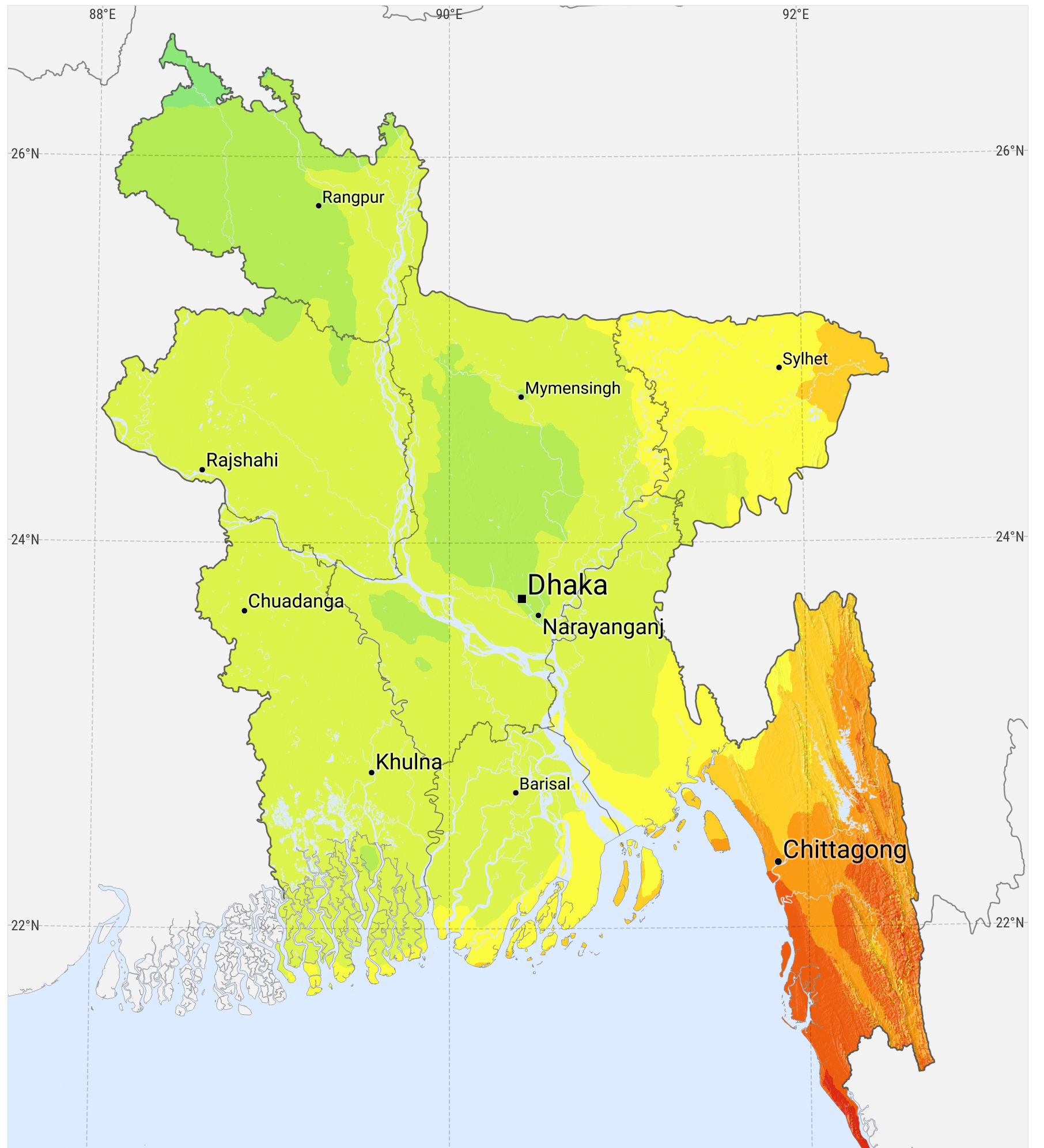
The official name of Bangladesh is ‘Peoples Republic of Bangladesh’. Bangladesh became an independent country on 16th December 1971. Bangladesh is surrounded by India on three sides. It is a low lying country formed by the alluvial plain of the river system of the Ganges and the Brahmaputra.
Bangladesh is a network of rivers. It has a Tropical Monsoon climate. The Sundarbans mangrove forest—one of the largest in the world and home of the Royal Bengal tiger is situated on the southern portion of the estuarine Gangetic delta near the Bay of Bengal.
“WBBSE Class 8 Geography Chapter 8, Neighbouring Countries of India study guide”
Bangladesh is an agricultural country with 70% of the land being used for agriculture. There is a little mineral resource in Bangladesh. A large amount of natural gas is found in the Sylhet region. Industrial development has occupied, very slightly in Bangladesh.
Agro-based Industry of Bangladesh: Due to the lack of mineral resources large-scale metallurgical industries have not been set up. Bangladesh is an agrarian country.
However, some agro-based and forest-based industries have developed here, like-jute industry, paper industry, tea Industry, sugar industry, cotton-textile industry, silk-textile industry and food processing industry etc. The main industry of Bangladesh is the jute industry with nearly about 80 jute mills are situated at Dhaka, Narayanganj, Khulna, Daulatpur, Chittagong and other cities.
“WBBSE Class 8 Neighbouring Countries notes, Geography Chapter 8”
The famous ‘Adamji Jute Mill’ is located in Damrai, near Narayanganj. The handloom (Tant) at Tangail, and Maslin at Sonargaon near Dhaka are world, famous. Bangladesh is developed in handicraft and cottage industry, like the conch industry of Dhaka, combs of Jessore etc. Besides these cement, ship repairing, sugar refining, and chemical fertilizer industries have been established here.
Chapter 8 Some Neighbouring Countries Of India: Myanmar
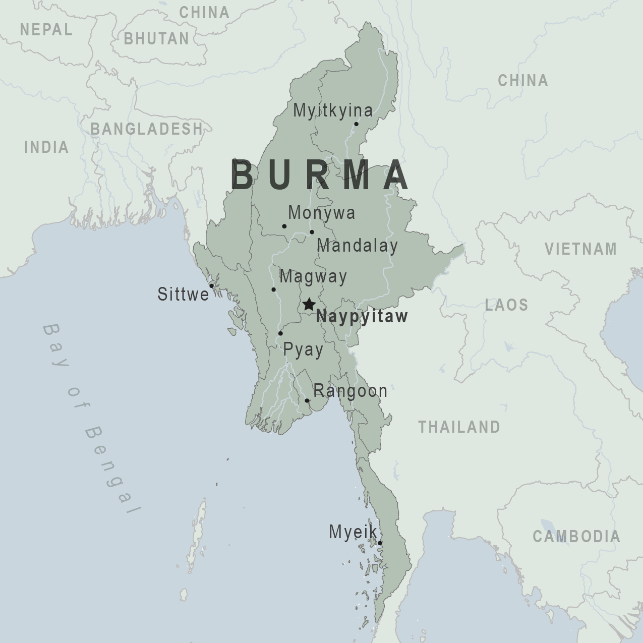
The official name of Myanmar (Burma) republic of the Union of Myanmar”. It is a resource-rich country with a strong agricultural base. Myanmar’s Irrawaddy Basin is surrounded by forested mountains and plateaus. Most people live in the fertile valley and delta of the Irrawaddy river. The climate of Myanmar is Tropical Monsoon type.
Countries That Border India
Mineral and Forest resources of Myanmar:
Mineral Resources: Myanmar is rich in mineral resources. Some important minerals are- mineral oil, tin, tungsten or Wolfram, lead, zinc, silver and precious stones.
Mineral oil is found in the Irrawaddy and Chindwin river valleys, mainly irMinbu, Enang Young, Chak etc. Tin is found in the Mouchi and Tyavoy regions of Tenasserim. In the Shan plateau region lead, Zinc, manganese, tungsten and silver are found. In this plateau, precious stones are found in Mogok. World-famous Ruby is found here. Some low-grade iron-ore, nickel and copper are also mined here.
“Class 8 WBBSE Geography Chapter 8, Neighbouring Countries easy explanation”
Forest resources: About 70% of the country is covered with forests. Different types of forests are found in Myanmar. In the forest areas sal, teak, poma trees are found in the deep interior. These trees are valuable hardwoods ‘Burma teak’ is famous in the world.
In the plains, deciduous trees are found. In the rain shadow areas in the middle of the country, trees are fewer and tall grasses are found. Important Evergreen trees like Garjan, Chaplash, Mahogony etc. and deciduous trees like Arjun, Sal, Teak etc are the valuable forest resource of Myanmar.
Chapter 8 Some Neighbouring Countries Of India: Srilanka
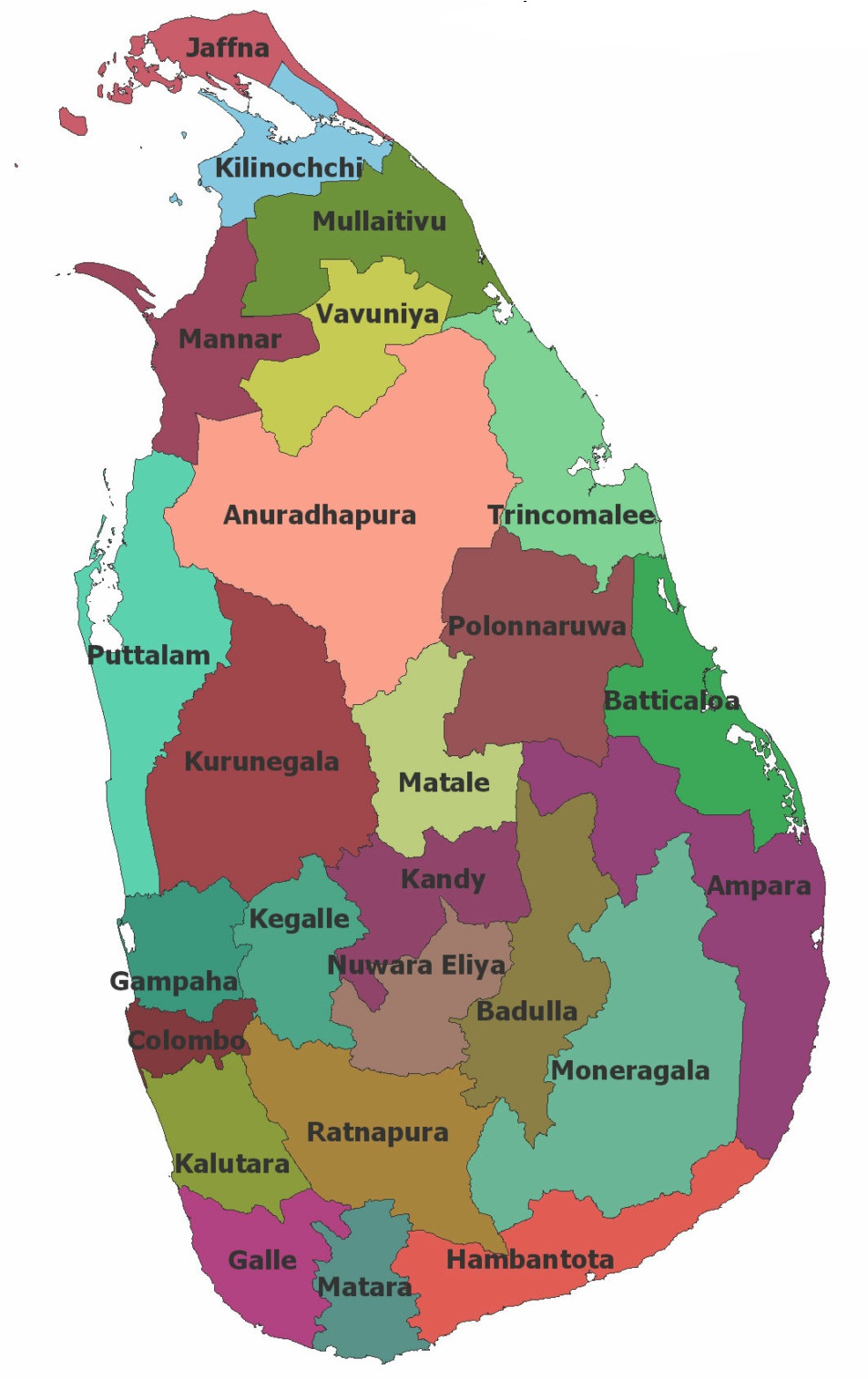
The official name of the Srilanka Democratic Socialist Republic of Sri Lanka’. Srilanka, known as Ceylon until 1972, is a tropical island lying near the southern tip of India and the Equator. From the coast, the land rises to a central plateau, where tea plantations are found. Srilanka has an Equatorial climate.
Agriculture of Sri Lanka: Agriculture is the main occupation of the people of Srilanka. Rice is the most important crop and yields are high due to the two rainy seasons in the year. Tea and rubber is cultivated intensely in the extensive highlands in the centre of the country.
Though small in size Srilanka ranks third after India and China in tea production. Srilanka earns high foreign exchange from the exports of tea and rubber. Tobacco is an important cash crop in the Jaffna, peninsula to the north of the country. Coconut is also an important cash crop of Srilanka. In coconut production, Srilanka ranks fourth in the world.
“WBBSE Class 8 Geography Chapter 8 notes, Neighbouring Countries PDF”
The various spices produced in Srilanka are cinnamon and clove. As cinnamon production is high, Srilanka is also called the “Cinnamon Island”. Other crops produced are maize, oilseeds, millets, cinchona, varieties of vegetables, bananas etc.
Mineral Resources: Srilanka is famous in mineral extraction. Srilanka occupies the first position in the production of Graphite. Precious stones like Saphire, Ruby, Cat’s eye etc. are produced in Srilanka.
These minerals are mainly mined from the old rocks of the central mountains. Gem City, the sabargammoya produces varieties of precious stones etc. Some limestone is produced from the northern Jaffna peninsula. Some bauxite is also mined from the central highland.
Chapter 8 Some Neighbouring Countries Of India: Pakistan
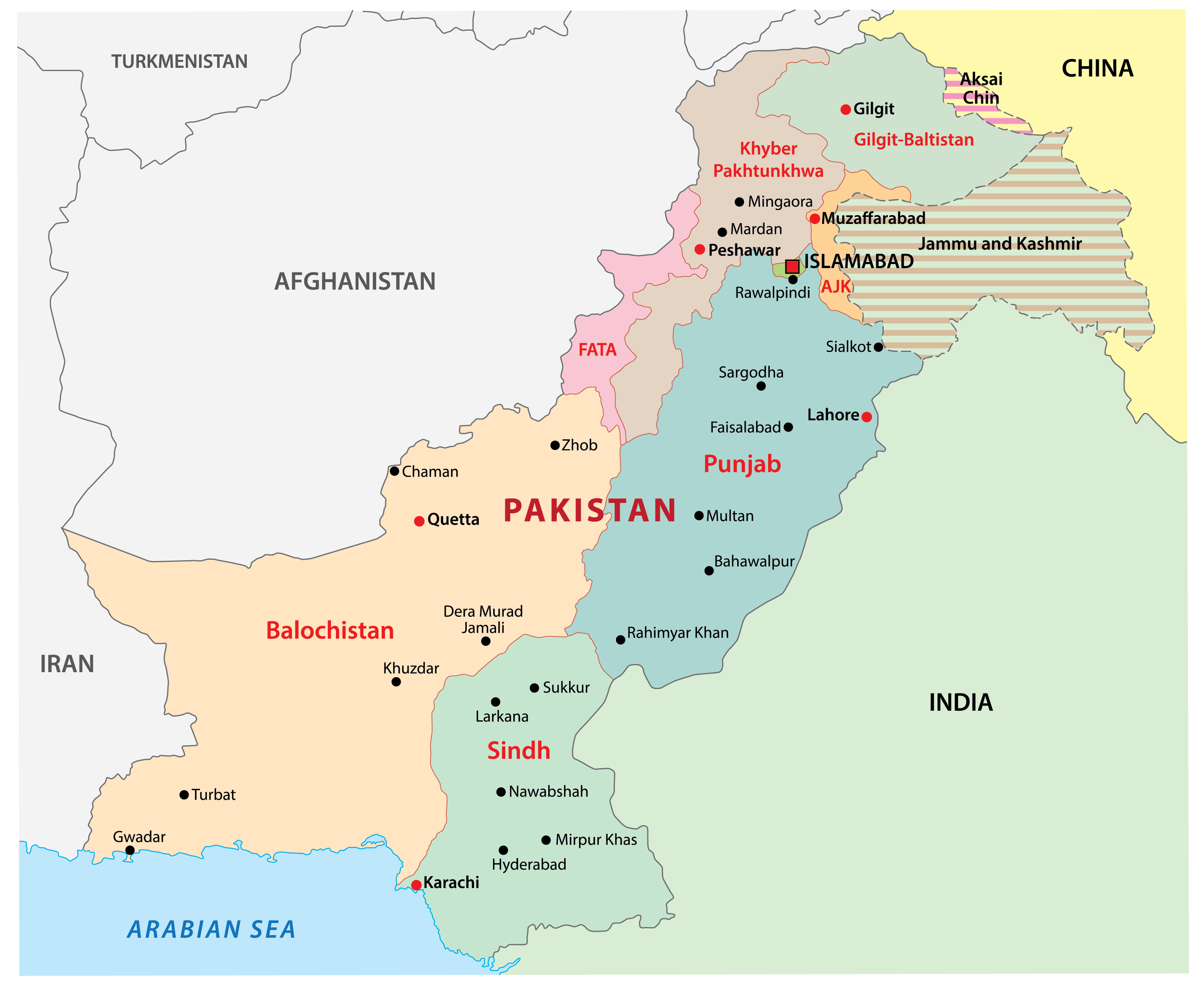
The official name of Pakistan is the Islamic Republic of Pakistan’. It is located along the north¬ western frontier of India. Pakistan is surrounded by Afghanistan and Iran on its north and west and India on its east and southern region and the Arabian Sea in the south.
The eastern and southern parts of Pakistan are dominated by the Indus river and its tributaries. West of the Indus, the land becomes increasingly arid and mountainous. The climate of Pakistan is dry and extreme type.
Countries Close To India
Rainfall is low here and summer temperatures shoot up while in winter they drop. Thus summers are very hot and winters are very cold Jacob Abad in the province of Sind records the highest temperature of 52°C in summer. Lack of rainfall has allowed less area to be under forest. In the arid regions xerophytes are found.
Irrigation and Agriculture of Pakistan: In Pakistan, the rainfall is very low, so irrigation is essential for cultivation. Canal irrigation is the most important. A large number of perennial canals are found in West Punjab.
The upper and Lower Jhelum canals, the upper and lower Chenab canals, and the lower Bari Daab canal from the Ravi are the most important of them. In Sind, the Liyod or Sukkur Barrage has been constructed over the Indus at Sukka. From the river, a large number of canals have been constructed to irrigate different parts of Sind.
In Baluchistan, the water dries up as soon as it comes down from the hills to the dry sand at the foot. So water of the hill streams is carried to the agricultural lands through underground tunnels. This system is called ‘Karez’.
“WBBSE Class 8 Geography Chapter 8, Neighbouring Countries important questions”
In West Punjab and Sind, there are wells. Besides, iyo barrage, other dams have been constructed over other parts of the Indus and its tributaries for irrigation. Eg. Mangla Dam over the Beas river in the north, Gulam Mohammad Dam over the Indus, Jinnah Dam etc. Agriculture of Pakistan depends largely on irrigation.
Agricultural of Pakistan: Pakistan is prosperous in agriculture due to the irrigation system in spite of different problems. Extensive irrigation has made large areas of the semi-deserts and deserts convert to productive farm lands overcoming the main problem of low rainfall.
In Pakistan, wheat and cotton are the most important crops. The other important crops are rice, sugar- cane, maize, millet etc. Wheat is cultivated in West Punjab, Sind, and. N.W. Frontier Province’
“Class 8 Geography Neighbouring Countries notes, WBBSE syllabus”
It is grown there in the weil-irrigated areas. West Punjab is the most important wheat-producing, area of Pakistan. Cotton cultivated with the help of canal irrigation is of very good quality, Rice grows in river valleys and deltaic regions.
N. W Frontier Province, sugar cane, grows in the river valleys. Different types of fruits like ‘apples, dates, peaches etc are also important agricultural products of Pakistan.
| Neighbouring Countries | Export goods of India | Import goods of India |
| Nepal | Iron and Steel, cement, sugar, tea, salt, car ‘ and spare parts, cotton, chemical fertilizer, garments, petrochemical goods etc. | Timber, hides and skin, oilseeds, pulses, carpet, raw Jute etc. |
| Bhutan | Textile goods, coal, cement, medicine, engineering goods, iron, steel, paper, salt, sugar etc. | Different fruits, jam, jelly, cardamom, fur and fur-based garments, timber, hides, wool, Ivory, the tail of yak arid, and wax. |
| Bangladesh | Wheat, rice,- cotton/ cloth and yarn, coal, machinery, books, medicine, video cassette, music cassettes etc. | Raw jute, fish, hides and skin, tea, paper pulp, books etc. |
| Myanmar | Coal, iron and steel, cotton textiles, jute goods, medicine, machines, coal, means of transportation etc. | Rice, mineral oil, silver, tin, tungsten, teak, lead, precious stones, rubber, cotton, sandalwood, and pulses. |
| Srilanka | Textile goods, jute goods, iron and steel, petroleum products, video cassettes, music cassettes etc. | Oil cake, tea, graphite, precious stones, rubber, copper, clove, coconut products hide etc. |
| Pakistan | Spices, medicines, rubber goods, tobacco, iron and steel, machinery, paper, coal, ‘ sugar, pharmaceuticals etc. | Cotton, hides, wool, rocksalt, textile, goods, dried fruits, wheat, carpets and woollen garments |
WBBSE Notes For 8 Class Middle School Geography
- Chapter 1 Interior Of The Earth Notes
- Chapter 2 Unstable Earth Notes
- Chapter 3 Rocks Notes
- Chapter 4 Pressure Belts And Winds Notes
- Chapter 5 Cloud And Rain Notes
- Chapter 6 Climatic Regions Notes
- Chapter 7 Human Activities And Environmental Degradation Notes
- Chapter 9 North America Notes
- Chapter 10 South America Notes
- Chapter 11 Oceania Notes